TLS LiDAR in Ecology: A Complete Guide for Researchers from Basics to Advanced Applications
This comprehensive guide explores Terrestrial Laser Scanning (TLS) LiDAR as a transformative tool for ecological research.
TLS LiDAR in Ecology: A Complete Guide for Researchers from Basics to Advanced Applications
Abstract
This comprehensive guide explores Terrestrial Laser Scanning (TLS) LiDAR as a transformative tool for ecological research. It begins by establishing the foundational physics and operational principles of TLS technology, tailored for ecologists. It then details practical field methodologies and diverse applications, from forest structure analysis to habitat modeling. The guide addresses common challenges in data acquisition and processing with optimization strategies, and concludes with a critical validation framework comparing TLS to traditional and other remote sensing techniques. Designed for ecologists and environmental scientists, this article provides the knowledge needed to effectively integrate high-resolution 3D ecosystem mapping into modern research.
What is TLS LiDAR? Core Principles and Ecological Relevance Explained
Within the foundational thesis of LiDAR basics for ecology, Terrestrial Laser Scanning (TLS) is defined as a ground-based, static active remote sensing technology. It uses Light Detection and Ranging (LiDAR) to capture precise, high-resolution three-dimensional (3D) information of the immediate environment from a tripod-mounted instrument. This technical guide details how TLS is fundamentally differentiated from Airborne LiDAR (ALS) and Mobile LiDAR (MLS) in its operational principles, data characteristics, and specific applications in ecological research and pharmaceutical development, where detailed structural understanding of biomes is critical for bio-prospecting.
Core Technological Differentiators
The primary distinction lies in platform, scale, and data collection geometry.
| Feature | Terrestrial Laser Scanning (TLS) | Airborne LiDAR (ALS) | Mobile LiDAR (MLS) |
|---|---|---|---|
| Platform | Static, ground-based tripod | Aircraft or UAV (drone) | Moving vehicle, backpack, or boat |
| Viewing Geometry | Side-looking, under-canopy, 360° horizontal; limited vertical FOV | Downward/nadir-looking; broad swath | Oblique & side-looking; continuous along trajectory |
| Typical Range | Short to medium (2m to several hundred meters) | Long (200m to >1000m AGL) | Medium (1m to 200m) |
| Spatial Resolution | Very High (mm to cm) | Low to Medium (10cm to 1m) | Medium to High (cm to dm) |
| Data Coverage | Single-position point cloud; requires multiple setups for area | Large-area coverage in a single flight | Corridor or street-level coverage |
| Key Strength | Extreme detail of vertical structures (e.g., tree trunk, bark) | Extensive landscape-scale topography and canopy height | Efficient, detailed mapping of linear features |
Table 1: Quantitative comparison of platform characteristics.
Data Characteristics and Accuracy
Empirical studies have established definitive metrics for data quality across the three modalities.
| Metric | TLS | ALS (UAV-based) | MLS | Source (Protocol) |
|---|---|---|---|---|
| Point Density | 1,000 - 50,000 pts/m² | 100 - 500 pts/m² | 500 - 2,000 pts/m² | Comparative Forest Inventory (2023) |
| Relative Accuracy | 1 - 5 mm | 2 - 10 cm | 1 - 5 cm | IEEE Geoscience & Remote Sensing (2022) |
| Canopy Penetration | Low (side-view blocked) | Moderate (top-down gaps) | Very Low (oblique blocked) | Ecological Informatics (2023) |
| Optimal Use Case | Single-tree allometrics | Canopy height model (CHM) | Understory vegetation transect | Frontiers in Plant Science (2024) |
Table 2: Quantitative data accuracy and density comparison.
Experimental Protocol: Comparative Biomass Estimation (2023)
Objective: Quantify bias in tree volume estimation between TLS, MLS, and UAV-LiDAR. Methodology:
- Site: Delineate a 1-ha temperate forest plot with 50+ trees of varying species.
- TLS Protocol: Establish 10 scan positions in a systematic grid. Use a phase-based scanner (e.g., Faro Focus). Apply spherical targets for co-registration. Merge scans using iterative closest point (ICP) algorithm.
- MLS Protocol: Navigate a backpack system (e.g., GeoSLAM) along predetermined transects covering the plot.
- ALS Protocol: Fly a UAV (e.g., DJI Matrice 300 with Zenmuse L1) at 80m AGL with 70% side overlap.
- Data Processing: For all datasets, segment individual trees. Apply quantitative structure models (QSMs) to reconstruct woody volume. Convert to biomass using species-specific wood density.
- Validation: Destructively harvest a subset of 5 trees for ground truth volume and weight.
Workflow for Ecological Applications
The application of TLS in ecological research follows a defined, multi-step protocol distinct from airborne or mobile approaches.
TLS Ecological Research Workflow
Signaling Pathway for Bioactive Compound Discovery
TLS data serves as a critical input for spatially-informed ecological research that can guide pharmaceutical bioprospecting.
From 3D Structure to Bioactive Discovery
The Scientist's Toolkit: Essential Research Reagents & Materials
| Item Name / Category | Function in TLS-based Ecological Research |
|---|---|
| Phase-based TLS Scanner | Core instrument emitting laser beams; measures phase shift of returned light for high-accuracy, high-density point clouds. |
| Retro-reflective Targets/Spheres | Used as stable, high-visibility tie points for accurate co-registration of multiple scans into a unified point cloud. |
| Portable DGPS/GNSS Receiver | Provides geospatial referencing for scan positions, enabling integration with broader GIS data (less critical for relative measurements). |
| Field Calibration Panels | Used for radiometric correction and validation of intensity values, important for material classification. |
| Quantitative Structure Model (QSM) Software | Algorithmic suite (e.g., 3D Forest, SimpleTree) to convert point clouds of trees into volumetric 3D models for biomass estimation. |
| Voxel Analysis Software | Segments the 3D space into volume pixels for calculating ecological indices like Plant Area Volume Density (PAVD). |
Table 3: Key research reagent solutions for TLS ecology workflows.
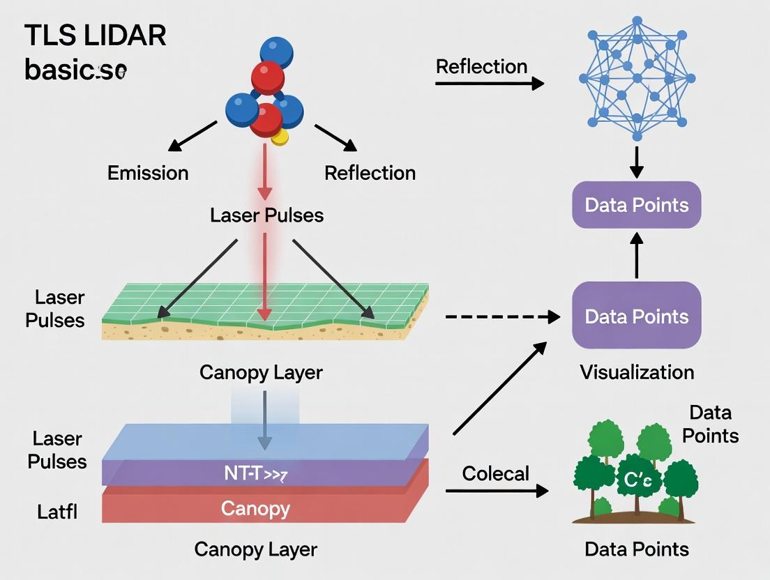
This technical guide details the core operational principles of Terrestrial Laser Scanning (TLS) LiDAR, specifically Time-of-Flight (ToF) and Phase-Shift (PS) measurement, within the context of ecological research. It provides the foundational physics required for researchers to select appropriate methodologies, interpret data, and understand the limitations of LiDAR-derived structural and biochemical metrics in natural systems.
Terrestrial Laser Scanning (TLS) is an active remote sensing technology that provides high-resolution, three-dimensional point clouds of environments. For ecologists, it enables non-destructive quantification of vegetation structure (e.g., Leaf Area Index, biomass, canopy architecture), habitat complexity, and, with advanced sensors, spectral properties. The accuracy of these ecological metrics is fundamentally dependent on the underlying range-finding principle employed by the scanner.
Core Measurement Principles
Time-of-Flight (ToF) Principle
The ToF principle measures distance by calculating the time interval between the emission of a laser pulse and the detection of its reflected signal. The distance (d) is derived from: d = (c * t) / 2 where c is the speed of light (~3 x 10⁸ m/s) and t is the measured round-trip time.
- Operation: Uses short (nanosecond), high-power pulsed lasers.
- Key Characteristic: Suitable for very long ranges (hundreds of meters to kilometers) but requires precise, fast timing electronics.
Phase-Shift (PS) Principle
The PS principle measures distance by comparing the phase difference between a continuously modulated emitted laser signal and its return signal. The distance is derived from: d = (c * ΔΦ) / (4πf) where ΔΦ is the measured phase shift and f is the modulation frequency.
- Operation: Uses amplitude-modulated continuous-wave (CW) lasers.
- Key Characteristic: Provides higher accuracy at shorter to medium ranges but results in range ambiguity (d_max = c / (2f)), requiring multiple modulation frequencies for long-range operation.
Quantitative Comparison of Principles
The following table summarizes the key technical parameters and their ecological implications.
Table 1: Comparative Analysis of ToF and PS Principles for TLS in Ecology
| Parameter | Time-of-Flight (ToF) | Phase-Shift (PS) | Primary Ecological Implication |
|---|---|---|---|
| Typical Max Range | 100 m to >1 km | 10 m to 300 m | ToF for landscape-scale transects/open forests; PS for understory/dense plots. |
| Ranging Accuracy | Centimeter-level (e.g., ±5-10 mm) | Sub-centimeter to millimeter-level (e.g., ±1-3 mm) | PS for high-fidelity structural detail (e.g., leaf orientation, bark texture). |
| Measurement Speed | Very High (10s-100s of kHz) | High (100s kHz - MHz) | ToF excels in rapid, large-area scanning. |
| Multiple Target Discrimination | Excellent (via waveform analysis) | Poor (without FMCW) | ToF crucial for separating canopy, branch, and ground returns in complex vegetation. |
| Eye Safety | Lower (high peak pulse power) | Higher (lower continuous power) | PS may allow safer use in collaborative field settings. |
| Power Consumption | Higher | Lower | PS may be advantageous for extended field campaigns with limited power. |
| Cost Trend | Higher for high-performance systems | Generally lower | Budget considerations for research programs. |
| Suitability for Vegetation Penetration | Superior due to high pulse power | Limited by lower power and coherence | ToF generally preferred for dense canopies and obtaining ground points. |
Experimental Protocols for Ecological Calibration & Validation
Protocol: Validation of TLS-Derived Tree Diameter at Breast Height (DBH)
Objective: To assess the accuracy of TLS point clouds (from both ToF and PS systems) in measuring tree DBH, a fundamental forestry metric.
Materials: See "The Scientist's Toolkit" below. Procedure:
- Plot Establishment: Mark a fixed-radius (e.g., 20m) plot within a forest stand.
- Ground Truthing: For every tree >10cm DBH within the plot, measure DBH manually using a diameter tape at 1.3m height. Record species and GPS location.
- TLS Scanning: a. Set up the TLS scanner at the plot center on a stable tripod. b. Perform a high-resolution 360° scan with multiple vertical inclinations. Ensure overlap with additional scans from plot edges to occlude shadows. c. Register multiple scans using fixed targets.
- Point Cloud Processing: a. Use software (e.g., CloudCompare, R lidR) to segment individual trees. b. Extract a horizontal cross-section (slice) of the point cloud at 1.3m height for each tree. c. Fit a circle or cylinder model to the points belonging to the tree trunk within this slice. d. Record the modeled DBH.
- Data Analysis: Perform a linear regression (TLS DBH vs. Manual DBH). Calculate metrics: R², RMSE, and bias.
Protocol: Assessing Canopy Gap Fraction via Waveform ToF Analysis
Objective: To utilize the full-waveform capability of advanced ToF scanners to estimate canopy openness.
Materials: Full-waveform TLS system (e.g., Riegl VZ series), analysis software (e.g., RIEGL RISCAN PRO, Matlab). Procedure:
- Scan Acquisition: Conduct a single, high-resolution scan from beneath the canopy (upward-looking) or from above (downward-looking from tower).
- Waveform Processing: For each laser shot, decompose the returned waveform into individual peaks using Gaussian decomposition. Each peak corresponds to a scattering object (e.g., leaf, branch).
- Echo Assignment: Classify the first echo as the canopy top and the last echo as the ground (if it penetrates).
- Gap Probability Calculation: For a given zenith angle, the gap fraction P_gap(θ) is the proportion of laser shots where the first return is not from the canopy (i.e., shots that fully penetrate to the ground).
- Validation: Compare P_gap derived from TLS with hemispherical photography taken at the scanner location.
Visualizing LiDAR Principles and Workflows
Diagram 1: TLS Time-of-Flight Measurement Workflow
Diagram 2: Phase-Shift Distance Measurement Logic
Diagram 3: Ecological TLS Validation Protocol
The Scientist's Toolkit: Essential Research Reagents & Materials
Table 2: Key Materials for TLS-Based Ecological Field Research
| Item | Category | Function & Ecological Relevance |
|---|---|---|
| High-Precision TLS System (e.g., RIEGL, Faro, Leica) | Core Instrument | Generates the primary 3D point cloud data. Choice between ToF and PS depends on range, accuracy, and vegetation penetration needs. |
| Calibrated Spheres & Targets | Field Validation | Used for precise co-registration of multiple scans and as scale references for validating point cloud distances. |
| Diameter Tape & Clinometer | Ground Truthing | Provides manual measurements of tree DBH and height for validating TLS-derived structural metrics. |
| Hemispherical Fisheye Lens Camera | Validation Tool | Acquires photos for canopy gap fraction analysis, used to validate TLS-derived light penetration estimates. |
| Differential GPS (RTK) | Georeferencing | Provides precise scanner and control point coordinates, enabling georeferencing of point clouds for multi-temporal studies. |
| Spectrometer (Field) | Ancillary Sensor | When integrated or used alongside TLS, adds spectral information for assessing plant chemistry (e.g., nitrogen, chlorophyll). |
| Point Cloud Processing Software (e.g., CloudCompare, Cyclone, R lidR) | Data Analysis | Essential for visualizing, segmenting, classifying, and extracting metrics (height, density, volume) from raw point clouds. |
| Full-Waveform Decomposition Software | Advanced Analysis | Unlocks the potential of waveform ToF data for better characterizing vegetation layers and reflectance properties. |
Within the broader thesis on Terrestrial Laser Scanning (TLS) LiDAR basics for ecology research, understanding the core outputs—point clouds, intensity, and derived 3D structural data—is fundamental. This in-depth guide details these data products, their acquisition, processing, and application for researchers, scientists, and professionals in ecology and related fields like drug development (e.g., in bioprospecting). TLS provides non-destructive, high-resolution three-dimensional representations of environments, crucial for quantifying ecosystem structure and function.
Core Data Outputs: Definitions and Technical Specifications
The Point Cloud
A point cloud is a set of data points in a 3D coordinate system (X, Y, Z), representing the external surface of scanned objects. Each point corresponds to a precise location where a laser pulse reflected from a target.
Quantitative Attributes of a Point Cloud:
| Attribute | Description | Typical Range/Values (Ecological TLS) |
|---|---|---|
| Point Density | Points per unit area (e.g., per m² on a plane). | 100 – 10,000 pts/m² |
| Accuracy | Positional accuracy of each point. | 2 – 10 mm (at 100m range) |
| Precision | Repeatability of point measurement. | 1 – 5 mm |
| Range | Maximum distance from scanner to target. | 2 – 4000+ meters (eco: often <150m) |
| Beam Divergence | Laser beam spread with distance. | 0.1 – 0.5 mrad |
Intensity
Intensity is a scalar value, typically ranging from 0 to 65535 (16-bit), representing the strength of the backscattered signal for each point. It is a function of target surface properties (reflectivity, moisture), incidence angle, and range.
Factors Influencing Intensity Values:
| Factor | Effect on Recorded Intensity | Correction Method |
|---|---|---|
| Range (Distance) | Decreases with square of distance. | Apply range normalization. |
| Incidence Angle | Decreases as angle deviates from normal. | Apply cosine correction. |
| Target Reflectivity | Higher reflectivity yields higher intensity. | Used for material classification. |
| Atmospheric Conditions | Attenuation by fog, dust, etc. | Difficult to correct; avoid poor conditions. |
Derived 3D Structural Data
Quantitative structural metrics are derived from point clouds through computational geometry and statistical analysis.
Common 3D Structural Metrics for Ecology:
| Metric | Description | Ecological Application |
|---|---|---|
| Canopy Height Model (CHM) | Raster model of canopy height above ground. | Canopy structure, growth monitoring. |
| Leaf Area Index (LAI) / PAI | Plant/Projected Area Index from gap fraction. | Light interception, productivity. |
| Basal Area | Cross-sectional area of tree stems. | Stand density, biomass estimation. |
| Crown Volume | 3D volumetric envelope of a tree crown. | Habitat mapping, biomass allometry. |
| Rugosity | Complexity of surface terrain or canopy. | Habitat complexity, biodiversity proxy. |
| Biomass | Estimated plant mass from volume metrics. | Carbon stock assessment. |
Experimental Protocols for TLS Data Acquisition and Processing
Protocol 1: Standardized Plot-Based TLS Scanning for Forest Ecology
Objective: To acquire a complete 3D point cloud of a forest plot for structural analysis.
- Site Selection & Setup: Establish a permanent plot (e.g., 40m x 40m). Use a GNSS receiver to geo-reference plot corners (accuracy <5 cm desired).
- Scanner Registration: Place the TLS on a stable tripod. Ensure the internal compass/tilt sensor is calibrated. Use a defined local coordinate system.
- Multi-Scan Setup: Plan scanner positions (typically 5-9) to minimize occlusion, including the plot center and midpoints of sides. Use high-visibility targets (e.g., spheres, checkerboards) placed securely throughout the plot for co-registration.
- Scanning Parameters: Set scanning resolution to ≤ 1 cm at 10m (≥ 10,000 pts/m²). Use a 360° horizontal and 90-270° vertical field of view. Enable dual or multiple return detection. Record intensity data.
- Data Acquisition: Execute scans at all positions. Record target positions with a distometer or total station for high-precision registration.
- Co-Registration & Merging: In processing software (e.g., CloudCompare, Cyclone), use target centers to align individual scans into a single, unified point cloud of the plot.
- Classification: Apply algorithms (e.g., Cloth Simulation Function) to classify ground points. Classify vegetation points from noise and structures.
Protocol 2: Intensity Calibration for Material Discrimination
Objective: To utilize corrected intensity values for discriminating leaf material from bark or litter.
- Reference Target Deployment: Place reference targets of known, stable reflectance (e.g., Spectralon panels with 20%, 50%, 99% reflectance) within the scan scene at varying distances and angles.
- Standardized Scanning: Scan the scene including the reference targets using consistent scanner settings (pulse repetition frequency, lens aperture).
- Intensity Correction: Apply the scanner manufacturer's range correction model. Use the reference targets to derive a linear or non-linear calibration function that maps raw digital numbers to apparent reflectance or a normalized intensity value.
- Formula: Icorr = (Iraw * R²) / (K * cos(θ)), where I_raw is raw intensity, R is range, K is a scanner constant, and θ is incidence angle.
- Validation: Apply the calibration to the entire point cloud. Verify that points on reference targets yield their known reflectance values. Use the calibrated intensity to segment points by material type via thresholding or machine learning.
Visualization of Core Concepts and Workflows
TLS Data Generation and Processing Pipeline
Standardized TLS Plot Scanning Workflow
The Scientist's Toolkit: Essential Research Reagent Solutions
| Item/Reagent | Function in TLS for Ecology | Example Product/Note |
|---|---|---|
| High-Reflectance Targets | Precise co-registration of multiple scans. | Fixed-height spheres (e.g., 14.5cm radius), checkerboard targets. |
| Calibration Panels | Intensity calibration and radiometric correction. | Spectralon diffuse reflectance panels (e.g., 20%, 50%, 99% reflectance). |
| Geodetic GNSS Receiver | Geo-referencing scan data to real-world coordinates. | RTK-GNSS systems (e.g., Trimble, Leica) for cm-level accuracy. |
| Total Station | High-precision measurement of target positions for registration. | Used in dense canopy where GNSS fails. |
| Stable Leveling Tripod | Provides a stable, level platform for the scanner. | Reduces noise and registration errors. |
| Point Cloud Processing Software | Alignment, classification, analysis, and metric extraction. | Commercial: FARO SCENE, Leica Cyclone. Open Source: CloudCompare, R lidR. |
| Vegetation Analysis Software | Derivation of ecological structural metrics. | Computree, TLS2trees, 3D Forest. |
| Digital Inclinometer | Verification of scanner leveling in field conditions. | Critical for accurate vertical profiles. |
Why TLS for Ecology? The Revolution of High-Resolution, Non-Destructive 3D Sampling
Terrestrial Laser Scanning (TLS) represents a pivotal node in the continuum of Light Detection and Ranging (LiDAR) technologies available to ecological researchers. As a ground-based, active remote sensing method, TLS fills a critical spatial-scale gap between airborne/platform LiDAR and handheld/close-range scanners. Its core thesis is the provision of quantitative, three-dimensional structural data at sub-centimeter resolution, enabling the non-destructive, repeatable measurement of ecosystems. This whitepaper details the technical principles, methodologies, and revolutionary applications of TLS for ecological science and associated fields like pharmaceutical bioprospecting.
Core Technical Principles & Quantitative Specifications
TLS instruments emit laser pulses and measure the time-of-flight or phase shift to calculate distances, creating a dense "point cloud" of the environment. Key performance metrics for ecological applications are summarized below.
Table 1: TLS Performance Metrics for Ecological Applications
| Metric | Typical Range/Value | Ecological Relevance |
|---|---|---|
| Range | 2m to >2km | Determines plot size, canopy access |
| Ranging Error | 1-5 mm | Critical for measuring growth & deformation |
| Beam Divergence | 0.1 - 0.5 mrad | Determines spot size, fine detail resolution |
| Scan Speed | 10,000 - 2,000,000 pts/sec | Impacts survey time & point density |
| Angular Resolution | 0.001° - 0.05° | Directly controls point spacing/density |
| Wavelength | 905nm, 1550nm (common) | Affects eye safety, vegetation penetration |
Table 2: Comparative LiDAR Platforms for Ecology
| Platform | Spatial Coverage | Point Density | Key Structural Metrics | Primary Limitation |
|---|---|---|---|---|
| Satellite LiDAR | Global | ~0.1-30 pts/100m² | Canopy height profiles | Extremely sparse data |
| Airborne LiDAR | Landscape (km²) | 10-500 pts/m² | DEM, Canopy Height Model | Cost, below-canopy detail |
| UAV LiDAR | Stand (ha) | 100-2000 pts/m² | Canopy Surface Models | Limited canopy penetration |
| Terrestrial (TLS) | Plot (0.01-1 ha) | 1,000-10,000 pts/m² | DBH, Stem Map, LAI, Gaps | Line-of-sight occlusion |
| Handheld/Backpack | Transect | 1,000-5,000 pts/m² | Understory structure, LAI | Limited range, registration drift |
Experimental Protocols for Key Ecological Applications
Protocol: Single-Tree Structural Attribute Extraction
Objective: To derive non-destructive biomass estimates and architectural metrics.
- Site Selection & Setup: Select an individual tree with clear line-of-sight from multiple angles. Establish a central scan station and 4-8 peripheral stations around the tree at distances of 1.5-2x tree height.
- Scanning: Deploy a TLS with ≤0.05° angular resolution. Scan from all stations, using high-quality targets (e.g., spheres) placed in the scene to enable co-registration.
- Co-registration & Processing: Import point clouds into software (e.g., CloudCompare, R lidR). Use target centroids for coarse, then Iterative Closest Point (ICP) algorithm for fine registration, aiming for mean error <5mm.
- Segmentation & Modeling: Isolate the tree point cloud via manual or automated clustering (e.g., Euclidean distance clustering). Apply a quantitative structure model (QSM) algorithm (e.g., TreeQSM or SimpleTree) to reconstruct stem and branch cylinders.
- Metric Extraction: From the QSM, extract diameter at breast height (DBH), tree height, volume, branch angle distribution, and crown volume. Convert woody volume to biomass using species-specific allometric equations.
Protocol: Plot-Level Forest Inventory and Canopy Gap Analysis
Objective: To census forest stands and quantify light environment in 3D.
- Plot Design: Establish a permanent circular or square plot (e.g., 40m x 40m). Use a systematic grid of scan positions (e.g., at plot corners and center).
- Multi-Scan Registration: Scan from all grid positions. Use permanently installed reflective targets or the natural forest structure for robust multi-station registration.
- Digital Terrain Model (DTM) Generation: Classify ground points using a progressive triangulated irregular network (TIN) densification filter. Interpolate to create a high-resolution DTM.
- Normalization & Canopy Height Model (CHM): Normalize point heights by subtracting the DTM. Create a rasterized CHM (e.g., 10cm cells) using local maxima (e.g., pit-free algorithm).
- Individual Tree Detection & Gap Analysis: Apply a local maximum filter to the CHM to identify tree tops. Delineate crowns using a watershed algorithm. Identify canopy gaps as contiguous areas where canopy height is below a defined threshold (e.g., 2m). Calculate gap size distribution, gap fraction, and leaf area index (LAI) from point cloud voxelization.
Protocol: High-Resolution Habitat Structure for Biodiversity Studies
Objective: To quantify microhabitat complexity for faunal studies.
- Multi-Scale Scanning: Conduct scans at both plot-level (as per 3.2) and fine-scale focused scans on areas of interest (e.g., rocky outcrops, deadwood, specific trees).
- Point Cloud Cleaning & Classification: Manually or via machine learning (e.g., Random Forest classifier) classify points into categories: bare earth, rock, litter, logs, live stems, foliage.
- 3D Complexity Metrics Calculation: Subdivide the volume into 3D voxels (e.g., 10cm³). Calculate metrics per vertical stratum:
- Rugosity: The surface area of the canopy or ground layer.
- Fractal Dimension (3D): A measure of structural complexity across scales.
- Porosity & Openness: The proportion of empty vs. filled voxels.
- Vertical Profile: Leaf area density (LAD) per height bin.
- Correlation with Field Data: Statistically correlate these 3D metrics with in-situ biodiversity surveys (e.g., bird counts, invertebrate sampling).
TLS Data Processing Workflow for Forest Ecology
TLS Position within LiDAR Ecology Thesis
The Scientist's Toolkit: Essential Research Reagent Solutions
Table 3: TLS Research Toolkit for Ecological Field Campaigns
| Item / Solution Category | Specific Example / Product | Function & Rationale |
|---|---|---|
| TLS Instrument | RIEGL VZ-400, FARO Focus, Leica RTC360 | Core data acquisition. Choice depends on required range, speed, accuracy, and foliage penetration. |
| Calibration Target | Certified 6" or 200mm Retroreflective Spheres (e.g., Leica HDS) | Provides known, high-contrast points for precise multi-scan co-registration in the field. |
| Georeferencing Backbone | High-precision GNSS Receiver (e.g., Trimble R12) | Allows transformation of point clouds into real-world coordinates for integration with other geospatial data. |
| In-Situ Validation Tools | Digital Calipers, Ultrasonic Dendrometer, DBH Tape | Provide ground-truth measurements for validating TLS-derived metrics (e.g., stem diameter, height). |
| Field Computer & Software | Ruggedized tablet with field registration software (e.g., SCENE Mobile) | Enables on-site scan preview, basic registration, and data integrity checks to prevent campaign gaps. |
| Power Supply System | High-capacity LiFePO4 battery packs (e.g., 600Wh) | Ensures uninterrupted power for full-day scanning operations in remote locations without grid access. |
| Point Cloud Processing Suite | CloudCompare, LAStools, R lidR package, TreeQSM | Open-source and specialist software for registration, classification, analysis, and metric extraction. |
| Machine Learning Framework | Python with PyTorch/TensorFlow & Open3D | For developing custom point cloud segmentation and classification models for complex ecological scenes. |
Terrestrial Laser Scanning (TLS) has revolutionized quantitative ecology by providing high-resolution, three-dimensional data of forest structure. This whitepaper, framed within a broader thesis on TLS LiDAR basics for ecological research, details the core parameters extractable from TLS point clouds, serving researchers, scientists, and professionals in related fields such as drug development, where natural product discovery is tied to detailed habitat characterization.
The following parameters are foundational for assessing forest biomass, carbon stocks, habitat quality, and ecosystem dynamics.
Table 1: Core Structural Parameters from TLS
| Parameter | Definition | Ecological Significance | Typical TLS Accuracy |
|---|---|---|---|
| Diameter at Breast Height (DBH) | Tree trunk diameter at 1.3m above ground. | Baseline for biomass estimation, growth monitoring, and stand inventory. | ± 1-2 cm (with careful occlusion handling) |
| Tree Height | Vertical distance from ground to top of apical meristem. | Indicator of site productivity, age, and carbon storage capacity. | ± 0.5-1.5 m (depends on canopy penetration) |
| Canopy Gap Fraction (GF) | Proportion of sky visible through the canopy at a given zenith angle. | Determines light interception, understory microclimate, and radiative transfer. | High correlation with hemispherical photography (R² > 0.85) |
| Crown Volume & Dimensions | 3D space occupied by the tree crown. | Linked to productivity, competition, and habitat provision. | Varies with algorithm (e.g., α-shape, voxel-based) |
| Stem Density & Spatial Pattern | Number of stems per unit area and their spatial arrangement. | Informs on stand dynamics, succession stage, and biodiversity. | >90% detection rate for stems >10cm DBH in complex stands |
Table 2: Derived Ecological Metrics
| Derived Metric | Calculation from Core Parameters | Application |
|---|---|---|
| Above-Ground Biomass (AGB) | Allometric equations using DBH, height, and species. | Carbon accounting, climate change studies. |
| Leaf Area Index (LAI) | Inferred from gap fraction and light transmission models. | Ecosystem gas exchange, productivity models. |
| Rugosity & Complexity | 3D variance of point cloud; canopy height variance. | Habitat structural complexity biodiversity proxy. |
Experimental Protocols for Key Measurements
Protocol 1: DBH Estimation from TLS Point Cloud
- Field Scanning: Deploy TLS (e.g., RIEGL VZ-400, FARO Focus) at multiple positions (≥3) around a plot to minimize occlusion. Ensure scans overlap by >30%.
- Data Pre-processing: Register multi-scan point clouds using permanent targets or iterative closest point (ICP) algorithm. Apply noise filter (e.g., Statistical Outlier Removal).
- Stem Detection & Isolation: Use a clustering algorithm (e.g., DBSCAN) or height slice (1.2-1.4 m) to identify stem points. Isolate individual trees via Euclidean clustering.
- Diameter Fitting: For each isolated stem slice, fit a circle or cylinder using a least-squares algorithm (e.g., RANSAC for robustness against outliers).
- Validation: Compare TLS-derived DBH with manual tape measurements. Apply linear regression correction if systematic bias is observed.
Protocol 2: Canopy Gap Fraction Estimation
- Point Cloud Preparation: Generate a normalized point cloud where heights are relative to the digital terrain model (DTM). Classify ground vs. vegetation points.
- Voxelization or Ray Tracing: Discretize the space above the plot into voxels (e.g., 10x10x10 cm) OR simulate laser pulses (rays) from a virtual hemispherical sensor positioned at plot center.
- Gap Calculation:
- Voxel Method: Gap Fraction = (Number of empty voxels along a zenith angle band) / (Total number of voxels in that band).
- Ray Method: Gap Fraction = (Number of rays not intercepted by vegetation before exiting the canopy) / (Total rays launched in a given zenith angle range).
- Angular Binning: Calculate GF for zenith angle bins (e.g., 0-10°, 10-20°, etc.) to characterize the angular distribution of gaps.
- Validation: Compare with Gap Fraction derived from concurrent hemispherical photography analyzed with software like HemiView or GLA.
Visualizing the TLS-to-Ecology Workflow
TLS Data Pipeline for Ecological Parameters
The Scientist's Toolkit: Essential Research Reagent Solutions
Table 3: Key Hardware, Software, and Analytical Tools
| Item | Category | Function & Rationale |
|---|---|---|
| High-Resolution TLS (e.g., RIEGL, FARO, Leica) | Hardware | Captures millimeter-accurate 3D point clouds. Waveform-digitizing scanners preferred for better penetration. |
| Permanent Survey Targets (Spheres, Checkboards) | Field Material | Enables precise co-registration of multiple scans in a common coordinate system. |
| Digital Terrain Model (DTM) Software (e.g., LAStools, PDAL) | Software | Filters ground points to create a ground surface model, essential for height normalization. |
| RANSAC Algorithm Library (e.g., PCL, scikit-learn) | Analytical Tool | Robustly fits geometric primitives (cylinders) to noisy stem point clouds for DBH. |
| Voxelization or Ray Tracing Code (e.g., rayR R package, C++ custom) | Analytical Tool | Quantifies canopy openness and gap probability from the 3D point cloud. |
| Allometric Equation Database | Reference | Converts TLS-derived DBH & Height to ecological variables like Biomass (e.g., GlobAllomeTree). |
TLS provides an unparalleled, non-destructive method to quantify the foundational structural parameters of ecosystems. The protocols and tools outlined here form the basis for rigorous, repeatable ecological research, enabling precise monitoring of forest dynamics and the abiotic drivers that shape habitats critical for biodiversity and bioprospecting.
Field Deployment and Analysis: A Step-by-Step Guide to TLS Ecological Applications
Terrestrial Laser Scanning (TLS) is a pivotal remote sensing technology in ecology, enabling the capture of high-resolution, three-dimensional structural data of ecosystems. This guide details the critical planning stages of a TLS campaign, framed within a broader thesis on TLS LiDAR basics for ecological research. Effective planning ensures the collected data meets the precision requirements for applications ranging from biomass estimation to habitat characterization for pharmaceutical bioprospecting.
Site Selection: Strategic and Logistical Foundations
Site selection balances scientific objectives with practical constraints.
Key Considerations:
- Scientific Objective: Define the ecological parameter (e.g., leaf area index, tree volume, understory complexity).
- Accessibility & Safety: Permits, terrain, and proximity to infrastructure.
- GPS/GNSS Accessibility: Required for georeferencing; canopy cover can impede signal.
- Environmental Conditions: Avoid precipitation, fog, and high winds. Stable, overcast conditions are ideal to minimize sun angle effects on noise.
- Temporal Factors: Seasonality (leaf-on/leaf-off) and time of day influence data quality.
Quantitative Site Selection Metrics:
| Factor | Optimal Condition / Target | Measurement Tool/Method | Impact on Data |
|---|---|---|---|
| Canopy Closure | <80% for understory scans | Hemispherical photography, densiometer | Affects scan completeness & multi-scan registration |
| Maximum Target Range | 50-150 m (forest dependent) | TLS datasheet, rangefinder | Determines scanner model & scan station density |
| Slope | <30° for safe operation & setup | Digital Elevation Model (DEM), clinometer | Influences occlusions and station placement strategy |
| Scan Area | 0.25 - 1 ha (typical plot) | GPS, tape measure | Defines campaign scale and time investment |
Scan Geometry: Minimizing Occlusions and Maximizing Coverage
Scan geometry refers to the spatial arrangement of scanner positions to capture the target from multiple angles, mitigating occlusion—the single largest source of data gaps.
Experimental Protocol for Optimal Scan Station Layout:
- Pre-Survey Reconnaissance: Walk the plot to identify key structural features and major obstacles.
- Define Scan Stations: Place stations to form a polygon or grid around and within the plot. Internal stations are crucial in dense vegetation.
- Inter-Station Distance Rule: Distance between stations (D) should be ≤ 0.5 x the distance to the target of interest (R). For example, to capture a tree at 20m range, place stations <10m apart.
- Angular Separation: Aim for angular separation of ≥ 30° between stations viewing the same target feature.
- Target Placement: Use high-contrast, spatially distributed artificial targets (e.g., spheres, checkerboards) in the overlap zone between stations to facilitate registration.
- Vertical Coverage: Vary scanner height (e.g., on a tripod vs. raised pole) to capture different vertical perspectives.
Resolution Considerations: Balancing Detail and Data Volume
Resolution is determined by the angular step size (or point spacing) at a given range. Finer resolution increases detail but also scan time and data volume exponentially.
Methodology for Determining Optimal Resolution: The required angular resolution (θ, in radians) is derived from the smallest object of interest (S, in meters) at a specific range (R, in meters): θ = S / R For example, to resolve a 1cm branch at 50m: θ = 0.01 / 50 = 0.0002 rad (~0.0115°).
Quantitative Resolution & Data Trade-offs:
| Scan Quality | Angular Step (º) | Point Spacing at 50m (cm) | Approx. Scan Time* | Data per Scan (GB)* | Best For |
|---|---|---|---|---|---|
| Low (Landscape) | 0.1 - 0.2 | 8.7 - 17.5 | 3-5 min | 0.2 - 0.5 | Plot extent, topography |
| Medium (Tree) | 0.04 - 0.06 | 3.5 - 5.2 | 10-15 min | 1.0 - 1.8 | Stem morphology, coarse canopy |
| High (Branch/Twig) | 0.01 - 0.02 | 0.9 - 1.7 | 25-45 min | 3.0 - 5.0 | Fine branching, leaf wood separation |
Note: Times and data volumes are scanner-dependent (e.g., phase-based vs. time-of-flight); values are illustrative.
The Scientist's Toolkit: Essential Research Reagent Solutions
| Item | Function in TLS Campaign |
|---|---|
| High-Contrast Registration Targets (e.g., spheres, checkerboards) | Provide unambiguous reference points for accurate co-registration of multiple scans into a single point cloud. |
| High-Precision GPS/GNSS Receiver | Enables georeferencing of the point cloud to real-world coordinates for integration with other spatial data. |
| Inertial Measurement Unit (IMU) / Tilt Sensor | Records scanner orientation, improving initial alignment and registration accuracy, especially on uneven ground. |
| Calibrated Reflectance Reference Panels | Allow for the radiometric calibration of backscattered intensity values, useful for material classification. |
| Dimensional Standard(s) (e.g., calibrated rods, bars) | Provide a known scale within the point cloud for validation of distances and derived metrics. |
| Hemispherical Lens / Densiometer | Quantifies canopy openness at scan locations to inform site selection and data interpretation. |
A meticulously planned TLS campaign, with rigorous site selection, strategic scan geometry, and appropriate resolution settings, forms the foundation for robust 3D ecological data. This structured approach minimizes occlusions, controls error propagation, and ensures the data is fit-for-purpose, whether for modeling carbon stocks or characterizing plant morphology for drug development research.
Thesis Context: This guide provides foundational techniques for Terrestrial Laser Scanning (TLS) within a broader thesis on leveraging LiDAR basics for quantitative ecology research. Precision in field setup directly impacts data quality for applications such as biomass estimation, habitat structure analysis, and long-term ecological monitoring, which are also relevant to natural product discovery and drug development from botanical sources.
Scanner Placement Optimization
Optimal scanner placement minimizes occlusions, maximizes coverage, and ensures consistent data quality across surveys.
Key Considerations & Quantitative Benchmarks:
| Consideration | Optimal Range/Value | Rationale |
|---|---|---|
| Distance to Target | 10m - 50m for most forestry scans | Balances point density (<1 cm at 10m) with coverage area. Signal-to-noise ratio degrades with distance. |
| Vertical Tilt Angle | ±5° from horizontal for tripod setup | Minimizes systematic errors from leveling inaccuracies. |
| Inter-Scan Spacing | ≤ 50% of scan radius | Ensures sufficient overlap (≥30%) for robust registration. |
| Ground Clearance | > 1.5m above ground | Reduces occlusion from ground vegetation and minimizes multipath error. |
Experimental Protocol: Occlusion Minimization Test
- Objective: Determine the minimum number of scan positions required to capture ≥95% of visible surface area of target trees in a plot.
- Methodology:
- Establish a circular plot (radius 20m).
- Place the scanner at the plot center (Position 0) and perform a full-dome scan (resolution: 1cm @ 10m).
- Identify major occlusions in the point cloud.
- Systematically place the scanner at 4 cardinal positions (N, E, S, W) at the plot boundary. Repeat scans.
- Register all scans and calculate the percentage of captured surface area for all trees with DBH > 10cm.
- Iterate, adding boundary positions (NE, SE, SW, NW) until the 95% target is met.
Targeting for Multi-Scan Registration
Accurate registration relies on well-distributed, stable targets.
Target Types & Performance Data:
| Target Type | Size | Recommended Max Range | Registration Error (Typical) |
|---|---|---|---|
| Planar Checkerboard | 40cm x 40cm | 25m | ±2-3mm |
| Spherical Target | 10cm diameter (high-reflectivity) | 50m | ±3-5mm |
| Virtual/Natural Target | N/A (e.g., distinct bark feature) | 20m | ±1-2cm |
Experimental Protocol: Target Network Configuration
- Objective: Achieve cloud-to-cloud registration error < 5mm RMSE.
- Methodology:
- For a survey area, deploy a minimum of 4 targets per scan position.
- Ensure targets are placed around the scanner's perimeter at varying heights and distances.
- Arrange targets so each is visible from at least 3 adjacent scan positions.
- Scan from all positions using the same point resolution.
- Perform registration in two stages: (a) initial target-based registration, (b) refined iterative closest point (ICP) on overlapping vegetation structure.
- Quantify RMSE using the residual errors on target centers and check against independent control points.
Multi-Scan Registration Workflow
A systematic registration workflow is critical for creating a seamless, accurate composite point cloud.
Diagram: Multi-Scan Registration Workflow
Diagram Title: TLS Multi-Scan Registration Protocol
The Scientist's Toolkit: Essential Research Reagent Solutions
| Item | Function in TLS for Ecology |
|---|---|
| High-Precision TLS System (e.g., RIEGL VZ-4000, Faro Focus) | Core data acquisition tool. Provides the intensity and spatial coordinates of each reflected laser pulse. |
| Stable Geodetic Tripod | Provides a stable, level platform for the scanner, minimizing vibration and drift during scanning. |
| Calibrated Spherical Targets | High-contrast, geometrically defined points used as references for accurate scan alignment (registration). |
| Field Laptop with Pre-Configured Software | For real-time data quality checks, initial registration, and backup in the field. |
| Differential GNSS Receiver | Provides geo-referenced control points for absolute positioning of the entire scan project in a global coordinate system. |
| Portable Power Supply | Enables extended field operation in remote locations without grid power. |
| Hemispherical Lens/Calibration Sphere | Used for on-site scanner calibration and correction of radiometric data (intensity values). |
| Structured Field Notebook (Digital or Physical) | For rigorous metadata collection: scan IDs, target maps, weather conditions, and phenological notes. |
Terrestrial Laser Scanning (TLS) has revolutionized quantitative ecology by providing a non-destructive, high-resolution method for capturing the three-dimensional structure of ecosystems. Within a broader thesis on TLS LiDAR basics for ecology, this technical guide details the critical processing workflows required to transform raw, unorganized point clouds into actionable ecological metrics. These metrics, such as Plant Area Index (PAI), gap fraction, and biomass estimates, form the foundation for studies in carbon sequestration, habitat characterization, and forest management, which are also of interest in fields like drug development for sourcing natural products.
The Core Processing Pipeline
The journey from raw scans to ecological metrics follows a sequential, often iterative, pipeline. The workflow can be executed in dedicated 3D software like CloudCompare (for visualization, coregistration, and manual editing) and statistical environments like R (for automated, reproducible metric calculation), often in tandem.
Diagram Title: Core TLS Data Processing Workflow for Ecology
Detailed Methodologies & Protocols
Experimental Protocol: Multi-Scan TLS Campaign for Forest Plot
- Objective: Capture a complete 3D representation of a 1-ha forest plot with minimal occlusion.
- Site Setup: Establish a permanent plot center with a marked reference target (e.g., sphere). Place additional reflective targets (≥4) throughout the plot, ensuring inter-visibility between multiple scan positions.
- Scanning: Position the TLS at 5-7 locations within and around the plot, including the center. At each position, perform a 360° hemispherical scan at a resolution of ≤1 cm at 10 m range. Ensure each scan captures at least 3 reference targets.
- Metadata: Record scan position coordinates (via GPS or total station), sensor height, and descriptive notes on weather conditions (e.g., wind speed).
Processing Protocol: Coregistration in CloudCompare
- Load Scans: Import all scan files (
*.las,*.e57). - Coarse Manual Alignment: Use the
Align (point pairs picking)tool. For each scan pair, manually pick corresponding points (e.g., target centers, distinct tree features). Apply initial alignment. - Fine Registration: Use the
Fine registration (ICP)tool. Iteratively run the Iterative Closest Point (ICP) algorithm on the coarsely aligned clouds. Set a high overlap assumption (>70%) and a final adjustment scale. - Merge: Use
Edit > Mergeto create a single, registered point cloud. Apply a global shift/scale if required for geographic accuracy.
Processing Protocol: PAI Calculation via Voxelization in R
- Import & Subset: Read the classified point cloud (ground points removed) using the
lidRpackage. - Normalize Height: Use
lasnormalize()to convert absolute Z (elevation) to height above ground (HAG). - Voxelize: Discretize the plot volume into 3D voxels (e.g., 0.5 m³). Calculate the occupancy or hit count per voxel.
- Apply Gap Theory: For a given zenith angle
θ, calculate the gap fractionPgap(θ)as the proportion of empty voxels to total voxels along vertical columns. - Compute PAI: Estimate Plant Area Index using the formula based on Miller's theorem:
PAI = -2 * ∫(0 to π/2) ln[Pgap(θ)] * cos(θ) * sin(θ) dθ. Implement numerically in R.
Table 1: Common TLS-Derived Ecological Metrics and Their Calculation
| Ecological Metric | Definition | Typical Calculation Method | Relevant R Package |
|---|---|---|---|
| Plant Area Index (PAI) | Total one-sided plant area per unit ground area. | Gap fraction analysis from voxelized or sliced point cloud. | lidR, LAI |
| Gap Fraction | Probability of a light ray penetrating the canopy to a given height. | Ratio of empty to total pixels/voxels in a projected image/slice. | lidR, LAI |
| Mean & Max Canopy Height | Average and maximum height of the vegetation canopy. | Statistics from a Canopy Height Model (CHM) raster. | lidR, raster |
| Rugosity | Complexity of the canopy surface. | Standard deviation of the CHM or 3D surface. | lidR |
| Basal Area | Cross-sectional area of tree stems at breast height. | From fitted cylinder models to stem points (DBH). | TLS (specific package) |
| Above-Ground Biomass | Dry mass of live vegetation. | Allometric equation using TLS-derived DBH or volume. | Custom (allometry) |
Table 2: Typical TLS System Parameters for Ecological Studies
| Parameter | Forest Ecology Range | High-Res Understory Range | Impact on Processing |
|---|---|---|---|
| Point Spacing at 10m | 5 - 10 mm | 1 - 3 mm | Determines decimation needs & file size. |
| Scan Positions per ha | 5 - 10 | 15 - 25 | Increases registration complexity & time. |
| Registration Error (ICP) | < 5 mm RMSE | < 2 mm RMSE | Critical for multi-temporal studies. |
| Voxel Size for PAI | 0.25 - 0.5 m | 0.1 - 0.25 m | Balances detail and computational load. |
The Scientist's Toolkit: Essential Research Reagents & Materials
Table 3: Key Research Reagent Solutions for TLS Ecology Workflows
| Item / Software | Category | Primary Function in Workflow |
|---|---|---|
| Terrestrial Laser Scanner | Hardware | Captures raw 3D point cloud data of the environment. |
| Reflective Target Spheres | Field Material | Provides stable, high-accuracy reference points for scan coregistration. |
| Rigid Tripod & Leveling Base | Field Material | Ensures stable and level scanner placement, reducing registration error. |
| CloudCompare (v2.13+) | Core Software | Open-source platform for 3D point cloud visualization, coregistration, filtering, and manual editing. |
R with lidR package |
Core Software | Statistical computing environment for reproducible point cloud analysis, metric extraction, and voxel-based modeling. |
| LAI package for R | Analysis Package | Specialized library for calculating Leaf/Plant Area Index from gap fraction data. |
lasR (C++ library via R) |
Analysis Package | High-performance library for out-of-memory processing of massive LiDAR datasets. |
| High-Performance Workstation | Computing Hardware | Handles memory-intensive point cloud processing and 3D rendering. |
Advanced Workflow: From Points to Predictive Models
For advanced applications like biomass prediction, the processed point cloud feeds into statistical or machine learning models. This often involves extracting a suite of structural metrics as predictor variables.
Diagram Title: TLS-Driven Biomass Prediction Modeling Pathway
The transformation of raw TLS scans into robust ecological metrics requires a disciplined, multi-software workflow. CloudCompare serves as the essential platform for data assembly and quality control, while R provides the analytical engine for reproducible, scalable metric extraction. Mastery of this pipeline, as detailed in this guide, empowers researchers to leverage the full potential of 3D structural data, advancing fundamental ecological understanding and its applications in related fields.
Terrestrial Laser Scanning (TLS) is a ground-based, active remote sensing technology that generates precise, high-resolution three-dimensional point clouds of forest structure. Within the broader thesis on TLS LiDAR basics for ecology, this application is fundamental. It shifts forest measurement from manual, coarse-scale, and often destructive techniques to an automated, highly detailed, and non-destructive paradigm. Accurate biomass estimation is critical for quantifying carbon stocks, understanding ecosystem productivity, and informing climate change mitigation strategies, including natural climate solutions relevant to environmental and pharmacological resource management.
Core Principles and Quantitative Metrics
TLS captures the three-dimensional arrangement of trunks, branches, and foliage. Key derived metrics for inventory and biomass are summarized below.
Table 1: Core TLS-Derived Structural Metrics for Forest Inventory
| Metric | Description | Ecological/Inventory Relevance |
|---|---|---|
| Diameter at Breast Height (DBH) | Stem diameter extracted from cylindrical fitting to point cloud at 1.3m height. | Fundamental for basal area, stem volume, and traditional allometric models. |
| Tree Height (H) | Vertical distance between highest canopy point and ground base. | Key variable in volume and biomass equations; indicator of site productivity. |
| Stem Location & Mapping | X, Y, Z coordinates for individual trees. | Enables creation of precise stem maps for spatial analysis and monitoring. |
| Crown Diameter/Area | Horizontal extent of the live crown. | Relates to photosynthetic capacity, competition, and biomass. |
| Crown Base Height | Height from ground to the lowest live branch. | Indicator of light competition and fire ladder fuel models. |
| Plant Area Index (PAI) | Derived from gap probability theory using laser penetration. | Volumetric leaf area measure; correlates with light interception and biomass. |
| Wood Volume | Directly reconstructed via quantitative structural models (QSM). | Provides direct volume estimate without species-specific allometrics. |
Table 2: Comparison of Biomass Estimation Approaches Using TLS
| Method | Principle | Advantages | Limitations | Typical R² Range |
|---|---|---|---|---|
| Allometric Scaling | TLS-measured DBH/H used in standard allometric equations. | Simple, leverages existing models. | Propagates errors of generic allometrics; ignores crown architecture. | 0.85 - 0.95 (vs. manual meas.) |
| Volume-Based (Convex Hull) | Converts crown/ stem point cloud to volume, assumes density. | Accounts for crown shape. | Poor representation of complex crowns; density assumption critical. | 0.70 - 0.90 |
| Quantitative Structural Modeling (QSM) | Reconstructs tree architecture as a series of connected cylinders; volume converted to mass using wood density. | Mechanistic, species-specific, captures branch biomass. | Computationally intensive; requires high-quality scans. | 0.90 - 0.98 (for total AGB) |
Experimental Protocol: From Field Scanning to Biomass Estimation
The following is a detailed methodology for a TLS-based forest inventory and biomass estimation campaign.
Protocol: TLS Forest Plot Survey for Biomass Estimation
A. Pre-Field Planning
- Plot Design: Define a fixed-area plot (e.g., 1-ha). For full coverage, plan a grid of multiple scanning positions.
- Scanner Selection: Select a phase-based or time-of-flight scanner with appropriate range (>100m) and angular resolution (<0.05°). Co-register with GPS for georeferencing.
- Target Placement: Prepare numerous (5-10) high-contrast spherical targets for multi-scan registration.
B. Field Deployment & Scanning
- Plot Setup: Establish plot corners with permanent markers. Place targets throughout the plot, ensuring visibility from multiple scanner positions.
- Scanner Positioning: Deploy the scanner on a tripod at pre-determined grid nodes. Ensure the scanner is level.
- Scan Acquisition: At each position, perform a 360° horizontal and vertical scan at the highest feasible resolution. Record scan metadata (location, tilt, etc.).
- Target Survey: Precisely measure the 3D coordinates of all targets using a total station for high-accuracy registration control.
C. Data Processing (Digital Workflow)
- Registration: Use target centroids or surface matching algorithms (e.g., Iterative Closest Point) to align all individual scans into a single, plot-level point cloud. Accuracy should be <1 cm RMSE.
- Classification: Apply algorithms to classify ground points (e.g., Multiscale Curvature Classification) and separate vegetation from ground.
- Normalization: Generate a Digital Terrain Model (DTM) from ground points. Subtract the DTM to create a height-normalized (above-ground) point cloud.
- Segmentation:
- Stem Detection: Use a clustering algorithm (e.g., DBSCAN) or layer-based approach to identify individual stem points.
- Tree Isolation: Apply a region-growing or distance-based algorithm to group all points (stem + crown) belonging to the same tree.
- Metric Extraction:
- Fit cylinders to stem points to extract DBH and stem curve.
- Calculate tree height as the 98th percentile of tree point heights.
- For QSM: Run reconstruction software (e.g., TreeQSM, SimpleTree) to convert the isolated tree point cloud into a cylinder model.
D. Biomass Calculation
- Allometric Path: Input TLS-derived DBH and H into published species-specific allometric equations to compute Above-Ground Biomass (AGB).
- QSM Path: Sum the volumes of all cylinders in the QSM. Multiply compartment volumes (stem, branches) by their respective wood densities to obtain mass. Sum for total tree AGB.
- Plot Aggregation: Sum AGB of all trees within the plot, apply expansion factor to report biomass per hectare (Mg ha⁻¹).
Diagram Title: TLS Forest Biomass Estimation Workflow
The Scientist's Toolkit: Research Reagent Solutions
Table 3: Essential Equipment and Software for TLS Forest Inventory
| Item/Category | Example Product/Solution | Function & Rationale |
|---|---|---|
| TLS Instrument | FARO Focus Premium, RIEGL VZ-400, Leica BLK360 | High-accuracy, long-range laser scanner for capturing 3D point clouds. Phase-based for speed, time-of-flight for range. |
| Registration Targets | HDS Spheres, Retroreflective Checkerboards | Provide stable, recognizable points for accurate co-registration of multiple scans into one coordinate system. |
| Georeferencing Kit | Survey-Grade GNSS Receiver (e.g., Trimble R12) | Provides absolute geographic coordinates to the TLS point cloud for integration with other geospatial data. |
| Field Computer | Rugged Tablet (e.g., Getac F110) | For scanner control, data preview, and metadata logging in challenging field conditions. |
| Processing Software | CloudCompare, FARO SCENE, RIEGL RIP | Proprietary and open-source software for point cloud registration, cleaning, and basic analysis. |
| Forest Analysis Software | 3D Forest, CompliPoint Forestry, AutoLiDAR | Specialized software for automated tree detection, DBH extraction, and basic metric calculation from plot clouds. |
| QSM Software | TreeQSM (MATLAB), SimpleTree (C++), 3D Wild | Algorithms to reconstruct tree architecture from point clouds into volumetric cylinder models for direct biomass computation. |
| Data Storage | High-Capacity Portable SSD (e.g., 4TB) | TLS datasets are large (tens to hundreds of GB per plot), requiring robust and fast storage solutions. |
Terrestrial Laser Scanning (TLS) represents a paradigm shift in quantitative vegetation ecology. As a core component of a thesis on TLS LiDAR basics for ecology, this application focuses on extracting three-dimensional structural parameters non-destructively. TLS transcends traditional two-dimensional metrics, enabling researchers to quantify canopy architecture, gap probability, and ultimately derive Plant Area Index (PAI) and Leaf Area Index (LAI) at unprecedented spatial resolution. This capability is fundamental for modeling light interception, photosynthesis, and biomass, with critical downstream applications in understanding ecosystem productivity and informing ecological drug discovery from plant compounds.
Table 1: Key Vegetation Structural Metrics Derived from TLS Point Clouds
| Metric | Definition | Typical Range (Forest Ecosystems) | Primary TLS Derivation Method |
|---|---|---|---|
| Plant Area Index (PAI) | Total one-sided plant area (leaf + wood) per unit ground area (m²/m²). | 1.0 - 7.0 | Gap probability theory (e.g., Beer-Lambert law applied to voxelized canopy). |
| Leaf Area Index (LAI) | One-sided leaf area per unit ground area (m²/m²). | 0.5 - 6.0 | PAI adjusted by wood/leaf separation algorithms or seasonal leaf-off/leaf-on scans. |
| Canopy Height Model (CHM) | Height of the top of canopy above ground. | 0 - 85+ m | Digital Terrain Model (DTM) subtracted from Digital Surface Model (DSM). |
| Canopy Cover | Fraction of ground covered by the vertical projection of canopy. | 10 - 100% | Percentage of ground cells with at least one canopy return above height threshold. |
| Gap Fraction | Probability of a laser beam penetrating to a given depth in the canopy. | 0 - 1 | Ratio of ground hits to total hits per zenith angle bin. |
| Vertical Profile | Distribution of plant area density with height. | N/A | Voxel-based counting of returns or contact frequency analysis. |
Table 2: Comparison of LAI Estimation Methodologies
| Method | Principle | Spatial Scale | Key Advantage | Key Limitation |
|---|---|---|---|---|
| TLS (Voxel-Based) | Gap probability inversion within discrete 3D volumes. | Very High (cm-m) | 3D explicit, provides vertical profile, non-destructive. | Computationally intensive, requires wood-leaf separation for true LAI. |
| TLS (Intensity-Based) | Use of return intensity to classify wood vs. leaf. | Very High (cm-m) | Can directly discriminate leaves, improving LAI accuracy. | Sensitive to range, incidence angle, and leaf moisture. |
| Hemispherical Photography | Gap fraction analysis from fisheye images. | Plot (~10m radius) | Cost-effective, established protocol. | Indirect, sensitive to exposure, provides 2D projection only. |
| LAI-2200C Plant Canopy Analyzer | Light attenuation measured at multiple angles. | Plot (~10m radius) | Direct measurement of light interception, rapid. | Requires diffuse light conditions, underestimates in clumped canopies. |
| Destructive Harvest | Direct measurement of harvested leaf area. | Plant/ Small Plot | Ground truth, most direct. | Destructive, labor-intensive, not scalable to large plots/trees. |
Detailed Experimental Protocols
Protocol 3.1: TLS Data Acquisition for Canopy Structure
Objective: Capture a complete 3D point cloud of a forest plot for structural analysis. Materials: TLS instrument (e.g., RIEGL VZ-400, Faro Focus), tripod, leveling base, panoramic reflector or checkerboard targets, GPS (optional), field computer. Procedure:
- Plot Establishment: Mark a circular or rectangular plot (e.g., 30m radius). Place 4-6 reflective targets throughout the plot, ensuring they are visible from multiple scan positions.
- Scanner Setup: Position the TLS at the plot center. Level and secure the instrument. Perform a preview scan to ensure no obstructions.
- Central Scan: Execute a high-resolution, full-hemisphere scan (e.g., 0.04° angular resolution). Record scan settings.
- Sub-Scan Setup: Move scanner to 3-4 sub-positions (e.g., at plot edge) to occlude shadows and improve understory coverage. Ensure each sub-position views at least 3 targets.
- Scan Registration: Use cloud-to-cloud or target-based registration in software (e.g., RIEGL RISCAN PRO, CloudCompare) to align all scans into a single coordinate system. Registration error should be < 6mm RMSE.
- Data Export: Export the merged, cleaned point cloud in a standard format (e.g., .las, .laz).
Protocol 3.2: Voxel-Based Plant Area Density (PAD) and PAI Estimation
Objective: Derive the vertical profile of plant area and compute PAI from a registered TLS point cloud.
Materials: Registered TLS point cloud, computational software (e.g., MATLAB, R with lidR/canopyLazR packages, or COMPLOT tool).
Procedure:
- Point Cloud Normalization: Classify ground points and generate a DTM. Height-normalize all non-ground points (Z = absolute height - DTM height).
- Voxelization: Define a 3D grid over the plot (e.g., 5m x 5m x 0.5m voxels). Assign each point to a voxel.
- Gap Probability Calculation: For each zenith angle band (θ), calculate the gap probability, Pgap(θ), for each voxel column as the proportion of laser beams that pass through the column without hitting a plant element.
- Inversion to Plant Area Density (PAD): Apply the Beer-Lambert law: Pgap(θ) = exp( -G(θ) * PAD(z) * ∆z / cos(θ) ), where G(θ) is the projection coefficient (often ~0.5 for a spherical leaf angle distribution). Solve for PAD(z) in each height layer using a least-squares approach across multiple angle bands.
- PAI Calculation: Integrate PAD(z) over the entire canopy height: PAI = ∑ (PAD(z) * ∆z).
Protocol 3.3: Intensity-Based Wood-Leaf Separation for True LAI
Objective: Classify TLS points as wood or leaf to refine PAI into LAI. Materials: Dual-wavelength TLS (e.g., 905nm & 1550nm) or single-wavelength TLS with calibrated intensity, classification software. Procedure:
- Intensity Calibration: Correct raw intensity values for distance and incidence angle effects using the instrument's range equation or empirical models.
- Feature Extraction: For each point or small cluster, calculate features: calibrated intensity, local point density, 3D dimensionality metrics (linear, planar, scattering).
- Training Data Collection: Manually label a subset of points from the scan as "leaf," "wood," or "ground."
- Classification: Train a Random Forest or Support Vector Machine classifier on the labeled data. Apply the classifier to the entire point cloud.
- LAI Calculation: Repeat Protocol 3.2, but only use points classified as "leaf" to calculate Leaf Area Density (LAD), then integrate to obtain LAI.
Visualizations
TLS to LAI Workflow: 3 Key Stages
Gap Theory to PAD & LAI
The Scientist's Toolkit: Research Reagent Solutions
Table 3: Essential Toolkit for TLS-based Vegetation Structure Research
| Item / Solution | Function & Role in Research | Example Product / Specification |
|---|---|---|
| High-Resolution TLS | Core sensor for capturing 3D point clouds of vegetation structure. Provides intensity and geometric data. | RIEGL VZ-400 (1550nm, long-range), Faro Focus S (905nm, high-speed). |
| Registration Targets | Enable precise co-registration of multiple scans into a unified coordinate system. | Spherical reflectors or planar checkerboard targets of known dimension. |
| Point Cloud Processing Software | Platform for scan registration, cleaning, classification, and analysis. | RIEGL RISCAN PRO, Leica Cyclone, CloudCompare (open source). |
| Specialized Analysis Packages | Implement peer-reviewed algorithms for gap probability, voxelization, and PAD/LAI calculation. | lidR & canopyLazR in R, COMPLOT (Matlab), 3D Forest. |
| Geospatial Data Storage | Manage and store large, spatially-referenced point cloud datasets. | LAZ/LAS format with spatial indexing (e.g., Entwine Point Tile). |
| Wood-Leaf Classification Algorithm | Software "reagent" to differentiate photosynthetic from non-photosynthetic materials. | Random Forest classifier using intensity & geometry features (e.g., in lidR). |
| Hemispherical Photography System | Provides a traditional, independent method for LAI validation and comparison. | Digital camera with fisheye lens (e.g., Nikon Coolpix with FC-E9) and analysis software (e.g., Hemisfer, CAN-EYE). |
| Field Computer & Power | For data backup, instrument control, and preliminary quality checks in remote locations. | Ruggedized laptop or tablet with sufficient storage and portable power supply. |
Thesis Context: Within the foundational framework of Terrestrial Laser Scanning (TLS) LiDAR for ecological research, this whitepaper details its critical application in quantifying fine-scale abiotic and biotic structures. This capability is fundamental for linking physical habitat to ecological processes and organism responses, a nexus relevant to fields from geomorphology to pharmaceutical bioprospecting.
TLS LiDAR provides millimeter- to centimeter-resolution 3D point clouds of surfaces, enabling the digital elevation models (DEMs) and structural analyses previously unattainable at these scales. For ecologists and environmental scientists, this allows rigorous quantification of the terrain and structural complexity that directly influences erosion processes, microclimates, species distributions, and habitat quality—factors inherently linked to biodiversity studies and the discovery of biologically active compounds.
Core Methodologies and Protocols
High-Resolution Microtopographic Mapping
Objective: To derive high-resolution Digital Elevation Models (DEMs) for analyzing surface roughness, water flow pathways, and sediment transport potential.
Experimental Protocol:
- Site Selection & Scanner Setup: Select a representative plot (e.g., 10m x 10m). Position the TLS on a stable tripod, ensuring a comprehensive view with minimal occlusion. Use multiple scan positions (≥3) around the plot with ≥30% overlap.
- Scan Registration: Place high-contrast spherical or checkerboard targets within the overlap zones. Perform scans from all positions. Use proprietary (e.g., Leena Cyclone, Faro SCENE) or open-source software (CloudCompare) to align point clouds via target-based or iterative closest point (ICP) registration. Aim for a registration error < 5 mm.
- Point Cloud Processing:
- Filtering: Apply a statistical outlier removal filter to eliminate noise.
- Classification: Manually or algorithmically classify points into "ground" and "non-ground" (e.g., vegetation, debris) classes.
- Ground Point Interpolation: Interpolate classified ground points into a continuous raster DEM using kriging or inverse distance weighting (IDW) at a resolution of 1-5 cm.
- Derivative Analysis: Calculate surface metrics from the DEM:
- Rugosity/Surface Roughness: Standard deviation of residual elevations from a smoothed surface.
- Slope & Aspect: Calculated using neighborhood algorithms.
- Curvature: Profile (flow acceleration) and planform (flow convergence) curvature.
- Flow Accumulation: Simulating overland water flow paths.
Erosion and Sediment Budget Monitoring
Objective: To quantify volumetric change (erosion/deposition) over time with high precision.
Experimental Protocol:
- Temporal Survey Design: Establish permanent ground control points (GCPs) using surveying nails or monuments. Perform baseline TLS survey.
- Repeat Surveys: Conduct subsequent surveys after significant events (storms, seasons) using identical scanner positions and GCPs.
- Change Detection: Co-register multi-temporal point clouds to a common coordinate system using the GCPs.
- Method A (DoD): Create DEMs for each epoch. Perform a Difference of DEMs (DoD) analysis. Apply a minimum level of detection (minLoD) threshold to filter out noise (e.g., changes < 9.5 mm).
- Method B (M3C2): Use the Multiscale Model to Model Cloud Comparison (M3C2) algorithm directly on point clouds. This method calculates normal surface distances and accounts for point cloud roughness and registration error, providing confidence intervals for each measured change.
- Volumetric Calculation: Aggregate positive (deposition) and negative (erosion) changes across the study area to compute net sediment flux.
3D Habitat Complexity Mapping
Objective: To quantify the physical 3D structure of habitats (e.g., forest understory, coral reefs, boulder fields) that influences species diversity and abundance.
Experimental Protocol:
- Full-Waveform vs. Discrete-Return Scanning: Utilize full-waveform-capable TLS to better penetrate dense vegetation/structures and characterize vertical profiles, or high-point-density discrete-return scanning.
- Volumetric Occupancy Metrics:
- Voxelization: Subdivide the point cloud (or a subset, e.g., understory below 2m) into 3D voxels (e.g., 5 cm³).
- Calculation: Compute the Rumple Index (ratio of 3D surface area to 2D projected ground area) and Structural Complexity Index (SCI) (fraction of voxels containing at least one point).
- Canopy Height Model (CHM) & Profile Analysis: Create a CHM by subtracting the DEM from a digital surface model (DSM) of first returns. Analyze vertical distribution of plant material using Leaf Area Index (LAI) or Plant Area Volume Density (PAVD) profiles derived from gap probability theory.
Table 1: Key Complexity Metrics Derived from TLS Point Clouds
| Metric | Formula/Description | Ecological Relevance |
|---|---|---|
| Surface Rugosity | SD of residuals from a fitted plane | Invertebrate habitat, seed retention, erosion resistance |
| Rumple Index | 3D Surface Area / 2D Planar Area | Canopy complexity, bird nesting sites |
| Structural Complexity Index (SCI) | Occupied Voxels / Total Voxels | Habitat space availability, predator refuge |
| Vertical Complexity Index (VCI) | Shannon index of point distribution per vertical stratum | Stratification of species niches |
| M3C2 Distance | Local normal surface distance between point clouds | Precise erosion/deposition, growth/bioerosion rates |
TLS Data Processing Workflow for Geomorphic and Habitat Analysis
The Scientist's Toolkit: Essential Research Reagents & Materials
Table 2: Core Toolkit for TLS-based Microtopography and Habitat Studies
| Item | Specification / Example | Primary Function |
|---|---|---|
| Terrestrial Laser Scanner | Phase-based (e.g., Faro Focus) or Time-of-Flight (e.g., Leica RTC360) | High-accuracy 3D data acquisition. Phase-based for speed, ToF for longer range. |
| Full-Waveform Scanner | Riegl VZ-4000 series | Captures the complete backscattered signal, enabling better penetration and material characterization. |
| Survey-Grade GPS/GNSS | Trimble R series, Leica GS series | Geo-referencing point clouds with centimeter-level absolute accuracy. |
| Total Station | Leica Nova TS60 | Precise measurement of Ground Control Points (GCPs) for scan registration. |
| Permanent GCPs | Survey monuments, brass nails | Stable reference points for multi-temporal change detection. |
| Scanning Targets | High-contrast spheres, checkerboards | Tie points for accurate multi-station scan registration. |
| Processing Software | RIEGL RiPROCESS, Leica Cyclone, CloudCompare (FOSS) | Point cloud alignment, classification, filtering, and analysis. |
| Geomorphic Analysis Tool | GDAL, SAGA GIS, Matlab/R with LSDTopoToolbox | Calculation of DEM derivatives and erosion models. |
| 3D Complexity Toolbox | Computree, lidR package (R) | Voxel-based analysis and habitat metric calculation. |
| Reference Datasets | UAV-photogrammetry, field quadrat surveys | Validation of TLS-derived metrics (e.g., vegetation cover, erosion pins). |
Multi-Temporal Erosion Analysis Pathways: DoD vs. M3C2
This whitepaper is presented as a chapter within a broader thesis on Terrestrial Laser Scanning (TLS) LiDAR fundamentals for ecological research. While foundational chapters cover TLS principles—such as time-of-flight/phased-shift operation, point cloud generation, and structural metrics derivation (e.g., DBH, canopy height models)—this section addresses advanced data fusion. TLS excels at capturing high-resolution, three-dimensional structural data but is limited in spectral and spatial coverage. Integration with hyperspectral imaging (providing biochemical information) and UAV platforms (providing extensive spatial coverage) creates a synergistic multi-modal dataset. This fusion is critical for answering complex ecological questions, from assessing forest health and biodiversity to modeling carbon sequestration, with direct implications for environmental monitoring and natural product discovery in drug development.
Core Fusion Methodologies and Protocols
Pre-Fusion Data Acquisition Protocols
Protocol 1: Co-Registration of TLS and Hyperspectral Data
- Objective: Achieve precise spatial alignment between TLS point clouds and hyperspectral image pixels.
- Materials: TLS system (e.g., RIEGL VZ-400), field spectrometer (e.g., ASD FieldSpec), high-contrast calibration targets (visible and NIR), GPS-RTK.
- Steps:
- Establish a geodetic control network within the plot using GPS-RTK.
- Deploy calibration targets (e.g., squares of BaSO4 white reference, spectralon) at known locations visible to both sensors.
- Perform TLS scan from multiple stations, ensuring targets are captured.
- Concurrently or under similar atmospheric conditions, acquire hyperspectral data via UAV-mounted (e.g., Headwall Nano-Hyperspec) or tripod-mounted imager.
- Use targets to perform geometric and radiometric calibration of hyperspectral imagery.
- In software (e.g., CloudCompare, ENVI LiDAR), use an Iterative Closest Point (ICP) algorithm to co-register the TLS point cloud and the hyperspectral-derived 3D point cloud or digital surface model.
Protocol 2: UAV-TLS Data Integration for Landscape-Scale Analysis
- Objective: Seamlessly integrate broad-scale UAV structure-from-motion (SfM) models with detailed TLS sub-plots.
- Materials: UAV (e.g., DJI Matrice 300), RGB or multispectral camera, TLS, ground control points (GCPs).
- Steps:
- Fly UAV over the area of interest with high front/side overlap (>80%). Capture imagery with precise GPS-logging.
- Within the UAV footprint, establish multiple TLS scan positions across a representative sub-plot.
- Process UAV imagery using SfM software (e.g., Agisoft Metashape, Pix4D) to generate a georeferenced 3D point cloud and orthomosaic.
- Merge individual TLS scans into a single, georeferenced point cloud.
- Use a data-driven fusion approach (e.g., using the UAV cloud as a base mesh) to insert the high-resolution TLS data, creating a multi-scale model.
Feature-Level Fusion Analysis Workflow
The following diagram illustrates the logical workflow for feature extraction and model development from fused data.
Diagram Title: Workflow for Multi-Source Ecological Data Fusion
Table 1: Performance Metrics of Fusion Models vs. Single-Source Models in Ecological Applications
| Application & Study (Year) | Fusion Data Types | Target Variable | Model Type | Key Metric (Fusion) | Key Metric (Single Source) | Improvement |
|---|---|---|---|---|---|---|
| Forest Biomass Estimation (Calders et al., 2020) | TLS + UAV Hyperspectral | Aboveground Biomass (AGB) | Random Forest | R² = 0.92, RMSE = 28.5 Mg/ha | TLS-only: R² = 0.85 | +8.2% R² |
| Leaf Trait Mapping (Liu et al., 2021) | TLS-derived LAD + UAV Hyperspectral | Leaf Chlorophyll Content (LCC) | Gaussian Process Regression | R² = 0.89, RMSE = 4.1 µg/cm² | Hyperspectral-only: R² = 0.76 | +17% R² |
| Species Classification (Alonzo et al., 2022) | TLS Structure + UAV Spectral | Tree Species ID | Support Vector Machine (SVM) | Overall Accuracy = 96.4% | Spectral-only: OA = 87.2% | +9.2% OA |
| Drought Stress Detection (Boon et al., 2023) | TLS Voxel Metrics + Thermal & VNIR | Plant Water Stress Index | Partial Least Squares (PLS) | R² = 0.88, Sensitivity = 0.91 | Thermal-only: R² = 0.71 | +24% R² |
Table 2: Technical Specifications for an Integrated Data Collection Campaign
| Parameter | TLS Component | UAV-Hyperspectral Component | UAV-SfM Component | Synchronization Requirement |
|---|---|---|---|---|
| Spatial Resolution | 1 cm @ 10m | 10 cm/pixel @ 100m AGL | 2 cm/pixel @ 50m AGL | Co-registration error < 1 pixel |
| Spectral Resolution | N/A (Intensity only) | 5-10 nm (270 bands: 400-1000nm) | RGB (3 bands) | Spectral calibration with field spectrometer |
| Temporal Window | ≤ 2 hours for full plot | ≤ 1 hour for flight | ≤ 30 minutes for flight | All data collected within a single day, under stable illumination |
| Key Derived Metrics | PAI, LAD, Gap Probability, Stem Map | NDVI, PRI, Cellulose Index, Red Edge Position | Canopy Height Model, Textural Features | Features must be extractable from co-aligned pixels/voxels |
The Scientist's Toolkit: Essential Research Reagents & Materials
Table 3: Key Research Reagent Solutions for TLS-Hyperspectral-UAV Fusion
| Item Name & Example | Category | Primary Function in Fusion Workflow |
|---|---|---|
| Spectralon Calibration Panels (Labsphere) | Calibration Target | Provides >99% diffuse reflectance as a white reference for in-scene radiometric calibration of hyperspectral sensors, critical for quantitative analysis. |
| BaSO4 Coating Powder / Paint | Calibration Target | Used to create custom, high-reflectance ground targets for visual tie-points in both TLS intensity and hyperspectral imagery, aiding co-registration. |
| GPS-RTK System (Trimble R12) | Geopositioning | Provides centimeter-accurate geolocation for ground control points (GCPs), TLS scan positions, and UAV navigation, enabling precise spatial fusion of datasets. |
| Field Spectrometer (ASD FieldSpec 4) | Validation Instrument | Measures in-situ spectral signatures of leaves, soil, and calibration targets to validate and calibrate airborne hyperspectral data, ensuring biochemical accuracy. |
| Retro-Reflective Targets (Sphere/Checkerboard) | Registration Aid | High-visibility targets placed in the scene to serve as unambiguous tie points for automated co-registration of multiple TLS scan positions and with UAV imagery. |
| LiDAR 360, ENVI LiDAR, CloudCompare | Software Solution | Specialized software suites for point cloud processing, feature extraction, and the co-analysis of 3D structural data with raster-based spectral information. |
| Radiation Transfer Model (PROSPECT-D, LIBERTY) | Modeling Tool | Leaf- and canopy-scale models used to simulate hyperspectral signals from TLS-derived structural parameters, aiding in mechanistically informed fusion. |
Advanced Fusion Signaling Pathway: From Data to Ecological Insight
The following diagram conceptualizes the "signaling pathway" of information flow from raw sensor data to an integrated ecological understanding, highlighting decision points.
Diagram Title: Information Pathway for Multi-Modal Ecological Data Analysis
Overcoming Common TLS Challenges: Noise, Occlusion, and Data Processing Bottlenecks
Thesis Context: Within the application of Terrestrial Laser Scanning (TLS) LiDAR for high-fidelity ecological research—such as forest structural analysis, habitat characterization, and long-term biomass monitoring—environmental noise from precipitation, fog, and wind represents a primary source of data corruption. This technical guide details targeted mitigation strategies essential for ensuring data validity in critical research domains, including the assessment of ecological impacts in pharmaceutical bio-prospecting.
Quantitative Impact of Environmental Noise on TLS LiDAR
The following table summarizes the quantifiable effects of atmospheric conditions on TLS LiDAR point cloud metrics, critical for ecological parameter derivation.
Table 1: Impact of Environmental Conditions on TLS LiDAR Data Quality
| Condition | Primary Effect | Quantifiable Metric Impact | Typical Error Range | Key Ecological Parameter Affected |
|---|---|---|---|---|
| Rain | Signal attenuation & false returns | Point cloud density reduction; Increased noise points | Density ↓ 30-70%; Noise points ↑ 500-2000% | Canopy Cover, Leaf Area Index (LAI) |
| Fog | Mie scattering & beam broadening | Intensity value distortion; Range accuracy loss | Intensity error ±15-40%; Range precision ↓ by 2-5x | Species Classification, Wood Density |
| Wind | Target movement & occlusion | Coordinate drift; Increased gap fraction | Positional error ±2-10 cm; Gap fraction ↑ 5-15% | Tree Height, Stem Diameter (DBH), Biomass |
Mitigation Strategies & Experimental Protocols
Protocol for Rain Noise Mitigation: Spectral Filtering & Temporal Gating
Objective: To isolate and remove rain-induced points from vegetation returns. Methodology:
- Dual-Wavelength Scanning: Deploy a TLS system capable of emitting at both 905 nm (standard) and 1550 nm (water-absorbent). Raindrops strongly attenuate 1550 nm signals.
- Data Acquisition: Perform simultaneous scans during a rainfall event (≥ 5 mm/hr).
- Point Cloud Differentiation: Register the two point clouds. Points present in the 905 nm cloud but absent or with significantly lower intensity in the 1550 nm cloud are classified as rain droplets.
- Validation: Compare derived Plant Area Index (PAI) from filtered data against a control scan taken post-rainfall under calm conditions.
Protocol for Fog Noise Mitibration: Intensity Thresholding & Polarization
Objective: To correct for beam scattering and false returns in fog (visibility < 1 km). Methodology:
- Polarimetric TLS Setup: Utilize a LiDAR system with a polarized laser source and a polarization-sensitive receiver.
- Backscatter Profiling: Collect full-waveform data. Fog droplets depolarize light, while hard targets (leaves, bark) largely preserve polarization.
- Intensity Calibration: Use a target of known reflectance (e.g., Spectralon panel) placed at varying distances (10m, 50m) during fog to model intensity decay.
- Algorithmic Filtering: Apply a depolarization ratio filter (e.g., remove points with ratio > 0.5) and an intensity-range correction model to the raw point cloud.
Protocol for Wind Noise Mitigation: Multi-Scan Fusion & Motion Compensation
Objective: To correct for wind-induced point cloud distortion and occlusion. Methodology:
- High-Temporal Resolution Scanning: Acquire rapid successive scans (e.g., 5 scans within a 2-minute period) of the target plot during windy conditions (> 3 m/s).
- Anemometer Co-Location: Record wind speed/direction data synchronously at the plot center.
- Dynamic Voxel Fusion: Segment the scan area into 5 cm voxels. For each voxel, calculate the modal position from all scans where data is present, rejecting outlier points induced by transient leaf/branch movement.
- Gap Imputation: Use a neighboring scans algorithm to interpolate minor occlusions caused by moving foliage.
Title: Environmental Noise Mitigation Workflow for TLS LiDAR
The Scientist's Toolkit: Key Research Reagent Solutions
Table 2: Essential Materials & Tools for Environmental Noise Mitigation Experiments
| Item / Reagent | Function in Protocol | Specification / Notes |
|---|---|---|
| Dual-Wavelength TLS | Enables rain droplet discrimination via differential absorption. | e.g., Systems with 905nm & 1550nm channels. |
| Polarimetric LiDAR Module | Measures depolarization to separate fog scatter from solid targets. | Add-on or integrated system with polarized receiver. |
| Spectralon Reflectance Panel | Provides known reflectance for intensity calibration in fog. | 50% & 99% reflectance standards, various sizes. |
| Ultrasonic Anemometer | Synchronizes high-fidelity wind data with LiDAR acquisitions. | 3-axis, ≥ 10 Hz sampling rate. |
| TLS Multi-Scan Alignment Software | Precisely registers sequential scans for wind fusion protocol. | e.g., CloudCompare, RIEGL RIPROCESS with ICP. |
| Voxel-Based Analysis Software | Implements dynamic fusion and outlier rejection algorithms. | Custom scripts (e.g., Python with PDAL) or FUSION/LVIS. |
| Controlled Climate Chamber (Large Scale) | Validates protocols under simulated rain/fog conditions. | For sensor calibration, not field plots. |
Title: Noise as Confounding Variable in TLS Ecology Models
Within the context of a broader thesis on Terrestrial Laser Scanning (TLS) basics for ecology research, the occlusion problem represents a fundamental challenge. TLS captures highly detailed 3D point clouds of environments such as forest stands, vegetation plots, or complex terrain. However, any single scan position suffers from occlusions—areas hidden behind objects like tree trunks or rocks—leading to incomplete data. For researchers, scientists, and professionals in fields like drug development (where plant phenotyping and natural product discovery rely on accurate 3D morphology), incomplete data can bias structural metrics, compromise biomass estimates, and invalidate longitudinal studies. This technical guide addresses the core optimization problem: determining the minimal number of scan positions and their optimal spatial arrangement to achieve complete coverage with minimal redundancy.
Core Principles of Occlusion and Coverage
Occlusion in TLS occurs when an object blocks the line-of-sight between the scanner and a target surface. Complete coverage is defined as every visible surface in the study area being sampled by at least one scan. The optimization goal is to balance data completeness against the costs of fieldwork, scan registration time, and data volume.
Key variables influencing this problem include:
- Scanner Field-of-View (FOV): The angular range (horizontal and vertical) of the scanner.
- Maximum Effective Range: The distance at which signal-to-noise ratio remains acceptable for the target surface.
- Scene Complexity: Density and size distribution of occluding elements (e.g., Stem Area Index in forests).
- Registration Error: The positional error introduced when aligning multiple scans, which creates uncertainty zones.
Quantitative Frameworks and Data
Current research leverages computational geometry and heuristic optimization algorithms. The following table summarizes key quantitative findings from recent studies on scan planning in complex environments.
Table 1: Summary of Scan Planning Strategies and Outcomes
| Study Focus | Recommended # of Scans (for ~30m radius plot) | Key Placement Strategy | Achieved Coverage | Primary Metric Optimized |
|---|---|---|---|---|
| Forest Inventory | 5-8 | Regular grid with offset center; positions near major tree gaps. | 98-99.5% | Stem detection rate, DBH accuracy. |
| Understory Vegetation | 10-15 | Paired scans along transects; emphasis on low-height scans. | >95% (for herbaceous layer) | Point density at 0.5m height. |
| Architectural Phenotyping | 4-6 (per plant) | Equilateral triangle around subject, plus top-down/angled scans. | ~100% (of external surface) | Leaf area coverage, branch connectivity. |
| Complex Terrain | 3-5 (per gully/feature) | Positions on opposing rims and within feature. | 97-99% | Digital Terrain Model (DTM) continuity. |
Table 2: Impact of Scan Number on Key Ecological Metrics
| Number of Scan Positions | Estimated Total Occluded Area (%) | Mean Registration Error (mm) | Computational Cost (Processing Time Index) | Derived DBH RMSE (cm) |
|---|---|---|---|---|
| 1 | 35-70% | N/A | 1.0 | 3.5 - 8.2 |
| 3 | 10-25% | 3.5 | 3.8 | 1.8 - 2.5 |
| 5 | 3-12% | 4.1 | 6.5 | 1.2 - 1.5 |
| 7 | 1-5% | 4.7 | 9.2 | 0.8 - 1.2 |
| 9 | <2% | 5.3 | 12.0 | 0.7 - 1.1 |
Experimental Protocols for Optimal Scan Planning
Protocol 4.1: Pre-Survey Simulation Using a Prior Model
Objective: To determine optimal scan positions before fieldwork using a simplified digital model of the site.
- Model Acquisition: Obtain a prior model, which can be a coarse TLS scan, a photogrammetric model, or even a simulated stand using allometric equations.
- Voxelization: Discretize the study volume into a 3D grid of voxels (e.g., 10cm resolution). Each voxel is classified as 'occupied', 'empty', or 'target surface'.
- Ray Casting Simulation: For candidate scanner positions (sampled from a predefined grid or randomly), simulate laser beams through the FOV. A voxel is considered 'covered' if a clear line-of-sight exists from the scanner to it.
- Optimization: Use a greedy algorithm or a genetic algorithm to select the set of candidate positions that maximizes total covered voxels of interest while minimizing the number of scans. The algorithm typically runs until coverage exceeds a preset threshold (e.g., 99%).
- Output: A set of recommended real-world coordinates (e.g., UTM) for scan placement.
Protocol 4.2: Adaptive On-Site Scan Placement (Next-Best-View)
Objective: To iteratively determine the next scan position during fieldwork to capture remaining occluded areas.
- Initial Scans: Perform 2-3 scans at predefined, widely spaced locations (e.g., plot center and two corners).
- Rapid On-Site Registration: Use scanner's onboard registration or a fast, low-resolution cloud alignment.
- Occlusion Map Generation: Analyze the merged point cloud to identify voids/unseen regions. This can be done by projecting points onto a spherical range image from a virtual scanner placed within the merged scene and detecting large gaps.
- Next-Best-View Selection: The centroid of the largest occluded region is calculated. The next scan position is chosen at a fixed distance (e.g., 5m) from this centroid, along the vector opposite the direction of the occlusion from the existing scan network.
- Iteration: Repeat steps 2-4 until the largest occluded region falls below a minimum area threshold or a maximum number of scans is reached.
Visualization of Methodologies
Diagram Title: Pre-Survey Simulation vs. Adaptive On-Site Scan Planning Workflows
Diagram Title: Next-Best-View Concept for Targeting Occlusions
The Scientist's Toolkit: Research Reagent Solutions
Table 3: Essential Materials for TLS Occlusion Studies in Ecological Research
| Item | Function in Experiment |
|---|---|
| High-Resolution TLS System (e.g., Phase-based or Time-of-Flight) | Primary data acquisition tool. Specifications like beam divergence and angular step directly influence the detectability of small gaps. |
| Hemispherical Photography Kit | Provides an independent, ground-truth measure of gap fraction and light availability, used to validate TLS-derived occlusion maps. |
| Retro-Reflective Targets & Spheres | Critical for accurate multi-scan registration. Their high reflectivity ensures precise centroid detection, minimizing registration error that exacerbates perceived occlusion. |
| Portable Weather Station | Monitors ambient conditions (rain, fog, wind) that can cause data noise or necessitate scan postponement, affecting coverage consistency. |
| Scan Planning Software (e.g., SceneFarmer, AutoScan or custom scripts in CloudCompare/Python) | Enables simulation of scan coverage and optimization of position placement using algorithms (e.g., greedy, simulated annealing). |
| Precision GPS/GNSS System | For georeferencing scan positions in extensive plots, allowing integration with larger ecological GIS datasets and repeat surveys. |
| Structural Reference Objects (e.g., calibrated diameter rods, known-size cubes) | Placed in-scene to validate scale and accuracy of merged point clouds, ensuring occlusion metrics are derived from correct geometry. |
Solving the occlusion problem through optimal scan number and placement is not a pursuit of perfect data, but of fit-for-purpose efficiency. For ecological research underpinning fields like drug discovery from plants, the recommended strategy is a hybrid approach: use pre-survey simulation to define a robust baseline scan network (typically 4-6 positions for a forest plot), followed by adaptive on-site checks for critical areas of interest. The presented quantitative frameworks and protocols provide a pathway to achieve complete coverage, ensuring that TLS-derived structural metrics are accurate, reproducible, and sufficient for robust ecological inference and modeling.
In the context of Terrestrial Laser Scanning (TLS) LiDAR for ecology research, managing the resultant massive point cloud datasets is a primary computational and analytical challenge. Efficient data handling is critical for deriving meaningful ecological insights, from forest biomass estimation to habitat structure analysis, and even informing biomimetic drug discovery by understanding structural complexities in nature.
Core Challenges in Point Cloud Data Management
Point clouds from modern TLS systems present significant management hurdles:
- Volume: Single scans can contain billions of points, leading to datasets in the terabyte range.
- Complexity: Data includes XYZ coordinates, intensity, RGB color, and often multiple returns.
- Processing Demand: Operations like classification, segmentation, and feature extraction are computationally intensive.
The scale of TLS LiDAR data in ecological studies is illustrated in the following tables.
Table 1: Typical TLS Data Volume by Ecological Application
| Ecological Application | Approx. Points per Scan | File Size per Scan (uncompressed) | Key Managed Attributes |
|---|---|---|---|
| Single-Tree Morphology | 50 - 100 million | 1.5 - 3.0 GB | XYZ, Intensity, Return Number |
| Forest Plot Inventory | 1 - 5 billion | 30 - 150 GB | XYZ, Intensity, RGB, Return Number |
| Riparian Zone Mapping | 2 - 10 billion | 60 - 300 GB | XYZ, Intensity, Classification |
| Landscape-Scale Habitat | 10+ billion | 300+ GB | XYZ, Intensity, RGB, Classification, Scan Angle |
Table 2: Data Management Performance Metrics (Current Benchmarks)
| Management Technique | Processing Speed (Million pts/sec) | Compression Ratio | Typical Use Case |
|---|---|---|---|
| In-Memory Processing (e.g., NumPy) | 100 - 500 | 1:1 (none) | Small subsets, feature testing |
| Out-of-Core Chunk Processing | 10 - 50 | 1:1 (none) | Large dataset processing on workstations |
| LAZ Compression (Lossless) | 5 - 20 | 7:1 to 10:1 | Long-term archiving, data transfer |
| Octree-Based Indexing | 50 - 200 (for query) | 3:1 to 5:1 | Real-time visualization, spatial queries |
| Voxel Grid Downsampling | 200 - 1000 | 10:1 to 100:1 (lossy) | Pre-processing for machine learning |
Detailed Methodologies for Efficient Data Handling
Protocol 1: Hierarchical Data Indexing and Storage
Objective: To enable rapid spatial queries and level-of-detail rendering without loading the entire dataset.
- Pre-processing: Clean raw scan data (noise removal, alignment) using software like CloudCompare or PDAL.
- Index Generation: Build a spatial index. An Octree is standard:
- Recursively subdivide 3D space until nodes contain points below a threshold (e.g., 50,000 points).
- Store node metadata (bounding box, point count, pointer to data) in a database (e.g., PostgreSQL with PostGIS).
- Data Partitioning: Store the point data for each octree node in a separate file or database block.
- Query Execution: For any spatial query, traverse the octree to identify relevant nodes and load only their corresponding data blocks.
Protocol 2: Out-of-Core Processing Pipeline for Biomass Estimation
Objective: To calculate above-ground biomass for a large forest plot exceeding system RAM.
- Data Chunking: Use a pipeline tool (PDAL, LASTools) to split the dataset into manageable chunks based on a 2D grid (e.g., 50m x 50m tiles).
- Parallel Ground Classification: Apply a ground-filtering algorithm (e.g., Cloth Simulation Filter) to each tile in parallel on a cluster or multi-core machine.
- Height Normalization: For each tile, normalize point heights by subtracting the digital terrain model (DTM).
- Individual Tree Segmentation: Apply a watershed or region-growing algorithm to each normalized tile to isolate individual trees.
- Metric Extraction & Aggregation: For each segmented tree, compute metrics (height, crown volume). Stream these metrics to a central database, discarding the point cloud chunk after processing.
Protocol 3: Optimized Data Format for Archival and Sharing
Objective: To compress data for storage and transfer while preserving all attributes.
- Attribute Selection: Identify essential attributes for ecological re-use (XYZ, intensity, classification). RGB may be stored separately at lower resolution.
- Format Conversion: Convert from generic formats (.ply, .txt) to the compressed LASzip (LAZ) format using
laszip. - Metadata Embedding: Embed critical metadata (scan date, sensor type, georeferencing info) into the LAZ file header using standards like ASPRS LAS specification v1.4.
- Creation of Overview: Generate a lightweight, downsampled version (e.g., 1% of points) in a standard format (.txt, .csv) for quick preview and metadata discovery.
Visualizing the Data Management Workflow
TLS Point Cloud Management Workflow
The Scientist's Toolkit: Research Reagent Solutions
Table 3: Essential Tools for Massive Point Cloud Management
| Tool / Solution | Category | Primary Function in Data Management |
|---|---|---|
| PDAL (Point Data Abstraction Library) | Software Library | A translation and processing pipeline for point cloud data, enabling scripting of complex workflows without GUI limitations. |
| LAStools / LASzip | Compression Utility | Provides highly efficient, lossless compression of LAS files to LAZ format, critical for data transfer and storage. |
| PostgreSQL + PostGIS + PointCloud | Spatial Database | Enables storage of billions of points in a relational database with spatial indexing, allowing SQL-based queries and analytics. |
| CloudCompare | Desktop Software | Open-source 3D point cloud and mesh processing software with a robust plugin architecture for custom ecological metrics. |
| Entwine / POTREE | Web Visualization Framework | Creates a multi-resolution octree structure from massive point clouds, enabling streaming and interactive viewing in a web browser. |
| R lidR / Python laspy | Analysis Library | Domain-specific libraries for programmatic reading, processing, and analysis of LiDAR data within common scientific computing environments. |
| Open3D | Library | Provides data structures and algorithms for 3D data processing, including efficient out-of-core operations on point clouds. |
Terrestrial Laser Scanning (TLS) is a pivotal remote sensing technology in modern ecology, enabling the non-invasive, high-resolution capture of three-dimensional ecosystem structure. The foundational step in deriving ecological metrics—such as canopy height models, leaf area index, above-ground biomass, and habitat complexity—is the accurate filtering and classification of raw point clouds into distinct classes: ground, vegetation, and noise. This process is critical for subsequent analysis in diverse applications, including forest inventory, carbon stock assessment, and habitat characterization for biodiversity studies, which can inform broader environmental and pharmacological discovery contexts.
The isolation of ground, vegetation, and noise points employs a sequential or hierarchical algorithmic approach. The following table summarizes the core algorithms, their principles, and typical performance metrics based on current literature.
Table 1: Core Algorithms for Point Cloud Classification
| Algorithm Class | Key Variants/Names | Core Principle | Target Class | Typical Accuracy* | Key Strengths | Key Limitations |
|---|---|---|---|---|---|---|
| Ground Filtering | Progressive Morphological Filter (PMF), Cloth Simulation Filter (CSF), Simple Morphological Filter (SMF) | Iteratively opens a window over the data, removing points above a gradually increasing height threshold relative to the local minimum. | Ground | 85-98% | Robust on gentle slopes, computationally efficient. | Struggles with complex terrain (cliffs, dense understory). |
| Cloth Simulation Filter (CSF) | - | Inverts the cloud and simulates a "cloth" dropping onto it; points where the cloth settles are classified as ground. | Ground | 90-97% | Handles discontinuous terrain well, few parameters. | Performance can degrade with steep slopes and large rocks. |
| Segmentation-Based | Region Growing, Connected Components, Watershed | Groups points based on spatial proximity and similarity of features (e.g., normal vectors, intensity). | Vegetation | 80-95% | Effective for isolating individual trees or shrubs. | Sensitive to parameter tuning, can over-segment. |
| Machine Learning | Random Forest (RF), Support Vector Machine (SVM), Deep Learning (e.g., PointNet++) | Uses supervised learning on feature vectors (e.g., height, density, intensity, echo width) per point or segment. | All Classes | 92-98% (RF) | High accuracy, can handle complex class definitions. | Requires extensive labeled training data. |
| Noise Removal | Statistical Outlier Removal (SOR), Radius Outlier Removal (ROR) | Identifies points whose mean distance to k-nearest neighbors deviates significantly from the neighborhood distribution. | Noise | N/A (Filtering) | Effective for sparse, isolated noise. | May remove fine vegetation elements if parameters are too aggressive. |
*Accuracy ranges are highly dependent on scan quality, ecosystem complexity, and parameter tuning. Values are synthesized from recent benchmarking studies (2020-2023).
Experimental Protocols for Method Evaluation
To validate and compare classification workflows, researchers follow standardized experimental protocols.
Protocol 1: Benchmarking Filtering Algorithms
- Site Selection: Establish TLS plot(s) in ecologically representative areas (e.g., closed-canopy forest, open woodland, shrubland).
- Data Acquisition: Scan plots from multiple positions using a phase-based or time-of-flight TLS system. Ensure high point density (>1000 pts/m²) and register scans into a unified coordinate system.
- Ground Truth Generation: Manually label a subset of the point cloud (e.g., 5-10%) into Ground, Vegetation, and Noise using specialist software (e.g., CloudCompare, LASTools). This serves as the validation set.
- Algorithm Application: Apply target algorithms (e.g., PMF, CSF) to the unlabeled data using standard software (e.g., PDAL, TerraScan) or custom scripts.
- Accuracy Assessment: Calculate confusion matrices and metrics (Overall Accuracy, F1-Score, Cohen's Kappa) by comparing algorithmic results to the manual labels. Report per-class performance, especially for ground points.
Protocol 2: Developing a Machine Learning Classifier
- Feature Extraction: For each point, compute a feature vector. Common features include:
- Height-based: Height above local minimum (Z-min).
- Density-based: Number of points within a sphere of radius R.
- Intensity-based: Normalized return intensity.
- Geometry-based: Linearity, planarity, scattering, verticality.
- Training/Test Split: Divide the manually labeled data into a training set (70%) and a hold-out test set (30%).
- Model Training: Train a classifier (e.g., Random Forest) on the feature vectors of the training set.
- Validation & Tuning: Use k-fold cross-validation on the training set to optimize hyperparameters.
- Final Evaluation: Apply the trained model to the held-out test set and compute accuracy metrics as in Protocol 1.
Visualization of a Standard Classification Workflow
Title: TLS Point Cloud Classification Workflow for Ecology
The Scientist's Toolkit: Research Reagent Solutions
Table 2: Essential Tools & Software for TLS Point Cloud Classification
| Item Name | Category | Function/Brief Explanation |
|---|---|---|
| Riegl VZ-4000 / Leica RTC360 | Hardware (TLS Scanner) | High-performance TLS systems providing high-accuracy, high-density point clouds with intensity and multi-return data. Essential for raw data capture. |
| CyClone Core / RiSCAN PRO | Software | Manufacturer-specific suites for scan registration, basic filtering, and visualization. The "first stop" for initial data processing. |
| CloudCompare / MeshLab | Open-Source Software | Versatile 3D point cloud and mesh processing software. Used for manual labeling (ground truth creation), visualization, and applying basic filters. |
| PDAL (Point Data Abstraction Library) | Open-Source Library | A "GDAL for point clouds." Used via command line or Python for building reproducible, pipeline-based processing workflows (filtering, classification, feature extraction). |
| LASTools (LASlib, LAStools) | Software Suite | A collection of highly efficient command-line tools for LiDAR processing, including ground classification (lasground), noise filtering, and format conversion. |
| scikit-learn / PyTorch | Programming Library | Machine learning libraries (Python). scikit-learn is used for traditional ML classifiers (RF, SVM). PyTorch/TensorFlow are used for developing deep learning models (e.g., PointNet++) for classification. |
| TerraScan / Bentley ContextCapture | Commercial Software | Industry-standard photogrammetry & LiDAR processing software. Offer advanced, automated classification modules and are widely used in professional and research contexts. |
| LAS/LAZ Format | Data Standard | The standardized file formats (.las, .laz [compressed]) for storing LiDAR point cloud data, including classification codes, intensity, and RGB values. |
Optimizing Computational Workflows for Deriving Ecosystem Metrics at Scale
Terrestrial Laser Scanning (TLS) LiDAR has revolutionized quantitative ecology by enabling non-destructive, high-resolution 3D structural mapping of ecosystems. Within the broader thesis on TLS LiDAR basics for ecology, this guide addresses the critical computational bottleneck: transforming vast, raw 3D point clouds into actionable, large-scale ecosystem metrics. This process is foundational for ecological research, forest management, and even informs drug discovery by characterizing biodiverse habitats for bioprospecting.
Core Computational Challenges & Quantitative Benchmarks
Processing TLS data involves sequential computational stages, each with distinct performance profiles. The table below summarizes benchmark data for a typical 1-hectare forest plot, scanned at 10,000 points/m².
Table 1: Computational Stage Benchmarks for TLS Data Processing
| Processing Stage | Input Data Size | Key Operations | Computational Cost (CPU Hours) | Output Size | Primary Challenge |
|---|---|---|---|---|---|
| Raw Data Import & Merging | 50-100 GB (multiple scans) | Coordinate transformation, registration | 2-5 hrs | 30-60 GB (merged cloud) | Memory I/O, disk throughput |
| Noise Filtering & Classification | 30-60 GB | Statistical outlier removal, ground point segmentation | 1-3 hrs | 25-55 GB | Scalability of neighborhood searches |
| Digital Terrain Model (DTM) Generation | 5-10 GB (ground points) | Interpolation (e.g., Kriging, TIN) | 0.5-1.5 hrs | 50-100 MB | Algorithmic efficiency of spatial interpolation |
| Normalization & Canopy Height Model (CHM) | 25-55 GB | Height above ground calculation, rasterization | 1-2 hrs | 100-200 MB | Parallelization of point-cloud queries |
| Metric Extraction (e.g., LAI, PAI, Gap Fraction) | CHM + Full Cloud | Voxelization, ray tracing, statistical summaries | 3-8 hrs | 10-100 KB (metrics) | Intensive geometric computations |
| Individual Tree Detection & Segmentation | Normalized Cloud | Cluster analysis, model fitting (e.g., cylinder) | 4-10 hrs | 1-5 GB (segmented) | Complexity of unsupervised learning |
Optimized Experimental Protocols & Methodologies
Protocol A: High-Throughput Canopy Structural Metric Derivation
Objective: Compute Leaf Area Index (LAI), Plant Area Index (PAI), and canopy cover fraction from TLS point clouds at plot and landscape scales.
- Input: Classified TLS point cloud (ground vs. vegetation points). Normalize points using a high-resolution DTM.
- Voxelization: Discretize the 3D space into voxels (e.g., 0.1 m³ resolution). Assign point counts per voxel.
- Gap Probability Calculation: Implement a hemispherical ray-tracing algorithm. For each zenith and azimuth angle bin, cast rays from ground positions upward. Calculate gap probability ( P_{gap}(\theta) ) as the fraction of rays not intercepting a vegetation voxel before exiting the canopy.
- Metric Computation:
- PAI: Compute using the Beer-Lambert law modified for finite-length paths:
PAI = -2 * ∫(ln(P_gap(θ)) * cos(θ) * sin(θ) dθ)from 0 to π/2. - LAI: Estimate by applying a species-specific or broadleaf/conifer leaf angle distribution model to correct PAI for woody material.
- Canopy Cover: Calculate as
1 - P_gapat the zenith angle closest to 0° (nadir).
- PAI: Compute using the Beer-Lambert law modified for finite-length paths:
- Validation: Compare with hemispherical photography or destructive sampling LAI measurements.
Protocol B: Scalable Individual Tree Metrics Pipeline
Objective: Detect, segment, and compute structural metrics (DBH, Height, Crown Volume) for every tree in a large-scale TLS survey.
- Preprocessing: Apply noise filter. Normalize point heights. Downsample cloud to 1 cm resolution for initial processing.
- Stem Detection: Use a horizontal slice (1.3 ± 0.2 m above ground). Apply a density-based clustering (e.g., DBSCAN) to identify stem locations. Fit circles or cylinders to points in each cluster to estimate Diameter at Breast Height (DBH).
- Tree Segmentation: Use a region-growing algorithm. Seed points are the identified stem tops. Grow crowns based on point proximity and vertical connectivity constraints.
- Metric Extraction per Segment:
- Tree Height: 98th percentile of Z values in segment.
- Crown Volume: Apply 3D alpha-shape or convex hull algorithm to crown points.
- Biomass Estimate: Apply allometric equations (e.g.,
Biomass = a * (DBH^b)) using species-specific coefficients a and b.
- Aggregation: Compile individual tree metrics into plot- or stand-level summaries (e.g., stem density, basal area, total biomass).
Workflow Architecture & Optimization Diagrams
Diagram Title: TLS Data to Ecosystem Metrics Processing Pipeline
Diagram Title: Hybrid Compute Strategy for Scaling TLS Analysis
The Scientist's Toolkit: Key Research Reagent Solutions
Table 2: Essential Computational Tools & Libraries for TLS Workflow Optimization
| Tool/Library Category | Specific Solution | Primary Function in Workflow | Key Advantage for Scaling |
|---|---|---|---|
| Core Point Cloud Processing | lidR (R), PDAL (C++/Python) |
Reading, filtering, normalizing, and classifying massive point clouds. | lidR enables catalog-based parallel processing; PDAL offers efficient streaming pipelines. |
| 3D Geometry & Algorithms | CGAL (C++), Open3D (Python/C++) |
Spatial indexing (kd-trees), mesh generation, shape detection (e.g., cylinder fitting for stems). | CGAL provides robust, high-performance geometric algorithms. |
| Parallel Computing Framework | Dask (Python), Spark (Scala/Python) |
Distributing voxelization, metric computation, and statistical summaries across clusters. | Enables out-of-core computation on datasets larger than RAM. |
| Geospatial Raster Processing | rasterio/xarray (Python), terra (R) |
Handling CHMs, DTMs, and other derived raster products for landscape analysis. | Efficient chunked reading/writing of large raster files. |
| Workflow Orchestration | Nextflow, Snakemake |
Managing and reproducing complex, multi-stage TLS processing pipelines. | Handles software dependencies, job submission to HPC/schedulers, and pipeline restarts. |
| Data Storage & Management | LAS/LAZ format, Parquet for tables, PostgreSQL + PostGIS |
Storing point clouds (LAZ), intermediate results (Parquet), and final georeferenced metrics (PostGIS). | LAZ provides lossless compression; Parquet enables columnar, efficient reads. |
1. Introduction This whitepaper, situated within a broader thesis on Terrestrial Laser Scanning (TLS) LiDAR basics for ecology research, addresses the fundamental challenge of optimizing resource allocation in field studies. For researchers, scientists, and professionals in applied ecology, the imperative is to maximize ecological information yield while pragmatically constraining survey effort, cost, and time. TLS LiDAR exemplifies this trade-off, offering rich, three-dimensional structural data at varying degrees of resolution and spatial coverage. A formal cost-benefit analysis (CBA) framework is essential for designing efficient and statistically robust monitoring programs and experiments.
2. Quantitative Framework: Defining Cost and Benefit Metrics Effective CBA requires the quantification of both "Cost" (effort) and "Benefit" (information gain).
Table 1: Common Metrics for Survey Cost (Effort)
| Metric Category | Specific Metrics | Unit of Measurement |
|---|---|---|
| Temporal Effort | Total survey time, Setup time per scan, Processing time per scan | Hours (hrs) |
| Financial Cost | Equipment rental/purchase, Personnel costs, Computational resources | Monetary ($, €, etc.) |
| Operational Complexity | Number of scan positions, Scan resolution/quality setting, Area covered per day | Count, Angular step (deg), m²/day |
Table 2: Common Metrics for Ecological Information Gain (Benefit)
| Metric Category | Specific Ecological Parameter | Derivable from TLS Data |
|---|---|---|
| Forest Structure | Canopy Height Model (CHM), Stem diameter (DBH), Stem density, Leaf Area Index (LAI) | Directly from point cloud |
| Biomass & Carbon | Above-ground biomass (AGB), Carbon stock | Estimated via allometric models from structural data |
| Habitat Complexity | Rugosity, Canopy openness, Vertical foliage profile | Calculated from 3D voxelization or porosity analysis |
| Change Detection | Growth increment, Disturbance impact (e.g., gap size), Phenology shifts | Comparison of multi-temporal point clouds |
3. Experimental Protocols: TLS Survey Design for CBA The following protocols illustrate methodologies to systematically evaluate the effort-information relationship.
Protocol A: Incremental Scan Position Analysis
- Objective: To determine the point of diminishing returns in information gain with increasing scan positions in a forest plot.
- Methodology:
- Establish a fixed-area plot (e.g., 1 ha).
- Perform a high-intensity reference survey with dense scan positioning (e.g., 25 positions per ha).
- Subsample the full dataset to simulate surveys with fewer scan positions (e.g., 1, 2, 4, 8, 16 positions).
- For each subsampled set, coregister points and compute key ecological parameters (e.g., stem count, mean canopy height, AGB).
- Compare each subsample's derived parameters to the "ground truth" from the full survey, calculating error statistics (e.g., RMSE, bias).
- Plot error against survey effort (number of scans, total time). The inflection point indicates the optimal effort level.
Protocol B: Scan Resolution vs. Processing Time Trade-off
- Objective: To quantify the increase in data processing time and storage for gains in point cloud resolution and ecological detail.
- Methodology:
- At a single scan position, collect data at multiple angular resolutions (e.g., 0.01°, 0.03°, 0.06°, 0.12°).
- Process each dataset through a standardized pipeline: registration, filtering, segmentation.
- Record the time and computational resources required for each step.
- Measure the precision of ecological outputs (e.g., accuracy of individual tree detection, detail in canopy surface model) for each resolution level.
- Create a benefit-cost curve, with "benefit" as output precision and "cost" as total processing time + storage.
4. Visualizing the Decision Workflow
TLS Survey Design Optimization Workflow
5. The Scientist's Toolkit: Essential Research Reagent Solutions
Table 3: Key TLS & Field Materials for Ecological CBA
| Item / Solution | Function in Cost-Benefit Context |
|---|---|
| High-Precision TLS System (e.g., RIEGL VZ-400, Faro Focus) | Primary data acquisition tool. Selection balances scan speed, range, accuracy, and cost. |
| Hemispherical Photography Setup | Provides a low-effort benchmark for canopy openness (gap fraction) to validate/calibrate TLS-derived metrics. |
| Permanent Plot Markers & Targets (Spheres, Checkerboards) | Essential for multi-temporal studies and co-registration. Reduces processing effort (cost) and increases accuracy (benefit). |
| Field Computer with Pre-Planning Software (e.g., ScannerTriage) | Enables real-time survey design optimization in the field to avoid coverage gaps or redundant effort. |
| Automated Point Cloud Processing Pipeline (e.g., lidR, TLS2trees, 3D Forest) | Scriptable software reduces manual processing time (major cost component), enabling sensitivity analysis of parameters. |
| Reference Data: Dendrometer Bands, DBH Tapes, Drone LiDAR | Provides "ground truth" for calibrating TLS models and quantifying the absolute information gain of TLS over cheaper methods. |
6. Data Synthesis and Decision Curves The core output of a CBA is a set of curves relating effort to information.
Table 4: Example CBA Output for a 1 ha Temperate Forest Plot
| Survey Design | Total Effort (Person-hrs) | Estimated AGB (t/ha) | Error vs. Intensive Survey | Tree Detection Rate | Cost-Effectiveness Score (Rate/Effort) |
|---|---|---|---|---|---|
| Single Scan, Low Res | 4 | 215 | ± 25% | 45% | 0.11 |
| 4 Scans, Medium Res | 16 | 238 | ± 8% | 78% | 0.05 |
| 9 Scans, High Res (Ref) | 36 | 247 | Baseline | 95% | 0.03 |
| 16 Scans, High Res | 64 | 249 | ± 0.8% | 98% | 0.02 |
Benefit-Cost & Marginal Benefit Curves
7. Conclusion Integrating a formal CBA into the planning phase of TLS-based ecological research is not an ancillary step but a core component of rigorous scientific design. By explicitly modeling the relationship between survey effort (cost) and ecological information gain (benefit), researchers can justify budgets, optimize field protocols, and ensure that the rich structural data from TLS is acquired in the most efficient manner possible. This approach maximizes the scientific return on investment, a principle that resonates from fundamental ecology to applied drug development in biodiscovery.
Validating TLS Data: How It Compares to Traditional Field Methods and Other Sensors
Terrestrial Laser Scanning (TLS) provides unparalleled, high-resolution three-dimensional data for quantifying forest structure, biomass, and habitat complexity in ecological research. The broader thesis posits that TLS-derived metrics—such as Plant Area Index (PAI), Stem Volume, and Biomass—are only as reliable as their validation against empirical, on-the-ground measurements. This guide details standardized protocols for ground truthing, integrating both destructive and non-destructive sampling to calibrate and validate TLS data, thereby ensuring robust, publishable results for ecological and drug discovery research (where natural product sourcing relies on accurate biomass assessments).
Core TLS Metrics Requiring Validation
The following table summarizes key TLS-derived structural metrics and their corresponding ground truth measurement targets.
Table 1: Primary TLS Metrics and Validation Targets
| TLS-Derived Metric | Ecological Parameter | Validation Sampling Type | Primary Ground-Truth Method |
|---|---|---|---|
| Plant Area Index (PAI) | Foliar density & light interception | Non-destructive | Digital Hemispherical Photography (DHP) / LAI-2200C Plant Canopy Analyzer |
| Stem Diameter at Breast Height (DBH) | Tree size, growth, biomass | Non-destructive | Manual caliper / diameter tape measurement |
| Tree Height | Canopy structure, volume | Non-destructive | Ultrasonic hypsometer / clinometer measurement |
| Stem Volume & 3D Architecture | Biomass, carbon stock | Destructive/Non-destructive | Terrestrial triangulation (for standing trees) or water displacement (for felled stems) |
| Above-Ground Biomass (AGB) | Carbon storage, ecosystem productivity | Destructive (allometric) | Destructive harvest with dry-weight measurement; used to refine allometric models. |
| Crown Volume & Complexity | Habitat quality, biodiversity proxy | Non-destructive | Manual crown delineation and measurement (for a subsample) |
Experimental Protocols for Validation
Protocol A: Non-Destructive Validation of PAI and Canopy Metrics
- Objective: To validate TLS-derived Plant Area Index (PAI) and gap fraction.
- Materials: TLS system (e.g., RIEGL VZ-400), Digital Hemispherical Camera (DHC), LAI-2200C Plant Canopy Analyzer, GPS, tripod.
- Methodology:
- Establish a permanent plot (e.g., 30m x 30m). Georeference all sample points with RTK-GPS.
- Perform TLS scanning from plot center and multiple sub-positions following a standardized scheme (e.g., 4 corners). Ensure full overlap.
- At identical georeferenced points used for TLS scanning, collect DHP images (fisheye lens, overcast sky or uniform low-light conditions) or LAI-2200C readings (above and below canopy measurements).
- Process TLS data using software (e.g.,
RpackageslidR&canopyLazR) to calculate PAI from voxel-based or ray-tracing methods. - Process DHP images with software like
HemisferorCAN-EYEto extract effective PAI. - Perform linear regression and Bland-Altman analysis comparing TLS-PAI and DHP/LAI-2200C-PAI.
Protocol B: Destructive Validation for Above-Ground Biomass (AGB)
- Objective: To develop or validate allometric equations linking TLS-derived volume metrics to dry-weight biomass.
- Materials: TLS system, chainsaw, diameter tape, electronic balance (large capacity), drying oven, wood moisture meter, calipers.
- Methodology:
- Select a representative sample of trees (n=20-30) across the DBH range present in the study site.
- Perform pre-harvest TLS scanning of each sample tree from multiple positions to create a detailed 3D model.
- Fell sample trees. Measure total height, merchantable height, and diameter at intervals (e.g., every 1m).
- Segment each tree into components: bole (stem), branches (by size class), and foliage.
- Weigh fresh mass of each component in the field.
- Sub-sample each component, record fresh weight, dry to constant mass in an oven (70°C), and record dry weight to determine moisture content.
- Calculate total dry biomass per tree from component fresh masses and moisture correction factors.
- Derive TLS metrics (e.g., stem volume, crown volume, convex hull metrics) from the pre-harvest scans.
- Develop a statistical model (e.g., power-law regression) predicting dry biomass (dependent variable) from TLS metrics (independent variables).
Visualization of Protocols
Title: TLS Ground Truthing Protocol Workflow
The Scientist's Toolkit: Essential Research Reagents & Materials
Table 2: Key Research Reagent Solutions & Essential Materials
| Item | Category | Function & Application in Ground Truthing |
|---|---|---|
| RIEGL VZ-400 or similar TLS | Hardware | High-speed, long-range 3D data acquisition. Provides the primary point cloud for metric derivation. |
| LAI-2200C Plant Canopy Analyzer | Optical Instrument | Measures leaf area index (LAI) and canopy gap fraction non-destructively for direct PAI validation. |
| Digital Hemispherical Camera (DHC) | Optical Instrument | Captures fisheye images for indirect PAI calculation via software analysis (e.g., Hemisfer). |
| FieldMap System or similar | Integrated System | Combines electronic caliper, laser rangefinder, and software for in-field stem mapping and dendrometry. |
| Hypsometer (e.g., Vertex) | Measurement Tool | Accurately measures tree height for validating TLS height extraction algorithms. |
| Large-Capacity Drying Oven | Laboratory Equipment | Dries biomass subsamples to constant mass for determining dry weight and moisture content. |
| Precision Electronic Balance (0.01g-30kg+) | Measurement Tool | Weighs fresh and dry biomass samples across a wide mass range for allometric development. |
R Statistical Software + lidR package |
Software | The primary open-source platform for processing TLS point clouds, calculating metrics, and statistical modeling. |
| CAN-EYE / Hemisfer Software | Software | Specialized tools for processing hemispherical photographs to extract canopy structure parameters. |
| Georeferencing Kit (RTK-GPS) | Positioning | Provides centimeter-accurate positioning to co-register TLS scans and ground sample locations precisely. |
This whitepaper provides a technical comparison between Terrestrial Laser Scanning (TLS) and traditional field survey methods within forest ecology research. Framed within the broader thesis of TLS LiDAR fundamentals for ecological applications, this document examines core metrics of accuracy, temporal efficiency, and structural detail capture. The analysis is directed at researchers, scientists, and professionals in fields where precise environmental data informs models, including drug discovery from natural products.
Core Comparative Analysis
Quantitative Comparison of Key Metrics
The following tables summarize current data on the performance characteristics of both methodologies.
Table 1: Accuracy and Detail Comparison
| Metric | Traditional Field Survey | TLS LiDAR | Notes |
|---|---|---|---|
| Positional Accuracy (XY) | ~0.1 - 0.5 m (with RTK GPS) | <0.02 m (relative) | Dependent on scanner class & registration. |
| Vertical Accuracy (Z) | ~0.05 - 0.2 m (clinometer/tape) | <0.01 m | TLS excels in vertical structural complexity. |
| Point Density | Single-point measurements | 1,000 - 10,000 pts/m² | TLS provides ultra-high-resolution 3D point clouds. |
| DBH Measurement Error | ~1-2% (with tape) | ~0.5-1.5% (from cloud) | TLS error depends on occlusion & fitting algorithm. |
| Canopy Gap Fraction Error | ~5-15% (from hemispherical photos) | ~2-5% (from voxelization) | TLS directly measures 3D light environment. |
| Leaf Area Index (LAI) Error | ~10-20% (indirect methods) | ~5-15% (from voxel-based models) | TLS derives Plant Area Index (PAI), requires correction. |
Table 2: Operational Efficiency and Data Completeness
| Metric | Traditional Field Survey | TLS LiDAR |
|---|---|---|
| Plot Establishment Time | Medium-High | Low-Medium |
| Data Acquisition Time (per 1-ha plot) | 2-5 person-days | 4-8 scanner setups (~1-2 field days) |
| Data Processing Time | Low (immediate manual entry) | Very High (days to weeks for full cloud processing) |
| Spatial Coverage (Per Day) | Limited by terrain/access | High, but limited by scanner range (<150m typical) |
| 3D Structural Data | Sparse, interpolated | Complete, explicit voxel-based representation |
| Non-Destructive | Yes (typically) | Yes (passive optical sensing) |
| Re-survey Consistency | Lower (observer bias) | Very High (instrument repeatability) |
Experimental Protocols for Comparative Studies
To generate the comparative data referenced above, standardized protocols are essential.
Protocol for TLS-Based Forest Inventory
- Site Selection & Plot Demarcation: Establish a fixed-radius (e.g., 20m) circular or rectangular plot. Use a high-precision GNSS receiver to mark plot center and corners with permanent markers.
- Scanner Setup: Position a phase- or time-of-flight-based TLS (e.g., RIEGL VZ-400, Faro Focus) at the plot center. Use a leveled tripod. For larger plots, implement a multi-scan scheme with 4-6 positions, including the center and cardinal directions, ensuring >30% overlap between scans.
- Scanning Parameters: Set scanning resolution to ≤ 0.05° (point spacing ~6.3mm at 10m range). Use a 360° horizontal and 90-300° vertical field of view. Apply high-quality scan mode to minimize noise.
- Target Registration: Place at least 4 spherical or planar checkerboard targets in stable locations visible from multiple scan positions. Pre-measure target centers if absolute accuracy is required.
- Data Acquisition: Execute scans. Record instrument height and any relevant metadata (time, weather).
- Data Processing (Workflow Diagram A): Register individual scans using target- or cloud-based registration software (e.g., RiSCAN PRO, CloudCompare). Apply noise filters. Use quantitative structural models (QSMs) in software like
TreeQSMor3D Forestto segment individual trees, extract DBH, height, volume, and crown architecture.
Protocol for Traditional Field Survey (Gold Standard)
- Plot Establishment: Identical to Step 1 of the TLS protocol.
- Tree Mapping: Using a tape and compass or a total station, map the (x,y) coordinates of every tree with DBH > 10 cm relative to the plot center.
- Diameter Measurement: Measure DBH at 1.3m height using a diameter tape for each mapped tree. Record species and health status.
- Tree Height Measurement: Measure a subset of trees (e.g., every 5th tree or by species) using a laser hypsometer (e.g., Vertex). Take multiple readings to account for crown shape.
- Canopy Assessment: At pre-determined sub-plot points, capture hemispherical photographs upward using a fisheye lens on a leveled camera. Process images with software like
HemivieworLAI-2200Cplant canopy analyzer to estimate LAI and gap fraction. - Data Compilation: Manually enter all measurements into a database or spreadsheet for analysis.
Visualization of Methodologies and Data Flow
Title: TLS Data Processing Workflow from Field to Metrics
Title: Decision Logic for Survey Method Selection
The Scientist's Toolkit: Essential Research Reagents & Materials
Table 3: Key Research Solutions for TLS vs. Field Survey Studies
| Item | Category | Function & Application |
|---|---|---|
| Phase-Based TLS System (e.g., RIEGL VZ series) | Hardware | High-accuracy, long-range 3D point cloud acquisition. Essential for plot-level structural ecology. |
| Time-of-Flight TLS System (e.g., Faro Focus) | Hardware | Portable, high-speed scanning for interior forest detail and smaller plots. |
| Spherical/Checkerboard Targets | Hardware | Used as ground control points for precise co-registration of multiple TLS scan positions. |
| High-Precision GNSS Receiver (RTK) | Hardware | Provides georeferencing for plot corners and targets, enabling data fusion with GIS and repeat surveys. |
| Laser Hypsometer (e.g., Vertex IV) | Hardware | Traditional method's height measurement gold standard. Used for validation of TLS-derived tree heights. |
| Diameter Tape & Clinometer | Hardware | Basic tools for traditional DBH and height measurements, serving as critical validation data. |
| Hemispherical Camera System | Hardware | Traditional method for assessing canopy openness and estimating LAI. Comparison baseline for TLS. |
| Point Cloud Processing Software (e.g., RiSCAN PRO, CloudCompare) | Software | Core platform for TLS data registration, cleaning, visualization, and basic measurement. |
| Quantitative Structural Model (QSM) Software (e.g., TreeQSM, 3D Forest) | Software | Algorithmic suite for segmenting trees from point clouds and modeling their 3D architecture and volume. |
LAI/Gap Fraction Analysis Software (e.g., Hemiview, lidR R package) |
Software | Extracts ecological metrics from both hemispherical photos and TLS point clouds via voxelization. |
| Field Data Collection App (e.g., Collector for ArcGIS) | Software | Streamlines traditional survey data logging, GPS point collection, and integration with spatial databases. |
Within a thesis on Terrestrial Laser Scanning (TLS) LiDAR basics for ecological research, it is critical to understand that TLS is not a standalone solution. The advent of Uncrewed Aerial Vehicle LiDAR (UAV-LiDAR) represents a complementary technological paradigm. This whitepaper provides an in-depth technical guide on how these two modalities operate at inherently different scales and resolutions, creating a synergistic framework for comprehensive ecosystem monitoring, from individual organ physiology to landscape-scale processes. This integrated data is vital for researchers, including those in drug development seeking natural product discovery or understanding ecological determinants of disease vectors.
Core Technical Comparison: Scales, Resolutions, and Capabilities
The fundamental differences between TLS and UAV-LiDAR are quantified in the table below.
Table 1: System Specifications & Data Characteristics
| Parameter | Terrestrial Laser Scanning (TLS) | Uncrewed Aerial Vehicle LiDAR (UAV-LiDAR) |
|---|---|---|
| Platform | Ground-based, static or mobile | Aerial, dynamic |
| Typical Altitude | 1m - 100m | 10m - 150m |
| Footprint & Scale | Single-plot to stand-level (≤1 ha) | Landscape-level (1 ha - 1000s ha) |
| Point Density | Very High (100s - 10,000 pts/m²) | Moderate to High (10 - 500 pts/m²) |
| Measurement Perspective | Side-looking, understory penetration | Down-looking, top-of-canopy emphasis |
| Key Ecological Metrics | Detailed stem architecture, leaf area density, fine-scale biomass, gap fraction | Canopy height model, canopy cover, coarse-scale biomass, topographic mapping |
| Primary Limitations | Limited spatial coverage, occlusion effects | Limited below-canopy detail, lower point density |
| Operational Complexity | High (set-up, multiple scans) | Moderate (flight planning, regulations) |
Table 2: Complementary Applications in Ecosystem Monitoring
| Research Objective | TLS Role | UAV-LiDAR Role | Synergistic Outcome |
|---|---|---|---|
| Forest Carbon Stock | High-fidelity 3D tree models for allometric calibration & validation. | Wall-to-wall mapping of canopy height and volume across landscape. | Robust, calibrated biomass estimates with quantified uncertainty. |
| Habitat Structure | Quantify understory complexity, log volume, and micro-habitats. | Map canopy heterogeneity, patch connectivity, and topographic features. | Complete 3D characterization of habitat for species distribution models. |
| Plant Phenotyping | Detailed leaf/stem geometry, intra-canopy light capture. | Temporal tracking of canopy growth, health, and senescence. | Link organ-scale physiology to canopy-scale expression and yield. |
| Hydrology & Erosion | High-res bank morphology, soil surface roughness. | Watershed-scale topography, drainage network delineation. | Integrated model of geomorphic processes from micro-feature to catchment. |
Experimental Protocols for Integrated Data Collection
Protocol 1: Coordinated Plot-Scale Structural Assessment
Objective: To derive ecosystem structural metrics by fusing TLS and UAV-LiDAR data within a permanent forest plot (e.g., 1-ha).
Pre-survey Planning:
- Establish plot corners with GNSS (RTK for georeferencing accuracy <10 cm).
- Design a UAV-LiDAR flight plan with 70% side lap, 80% front lap, flying altitude 50-80m AGL to achieve target point density (>200 pts/m²).
- Plan TLS scan locations within the plot using a systematic grid (e.g., 20m spacing) to minimize occlusion.
UAV-LiDAR Acquisition:
- Deploy a UAV equipped with a lightweight laser scanner (e.g., RIEGL miniVUX-1UAV) and integrated GNSS/IMU.
- Execute flight plan under stable atmospheric conditions (low wind).
- Collect ground control point (GCP) data for optional post-processing enhancement.
TLS Acquisition:
- Set up a phase- or time-of-flight-based TLS system (e.g., RIEGL VZ-400) at each pre-determined location.
- Use high-visibility targets co-located with plot markers for subsequent scan co-registration.
- Perform 360-degree scans at high resolution (e.g., 0.05° angular step).
Data Processing Workflow:
- UAV-LiDAR: Process trajectory using GNSS/IMU data, calibrate boresight, generate georeferenced point cloud. Classify ground points and produce a Digital Terrain Model (DTM) and Digital Surface Model (DSM).
- TLS: Register individual scans using target matching or cloud-based methods into a unified plot point cloud. Apply noise filtering.
- Data Fusion: Co-register the TLS cloud to the UAV-LiDAR cloud using iterative closest point (ICP) algorithm or common targets. Use the UAV-derived DTM to normalize TLS heights.
Protocol 2: Multi-Temporal Canopy Phenology Monitoring
Objective: To track seasonal changes in canopy structure and leaf area.
- Baseline Campaign: Perform coordinated TLS and UAV-LiDAR surveys at peak leaf-on (summer).
- Temporal Repeats: Conduct UAV-LiDAR-only surveys at key phenological stages (e.g., spring budbreak, autumn senescence, winter leaf-off) monthly/bi-monthly.
- TLS Validation Surveys: Re-deploy TLS at a subset of fixed sub-plots during each major phenophase.
- Analysis:
- From UAV time-series, calculate landscape-scale metrics: Canopy Height Model (CHM), Gap Fraction, Leaf Area Index (LAI) proxies.
- From TLS data, derive physical-based LAI, leaf angle distribution, and intra-canopy gap probability.
- Use TLS metrics to calibrate and validate the UAV-derived landscape metrics, creating a physically robust phenology curve.
Visualization of Methodological Frameworks
TLS & UAV-LiDAR Data Fusion Workflow
Multi-Temporal Calibration & Validation
The Scientist's Toolkit: Research Reagent Solutions
Table 3: Essential Hardware & Software for Integrated LiDAR Ecology
| Item / Solution | Function in Research | Technical Note |
|---|---|---|
| Tripod-Mounted TLS System (e.g., RIEGL VZ series, FARO Focus) | High-resolution 3D digitization of plot vegetation structure. Enables derivation of volume, surface area, and architectural metrics. | Choice depends on range, speed, and wavelength (e.g., 905nm vs. 1550nm for leaf/wood discrimination). |
| UAV-LiDAR Payload (e.g., Geo-MMS, YellowScan Mapper) | Landscape-scale acquisition of topographic and canopy structural data. Integrates laser scanner, GNSS, and IMU. | Key specs: scan frequency, FOV, multiple return capability, and system weight. |
| RTK GNSS System | Provides centimeter-accuracy georeferencing for both TLS target points and UAV LiDAR ground control. Critical for data fusion. | Ensures spatial coherence between TLS plots and UAV surveys. |
| Scan Registration Software (e.g., RIEGL RIP, CloudCompare, Cyclone) | Aligns multiple TLS scans into a unified coordinate system. Includes noise filtering and basic measurement tools. | Often vendor-specific but open-source tools (CloudCompare) are widely used. |
| LiDAR Point Cloud Processing Suite (e.g., LASTools, lidR (R), PyLiDAR) | Classifies ground vs. vegetation points, computes canopy height models, extracts metrics (height percentiles, density). | lidR is essential for reproducible research and batch processing of plot/landscape data. |
| 3D Forest Reconstruction Software (e.g., TreeQSM, 3D Forest) | Reconstructs quantitative structure models (QSMs) of trees from TLS data to estimate biomass, volume, and growth. | Algorithms segment point clouds into individual trees and model them as geometric primitives. |
| Geospatial Analysis Platform (e.g., ArcGIS Pro, QGIS) | Visualizes and analyzes raster products (CHM, DTM), manages spatial layers, and conducts landscape pattern analysis. | Used for deriving landscape ecology metrics from UAV-LiDAR rasters. |
TLS and UAV-LiDAR are not competing technologies but essential, complementary instruments in the modern ecologist's toolkit. TLS provides the high-resolution, ground-truth data required for physiological and micro-structural understanding and for calibrating broader-scale models. UAV-LiDAR provides the extensive spatial coverage and capacity for rapid temporal repeat required for landscape ecology and monitoring. Framed within a thesis on TLS basics, this synergy underscores that the most powerful ecological insights are gained not from a single sensor, but from the intelligent integration of data across scales, resolving ecosystem structure from the leaf to the landscape.
Ecological research demands a multi-scale understanding of structural and functional biodiversity. Terrestrial Laser Scanning (TLS) and Satellite-based Remote Sensing represent two ends of the spatial-scale continuum. TLS, a ground-based LiDAR technology, captures hyper-detailed, three-dimensional structural data at the individual organism or plot level (sub-cm to meter scale). Satellite remote sensing, particularly with LiDAR sensors like GEDI or multispectral/hyperspectral imagers, provides extensive spatial coverage (regional to global) but at coarser resolutions (meters to kilometers). This guide frames their integration within a foundational thesis on TLS LiDAR basics for ecology, outlining how their complementary nature can address critical questions in ecosystem modeling, carbon stock assessment, and habitat characterization for biodiversity and bioactive compound discovery.
Core Technical Principles & Comparative Metrics
Terrestrial Laser Scanning (TLS) Fundamentals
TLS operates on the principle of Time-of-Flight or phase-shift measurement, emitting laser pulses and calculating distance based on the return time. It generates dense point clouds (thousands of points/m²) from fixed tripod positions. Key ecological applications include:
- Quantitative Structural Modeling (QSM): Deriving tree architecture, volume, and biomass.
- Canopy Gap Fraction & Leaf Area Index (LAI): Assessing light interception and canopy porosity.
- Habitat Complexity Mapping: Creating 3D maps of microhabitats for fauna.
Satellite Remote Sensing Fundamentals
Satellite-based systems, including LiDAR (e.g., ICESat-2, GEDI) and optical sensors (e.g., Sentinel-2, Landsat), measure reflected or backscattered radiation. GEDI, for example, is a full-waveform LiDAR system specifically designed to measure forest structure and ground topography.
Quantitative Comparison
The table below summarizes the core technical and operational differences between the two technologies in an ecological context.
Table 1: Technical Comparison of TLS and Satellite Remote Sensing for Ecology
| Parameter | Terrestrial Laser Scanning (TLS) | Satellite Remote Sensing (LiDAR/Optical) |
|---|---|---|
| Spatial Resolution | Sub-centimeter to centimeter (point spacing) | Meter to kilometer (pixel/ footprint size) |
| Spatial Coverage | Local (single plots, <1 ha typical) | Regional to Global |
| Data Collection Mode | Ground-based, static or mobile | Spaceborne or Airborne platform |
| Primary 3D Output | High-density 3D point cloud (~10³-10⁶ pts/m²) | Sparse point cloud (GEDI) or 2.5D surface model (DSM) |
| Key Direct Metrics | Stem diameter, tree height, crown volume, leaf angle distribution | Canopy height, canopy cover, topography, spectral indices (NDVI, EVI) |
| Derived Ecological Variables | Individual tree biomass, LAI, gap probability, rumple index | Above-ground biomass density, forest loss/gain, habitat fragmentation |
| Temporal Revisit | Campaign-based (user-defined) | Fixed orbit (days to weeks) |
| Limitations | Limited spatial extent, occlusion effects, labor-intensive | Coarser resolution, limited vertical detail, cloud cover (optical) |
| Strengths | Unparalleled structural detail, understory penetration, accurate volumetrics | Synoptic view, consistent time-series, global accessibility |
Bridging the Gap: Methodologies for Integration
The synergy between TLS and satellite data is achieved through scaling and validation protocols.
Experimental Protocol: TLS-GEDI Integration for Forest Biomass Validation
Objective: To use TLS-derived plot-level biomass as validation and calibration data for satellite LiDAR (GEDI) biomass products.
Detailed Methodology:
- Site Selection: Establish a 1-ha forest plot within a GEDI footprint track. Georeference plot corners with high-precision GNSS (RTK).
- TLS Data Acquisition:
- Set up a multi-scan registration scheme. Place scan positions at plot corners and center to minimize occlusion.
- Use a phase or time-of-flight TLS scanner (e.g., RIEGL VZ-400, Faro Focus). Scan at high resolution (e.g., 0.02° angular resolution) with 360° horizontal and 90-270° vertical field of view.
- Place high-visibility registration targets (spheres or checkerboards) in overlap zones between scans.
- TLS Data Processing:
- Registration: Align individual scans using target-based or cloud-to-cloud registration in software (e.g., RIEGL RiSCAN PRO, CloudCompare). Aim for registration error < 1 cm RMSE.
- Classification: Classify points into "ground," "vegetation," and "noise" using algorithms (e.g., Cloth Simulation Filter for ground).
- Segmentation & Modeling: Isolate individual trees using a clustering algorithm (e.g., connected components, DBSCAN). For each tree, apply a Quantitative Structural Model (QSM) using software like SimpleTree or TreeQSM to reconstruct cylinder models of stems and branches.
- Biomass Calculation: Compute tree volume from the QSM cylinders. Convert to above-ground biomass (AGB) using species-specific or generalized wood density (ρ) values from databases (e.g., Global Wood Density Database). Formula:
AGB_tree = Volume_tree * ρ * Biomass Expansion Factor (BEF). - Plot Biomass: Sum AGB of all trees within the plot. Convert to biomass per unit area (Mg/ha).
- GEDI Data Extraction:
- Download GEDI L2A (elevation/height) and L4A (AGB density) data for the plot's coordinates and acquisition timeframe from NASA's Earthdata Search.
- Extract all GEDI footprints (≈25m diameter) that intersect the 1-ha plot.
- Extract metrics:
rh100(canopy top height),agbd(predicted AGB density in Mg/ha).
- Data Integration & Analysis:
- Co-locate TLS plot biomass with the corresponding GEDI footprint
agbdvalue. - Perform linear or non-linear regression analysis (
GEDI_agbd ~ TLS_agbd) to develop a calibration model. - Validate the GEDI L4A product's accuracy using independent TLS-derived biomass from multiple plots across a biomass gradient.
- Co-locate TLS plot biomass with the corresponding GEDI footprint
Diagram 1: TLS-GEDI Biomass Calibration Workflow
Experimental Protocol: TLS-Upscaling to Satellite Imagery via Spectral Traits
Objective: To link ultra-fine structural traits from TLS with canopy spectral signatures from multispectral satellites to create wall-to-wall maps of functional diversity.
Detailed Methodology:
- TLS & Field Spectroscopy:
- Perform TLS scanning as per Protocol 3.1.
- Simultaneously, use a field spectroradiometer (e.g., ASD FieldSpec) to collect hyperspectral reflectance (350-2500 nm) of individual tree crowns or sub-canopy elements within the TLS plot. Measure under clear sky conditions near solar noon.
- TLS-Derived Structural Traits:
- From the TLS point cloud, calculate: Leaf Area Density (LAD) profiles, Crown Rugosity (3D complexity), and Gap Fraction.
- Spectral Trait Extraction:
- Process field spectra to compute Vegetation Indices (VIs) like NDVI, PRI (Photochemical Reflectance Index), and Narrowband indices related to pigments, water, and lignin.
- Download coincident cloud-free satellite imagery (e.g., Sentinel-2 MSI) for the plot.
- Extract surface reflectance values for the same bands/indices from the satellite pixel overlapping the plot.
- Trait-Spectra Modeling:
- Establish empirical relationships between key TLS-derived structural traits (e.g., LAD) and field/spaceborne spectral indices using regression (e.g., Random Forest, Gaussian Processes).
- Upscaling:
- Apply the calibrated model to the entire satellite image scene to predict the high-resolution structural trait across the landscape.
Diagram 2: Upscaling TLS Traits via Spectroscopy
The Scientist's Toolkit: Essential Research Reagents & Materials
Table 2: Key Research Reagent Solutions for Integrated TLS-Satellite Studies
| Item / Solution | Function in Research | Example Product / Specification |
|---|---|---|
| TLS System | Captures high-resolution 3D point clouds of study plots. | RIEGL VZ-400i (pulse-based, long-range); FARO Focus S (phase-based, high-speed). |
| High-Precision GNSS Receiver | Provides georeferencing for TLS scans to align with satellite coordinate systems. | Trimble R12 (Real-Time Kinematic, <2 cm horizontal accuracy). |
| Registration Targets | Enables accurate co-registration of multiple TLS scans into a single point cloud. | RIEGL Retro-Reflective Targets; Faro Sphere Targets. |
| Field Spectroradiometer | Measures in-situ hyperspectral reflectance to link structure with chemistry for satellite validation. | ASD FieldSpec 4 Hi-Res; Spectral range: 350-2500 nm. |
| Radiometric Calibration Panel | Calibrates spectroradiometer readings to absolute reflectance. | Spectralon 50% or 99% Reflectance Panel (Labsphere). |
| Point Cloud Processing Software | Registers, classifies, segments, and analyzes TLS data. | RIEGL RiSCAN PRO (vendor); CloudCompare, LAStools (open). |
| Quantitative Structural Modeling (QSM) Software | Reconstructs tree architecture from point clouds for biomass/volume. | TreeQSM (MATLAB), SimpleTree (C++), 3D Forest. |
| GEDI Data Product Suite | Provides global canopy height and biomass density estimates for calibration. | GEDI L2A (Elevation/Height), L4A (AGB Density) via NASA Earthdata. |
| Satellite Imagery Platform | Source of spatially extensive, multi-temporal spectral data for upscaling. | Google Earth Engine (Sentinel-2, Landsat); USGS EarthExplorer. |
| Statistical Computing Environment | Performs data integration, regression modeling, and spatial analysis. | R (lidR, rGEDI, terra packages); Python (scikit-learn, pandas, rasterio). |
Assessing Uncertainty and Error Propagation in TLS-Derived Ecological Models
1. Introduction Terrestrial Laser Scanning (TLS) has revolutionized quantitative ecology by providing high-resolution, three-dimensional data for structural analysis of vegetation. However, TLS-derived models are not direct observations but estimates subject to multiple, interacting sources of uncertainty. This technical guide, framed within a broader thesis on TLS LiDAR basics for ecology, examines the primary sources of error in TLS ecological surveys and provides a methodological framework for their assessment and propagation through to final model outputs. Robust error accounting is critical for researchers, scientists, and applied professionals in fields like habitat assessment and drug discovery from natural products, where model reliability directly impacts downstream analysis.
2. Primary Sources of Uncertainty in TLS Data Capture Uncertainty originates from instrumental, environmental, and target-related factors. Key sources are quantified in Table 1.
Table 1: Primary Uncertainty Sources in TLS Ecological Surveys
| Source Category | Specific Error Source | Typical Magnitude Range | Impact on Ecological Metric |
|---|---|---|---|
| Instrumental | Range measurement noise | ±2-10 mm at 100m | Stem diameter, canopy height |
| Angular encoder error | ±10-60 arcseconds | Point cloud distortion | |
| Beam divergence & footprint | 0.1-10 mrad | Effective resolution, occlusion | |
| Scanning Setup | Co-registration error (multi-scan) | 3-25 mm RMSE | Plot-level volume & biomass |
| Levelling & misalignment | <0.01° tilt error | Vertical profile distortion | |
| Environmental | Wind-induced target motion | 10-500 mm sway | Canopy structure, leaf area |
| Atmospheric attenuation | Variable with conditions | Effective ranging distance | |
| Target | Occlusion & shadowing | 10-60% of targets | Understory biomass, completeness |
| Mixed pixels at edges | 50-150 mm spread | Branch diameter, foliage clumping |
3. Propagation of Error to Derived Ecological Models Uncertainty propagates through the processing chain from point cloud to ecological metric. Key models and their sensitivity are summarized in Table 2.
Table 2: Error Propagation to Key Ecological Models
| Ecological Model | Primary TLS Input | Major Processing Step | Key Propagated Error Sources | Estimated Final Uncertainty* |
|---|---|---|---|---|
| Stem Diameter at Breast Height (DBH) | Cylinder point subset | Cylinder fitting (least squares) | Range noise, occlusion, tilt error | 0.5 - 2.5 cm (RMSE) |
| Tree Height | Highest canopy point | Vertical distance calculation | Co-registration, levelling, wind | 0.5 - 1.5 m (RMSE) |
| Canopy Height Model (CHM) | Normalized point cloud | Rasterization & binning | Co-registration, angular error | 0.1 - 0.5 m (Std. Dev.) |
| Plant Area Index (PAI) | Gap probability from voxels | Inversion of Beer-Lambert law | Occlusion, wind, mixed pixels | 15 - 30% relative error |
| Above-Ground Biomass (AGB) | Volume from quantitative structure models (QSM) | Allometric or volumetric conversion | All prior steps, allometric uncertainty | 20 - 40% (for complex stands) |
- Typical ranges from literature, highly site and instrument dependent.
4. Experimental Protocols for Uncertainty Quantification
Protocol 4.1: Empirical Assessment of Single-Scan Range Error Objective: Quantify instrumental range precision and bias under controlled conditions. Materials: See The Scientist's Toolkit. Procedure:
- Position a flat, high-reflectance target plate at known distances (e.g., 10m to 100m in 10m increments) using a distometer (certified accuracy <1 mm).
- At each distance, acquire ten consecutive TLS scans without moving the instrument or target.
- For each scan, fit a plane to the target points and calculate the mean distance from the scanner origin to the fitted plane.
- For each distance bracket, calculate the mean measured distance (accuracy/bias) and standard deviation across the ten scans (precision).
- Model bias and precision as a function of distance.
Protocol 4.2: Multi-Scan Co-registration Error Assessment Objective: Determine the residual error after aligning multiple scans via target-based registration. Procedure:
- In a forest plot, establish 5-10 permanent, spatially distributed, high-contrast targets.
- Perform TLS scans from 3-5 positions, ensuring each target is visible in at least 3 scans.
- Compute the center of each target sphere in each scan's coordinate system.
- Perform pairwise registration using a least-squares algorithm (e.g., ICP) with targets as correspondences.
- After global registration, compute the RMSE of the distances between corresponding target centers. This RMSE is the co-registration error.
Protocol 4.3: Tree DBH Estimation Error via Destructive Sampling Objective: Establish a robust error model for TLS-derived DBH. Procedure:
- In a sample area, perform a detailed multi-scan TLS survey to minimize occlusion.
- For each sample tree (n>30), derive DBH via cylinder fitting to the point cloud at 1.3m.
- Fell each tree and measure DBH manually using a diameter tape.
- Calculate the error (TLS DBH - Manual DBH) for each tree.
- Model error as a function of manual DBH, range to scanner, and stem lean using multivariate regression to identify significant bias sources.
5. Workflow for Uncertainty-Aware TLS Ecological Modeling The logical sequence from planning to error-informed model reporting is diagrammed below.
TLS Uncertainty Assessment Workflow
6. The Scientist's Toolkit: Key Research Reagent Solutions
| Item | Function in TLS Uncertainty Research |
|---|---|
| High-Precision Spherical Targets | Serve as known, invariant reference points for quantifying co-registration error and instrument calibration. |
| Distometer / Electronic Distance Meter (EDM) | Provides ground-truth distance measurements with sub-mm accuracy for empirical range error assessment. |
| Digital Inclinometer / Level | Quantifies leveling error of the TLS instrument during setup, a key systematic bias source. |
| Reference Tree Stems (PVC pipes) | Used as geometrically simple, known-diameter objects to test stem reconstruction algorithms under controlled conditions. |
| Anemometer & Data Logger | Quantifies wind speed during scans to correlate with point cloud noise and target motion uncertainty. |
| Destructive Sampling Kit (Diameter tape, etc.) | Provides definitive biological measurements (e.g., DBH, biomass) for validating and error-modeling TLS-derived metrics. |
7. Advanced Error Propagation: A Monte Carlo Approach For complex models like AGB from QSMs, analytic error propagation is intractable. A Monte Carlo (MC) simulation is recommended. Protocol:
- Define Input Distributions: For each input parameter (e.g., point coordinates, cylinder radii), define a probability distribution (e.g., Gaussian) based on quantified uncertainties (e.g., from Protocol 4.1 & 4.2).
- Generate Random Realizations: Create N (e.g., 1000) perturbed instances of your core data by sampling from these input distributions.
- Run Model Iteratively: Process each of the N perturbed datasets through the entire pipeline (segmentation, QSM reconstruction, volume calculation, allometric conversion).
- Analyze Output Distribution: The distribution of the N output AGB values represents the propagated uncertainty. Report the mean as the estimate and the standard deviation (or 5th/95th percentiles) as the uncertainty.
This MC framework is visualized in the following diagram.
Monte Carlo Error Propagation Process
8. Conclusion Integrating rigorous uncertainty assessment and propagation is non-optional for producing credible TLS-derived ecological models. By adopting the protocols and frameworks outlined—from controlled error quantification experiments to Monte Carlo simulation—researchers can move beyond point estimates to deliver statistically informed results. This is essential for advancing ecological theory and for robust applications in conservation and resource management, ensuring that decisions are made with a clear understanding of underlying data limitations.
Ecological research is increasingly data-intensive, requiring tools that can capture structural complexity across scales. While airborne (ALS) and satellite LiDAR provide landscape-level data, and close-range tools like handheld scanners offer portability, Terrestrial Laser Scanning (TLS) occupies a critical, non-replaceable niche: the ultra-high-resolution, three-dimensional quantification of vegetation and habitat structure at the plot-to-stand level. This whitepaper synthesizes TLS's unique role within the modern ecologist's toolbox, grounded in the core thesis that TLS is the foundational method for establishing ground-truth structural metrics that inform and validate broader remote sensing platforms.
Comparative Positioning of LiDAR Platforms in Ecology
The utility of a LiDAR platform is defined by its spatial coverage, point density, operational flexibility, and cost. The following table positions TLS against other primary LiDAR modalities.
Table 1: Comparative Analysis of LiDAR Platforms for Ecological Applications
| Platform | Typical Spatial Coverage | Point Density (pts/m²) | Key Ecological Applications | Primary Limitations |
|---|---|---|---|---|
| Terrestrial (TLS) | 0.01 - 1 ha | 1,000 - 10,000+ | Biomass estimation, gap fraction, leaf area index (LAI), habitat complexity, precise DBH & stem mapping, coarse woody debris volume. | Limited spatial extent, occlusion effects, labor-intensive setup. |
| Airborne (ALS) | 10 - 10,000+ ha | 5 - 50 | Landscape-scale canopy height models, forest carbon stock mapping, watershed topography, habitat fragmentation. | Lower resolution obscures understory, high operational cost. |
| UAV LiDAR | 1 - 100 ha | 100 - 500 | Stand-level canopy structure, post-disturbance assessment, precision forestry, riparian zone mapping. | Battery life limits coverage, payload constraints, weather sensitivity. |
| Satellite LiDAR (e.g., GEDI, ICESat-2) | Global | ~0.1 - 4 (along-track) | Global biomass and canopy height products, biome-scale structural trends, validation of climate models. | Very sparse sampling, cannot resolve individual trees or understory. |
| Handheld/Backpack | 0.001 - 0.1 ha | 500 - 5,000 | Indoor/forest plot navigation, rapid inventory, archaeological site documentation, supplemental field data. | Lower accuracy and range than TLS, limited for large-area quantification. |
Data synthesized from recent reviews (2022-2024) on LiDAR platform comparisons and ecological use cases.
TLS's niche is defined by its unmatched resolution for below-canopy structural measurement. It is the primary tool for non-destructively deriving architectural traits like leaf angle distribution, trunk volume, and branch architecture, which are essential for calibrating allometric models and radiative transfer models used in global ecology.
Core TLS-Derived Metrics and Experimental Protocols
Protocol: Quantitative Structural Model (QSM) Generation for Above-Ground Biomass
Objective: To derive precise, non-destructive estimates of tree volume and above-ground biomass (AGB) from TLS point clouds.
Materials & Software:
- TLS system (e.g., RIEGL VZ-400, Faro Focus).
- Registration targets (spheres/checkerboards).
- High-performance computing workstation.
- Software: CloudCompare (pre-processing), 3D Forest, SimpleTree, or COMPUTREE for QSM reconstruction, R for statistical analysis.
Methodology:
- Multi-Scan Registration: Perform >4 scans per plot from opposing corners and center. Precisely locate registration targets in each scan. Use manufacturer's software for coarse registration followed by iterative closest point (ICP) algorithm for fine alignment. Target mean registration error < 1 cm.
- Point Cloud Pre-processing: Classify ground points using a cloth simulation filter. Segment individual trees manually or via automated clustering (e.g., DBSCAN). Isolate the target tree point cloud.
- QSM Reconstruction Pipeline: Feed the tree point cloud into a QSM algorithm (e.g., SimpleTree). Key steps include: a. Stem Detection & Cylinder Fitting: The algorithm identifies the main stem and fits a series of overlapping cylinders along its length and branches. b. Volume Calculation: The volume of each cylinder (π * radius² * height) is computed. Total tree volume is the sum of all cylinder volumes. c. Biomass Conversion: Apply wood density species-specific values (from databases like Dryad or TRY) to convert volume to biomass (AGB = Volume * Wood Density). A correction factor for carbon content (typically ~0.47) is applied for carbon stock estimation.
- Validation: Destructively harvest a subsample of trees (if permissible), or compare to traditional allometric models. Calculate RMSE and bias.
TLS QSM to Biomass Workflow
Protocol: Leaf Area Index (LAI) and Gap Fraction Estimation
Objective: To measure plant area index and canopy gap distribution using hemispherical (voxel-based) analysis of TLS data.
Materials & Software:
- TLS with high reflectivity for leaf returns (e.g., 905nm or 1550nm systems).
- Standardized LAI-2200C plant canopy analyzer for validation.
- Software: HemiSLI, VoxLAD, or CANOPY lidar processing package.
Methodology:
- Single Zenith Scan: Position the TLS at plot center, level the instrument, and perform a single 360-degree scan at the highest angular resolution.
- Point Cloud Voxelization: Import the registered point cloud. Overlay a 3D voxel grid (e.g., 5 cm³ resolution). Code each voxel as "occupied" (contains points) or "empty."
- Gap Probability Calculation: For a given zenith angle (θ), cast rays from the scanner position through the voxel grid. The gap probability, Pgap(θ), is the proportion of rays that reach a certain height without hitting an occupied voxel.
- LAI Derivation: Apply the Beer-Lambert law: LAI = -2 ∫(0,π/2) [ln(Pgap(θ)) * cos(θ) * sin(θ)] dθ. Software automates this integration. The result is a "effective Plant Area Index" (PAIe), which includes wood material.
- Clumping Correction: Use CANEY or similar logic to separate wood and leaf points via intensity/geometry, applying a clumping index (Ω) to estimate true LAI (LAItrue = PAIe * Ω).
TLS-derived LAI Estimation Pathway
The Scientist's Toolkit: Essential Research Reagents & Materials
Table 2: Key Research Reagent Solutions for TLS-based Ecological Studies
| Item | Function & Technical Role | Example Product/Specification |
|---|---|---|
| Retroreflective Targets | Critical for high-accuracy co-registration of multiple scans. Provide stable, high-contrast points for automatic detection in point clouds. | Sphere targets (e.g., 4" or 6" diameter), Checkerboard planar targets. |
| Calibrated Validation Objects | Used to assess the absolute accuracy and measurement uncertainty of the TLS system in field conditions. | Certified ranging bars (e.g., 1m Invar bar), known-dimension calibration frames. |
| Enhanced Registration Software | Advanced algorithms to align scans with minimal error, crucial for multi-temporal studies. | Riscan Pro (RIEGL), Faro Scene, open-source CloudCompare with ICP plugin. |
| Wood Density Database | Species-specific wood density values required to convert TLS-derived volume to biomass. Essential "reagent" for carbon stock studies. | TRY Plant Trait Database, Global Wood Density Database. |
| Radiometric Calibration Panel | For studies using intensity data (e.g., leaf/wood classification). Allows correction of intensity values for distance and incidence angle. | Spectralon diffuse reflectance panel with known reflectance (e.g., 50%, 99%). |
| Allometric Equation Repository | Provides benchmark data for validating TLS-derived structural metrics like DBH, height, and biomass. | Allometree, BIOMASS R package, literature-compiled species equations. |
Synthesis: The Indispensable Niche of TLS
TLS is not a competitor to broader-scale LiDAR but its essential partner. Its niche is defined by three pillars:
- The Ground-Truth Anchor: TLS provides the highest-fidelity validation data for calibrating and verifying metrics (like canopy height or biomass) derived from ALS, UAV, and satellite LiDAR.
- The 3D Microstructure Revealer: It uniquely quantifies structural attributes that govern ecosystem function—within-crown foliage distribution, habitat complexity indices, and microtopography—which are invisible to other platforms.
- The Non-Destructive Core Scanner: TLS acts as a "CT scan" for vegetation plots, enabling longitudinal studies of growth, mortality, and disturbance recovery at the individual organism level.
The modern ecologist's toolbox is hierarchical and integrated. Satellite and ALS guide broad-scale questions, UAVs offer flexible intermediate-scale mapping, but TLS remains the definitive tool for establishing the fundamental, mechanistic link between organismal form and ecosystem function. Its continued evolution towards multi-spectral and faster acquisition will only deepen this critical niche.
Conclusion
TLS LiDAR has firmly established itself as a cornerstone technology for quantitative, three-dimensional ecology, enabling non-destructive measurement of ecosystem structure with unprecedented detail. This guide has traversed from its foundational principles through practical deployment, troubleshooting, and rigorous validation. The key takeaway is that TLS is not a mere replacement for traditional methods but a transformative platform that creates new ecological observables and scales of analysis. Successful implementation requires careful planning, an understanding of its limitations (like occlusion and data volume), and robust validation protocols. The future of TLS in ecology lies in multi-sensor fusion (e.g., with hyperspectral and UAV data), automated processing through AI/ML for scalable analytics, and its growing role in monitoring ecosystem dynamics, carbon sequestration, and biodiversity in response to global change. For researchers, mastering TLS unlocks the third dimension of ecosystems, offering critical data to address pressing environmental challenges.