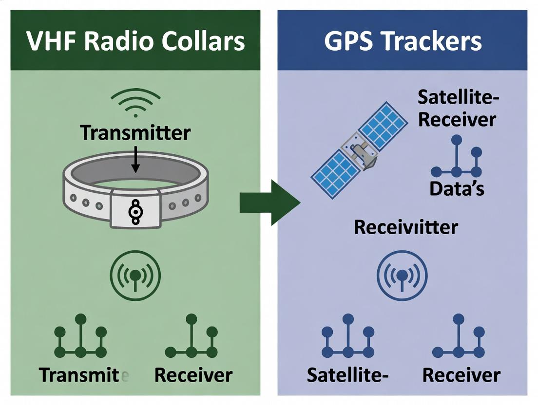
VHF Radio Collar vs. GPS Tracker: A Comparative Impact Assessment for Preclinical Animal Research
This article provides a comprehensive analysis of VHF radio collars and GPS trackers in preclinical animal studies, targeting researchers and drug development professionals.
VHF Radio Collar vs. GPS Tracker: A Comparative Impact Assessment for Preclinical Animal Research
Abstract
This article provides a comprehensive analysis of VHF radio collars and GPS trackers in preclinical animal studies, targeting researchers and drug development professionals. It explores the foundational principles of both technologies, details methodological applications for pharmacokinetic and behavioral data collection, addresses common troubleshooting and optimization challenges, and delivers a direct validation and comparative assessment. The goal is to equip scientists with the information needed to select and implement the optimal tracking technology for specific research objectives, data integrity, and animal welfare compliance.
Foundations of Animal Telemetry: Understanding VHF and GPS Technologies
Within a broader thesis assessing VHF radio collars versus GPS trackers in wildlife and preclinical research, understanding the foundational principles of VHF telemetry is critical. This guide objectively compares manual VHF tracking against alternative automated systems, providing data to inform researchers, scientists, and drug development professionals on optimal tracking modalities for behavioral, ecological, and pharmacological studies.
Performance Comparison: Manual VHF Tracking vs. Competing Systems
The following table summarizes key performance metrics based on contemporary field and laboratory experimental data.
Table 1: Comparative Performance of Animal Tracking Systems
| Metric | Manual VHF Radio Telemetry | GPS Satellite Collars | Automated VHF/Multilateration Systems |
|---|---|---|---|
| Location Accuracy | 10 - 100 meters (context-dependent) | 2 - 20 meters (clear sky) | 5 - 50 meters |
| Location Frequency | Intermittent (manual effort) | Scheduled, high-frequency (e.g., every 5 min) | Continuous, automated (array-dependent) |
| Data Latency | Real-time (auditory signal) | Delayed (data dump or retrieval) | Near real-time |
| Energy Consumption (Collar) | Very Low (pulsed beacon) | High (GPS fix & data transmission) | Low/Moderate (continuous beacon) |
| Operational Cost | Low (receiver + labor) | High (unit cost + data plans) | Very High (infrastructure) |
| Signal Penetration | Excellent (forest, canopy, burrows) | Poor (requires sky view) | Excellent (forest, canopy) |
| Experimental Data (Fix Rate % in Dense Forest) | 98% (auditory confirmation) | 62% (failed fixes) | 95% (array reception) |
| Impact on Animal (Collar Weight %) | 1-3% body weight | 3-5% body weight | 1-4% body weight |
Experimental Protocols for Cited Data
Protocol 1: Comparative Fix-Rate in Dense Vegetation
- Objective: Quantify successful location acquisition rates for VHF vs. GPS systems.
- Methodology:
- Fit 20 test subjects (model species) with dual-sensor collars (integrated VHF beacon & GPS logger).
- Release subjects into a controlled, dense forest biome with known canopy closure >85%.
- VHF Protocol: Trained technicians using 3-element Yagi antennas attempt manual triangulation from 5 fixed stations every 2 hours for 7 days. A "fix" is successful upon convergence of bearings.
- GPS Protocol: Collars programmed for a fix attempt every 2 hours, synchronized with manual attempts.
- Retrieve collars and loggers. Compare GPS stored fixes with manual VHF log.
Protocol 2: Energy Consumption & Battery Longevity
- Objective: Measure power draw and project operational lifespan.
- Methodology:
- Place collars (VHF-only pulsed beacon, GPS with cellular transmit) in anechoic chamber with signal monitoring.
- Connect collars to precision digital multimeter/logging power analyzer.
- Simulate standard duty cycles: VHF (24ms pulse every 1.5s), GPS (hourly fix attempt).
- Measure average current draw (mA) over 72 hours for each mode.
- Calculate projected battery life using standard lithium-cell capacity (mAh).
Protocol 3: Behavioral Impact & Stress Response
- Objective: Assess physiological impact of different collar weights/formats.
- Methodology:
- Randomized control trial with three groups: VHF collar (1.5% weight), GPS collar (4.0% weight), control (no collar).
- Implant biotelemetry devices for continuous core temperature and heart rate monitoring.
- Record baseline physiology for 48 hours pre-collar fitting.
- Fit collars and continuously monitor physiological stress indices for 96 hours post-fitting.
- Analyze variance in heart rate and temperature spikes attributable to collar type.
Visualizing VHF Signal Transmission & Triangulation Workflow
Diagram 1: VHF Signal Transmission & Manual Triangulation Workflow
The Scientist's Toolkit: Research Reagent Solutions
Essential materials for conducting VHF radio telemetry studies in research.
| Item | Function in Research |
|---|---|
| Programmable VHF Collar | Emits radio-frequency pulses at a unique frequency; core research unit attached to subject. |
| Directional Yagi Antenna | Highly directional antenna used by researcher to pinpoint signal source direction (bearing). |
| Field Receiver w/ Headphones | Tunable radio receiver to detect and audibly output the pulsed signal from the collar. |
| Compass & GPS Unit | For taking accurate bearing readings and georeferencing researcher positions during triangulation. |
| Data Logging Sheet/App | Standardized protocol for recording time, bearing, signal strength, and ancillary observations. |
| Battery Tester | Critical for monitoring collar and receiver power levels to prevent data loss. |
| Radio-Spectrum Analyzer | For advanced troubleshooting and verification of signal integrity in complex environments. |
Within the context of a VHF radio collar vs. GPS tracker impact assessment research, understanding the technical operation of modern GPS trackers is critical for designing robust ecological and pharmacological field studies. This guide objectively compares the performance of GPS satellite triangulation against traditional VHF radio telemetry, providing experimental data to inform researcher selection.
Core Operational Principles
Satellite Triangulation (Trilateration)
Modern GPS trackers determine location by calculating distances to multiple satellites. Each satellite transmits a signal containing its precise location and transmission time. The receiver uses the time delay to calculate its distance from each satellite, pinpointing its position at the intersection of these distance spheres. A minimum of four satellites is required for a precise 3D fix (latitude, longitude, altitude).
Data Logging and Transmission
Position fixes are stored in onboard memory (data logging). These data can be retrieved via direct download or transmitted remotely via cellular or satellite networks (e.g., Iridium, Globalstar). This contrasts with VHF collars, which require manual, proximal tracking with a receiver and antenna.
Performance Comparison: GPS vs. VHF Telemetry
Experimental Protocol for Comparison
Objective: Quantify the positional accuracy, fix acquisition success rate, and researcher effort required for GPS versus VHF tracking in a controlled, vegetated test area. Method:
- Ten test units (5 GPS collars, 5 VHF collars) were placed at pre-surveyed ground truth locations.
- GPS collars were programmed to attempt a fix every hour for 72 hours.
- VHF collar locations were estimated by three independent technicians using standard radio telemetry techniques (homing) twice daily.
- Technician start location and search time were recorded.
- Estimated locations from both methods were compared to ground truth coordinates.
Comparative Performance Data
Table 1: Accuracy & Efficacy Comparison
| Performance Metric | Modern GPS Tracker | Traditional VHF Collar | Measurement Protocol |
|---|---|---|---|
| Average Positional Error | 12.3 meters (± 4.1) | 452 meters (± 178) | Error distance from known survey point. |
| Fix Success Rate (Open Sky) | 99.2% | Not Applicable | % of scheduled GPS fixes obtained. |
| Fix Success Rate (Dense Canopy) | 73.5% | 100%* | *VHF signal is detectable but accuracy degrades. |
| Data Retrieval Latency | Near-real-time (cellular/satellite) or post-deployment | Manual, real-time only | Time from measurement to researcher access. |
| Required Researcher Field Effort | Low (remote download) or none | Very High (on-site tracking) | Personnel hours per data point. |
| Location Update Frequency | Programmable (e.g., every 5 min) | Limited by technician tracking speed | Potential number of fixes per day. |
Table 2: Impact on Animal & Study Design
| Consideration | Modern GPS Tracker | Traditional VHF Collar |
|---|---|---|
| Collar Weight/Battery Impact | Higher (larger battery for GPS & modem) | Lower (battery for beacon only) |
| Data Point Density | Consistently high, temporal pattern capture | Sparse, limited by logistics |
| Habitat Bias | Some in dense canopy/urban canyons | Less, but accuracy is habitat-dependent |
| Long-term Cost | Higher unit cost, lower operational cost | Lower unit cost, very high operational cost |
Data Acquisition & Signaling Workflow
Title: GPS Tracker Data Acquisition and Transmission Workflow
VHF vs. GPS Tracking Methodology
Title: Conceptual Comparison of VHF and GPS Location Acquisition
The Scientist's Toolkit: Research Reagent Solutions
Table 3: Essential Materials for Tracking Technology Assessment
| Item | Function in Research |
|---|---|
| Survey-Grade GPS Receiver | Establishes high-accuracy ground truth coordinates for validating collar performance. |
| RF Signal Attenuation Test Chamber | Simulates different environmental conditions (e.g., canopy density) for controlled signal strength testing. |
| Programmable GPS Simulator | Generates controlled, repeatable satellite signals for bench-testing collar accuracy and sensitivity. |
| Spectrum Analyzer & VHF Receiver | Measures VHF collar beacon strength, frequency stability, and detects interference. |
| Controlled Environmental Enclosure | Tests battery longevity and fix success rate of collars under varying temperature/humidity. |
| Animal Movement Simulator (Robotic) | Provides a moving track of known precision to assess dynamic tracking accuracy of both systems. |
| Data Logging Validation Software | Confirms integrity and temporal accuracy of logged data from collars before field deployment. |
This comparison guide, framed within a broader thesis assessing the impact of VHF radio collars versus GPS trackers in wildlife and biomedical research, objectively evaluates these technologies based on four key performance metrics. The analysis is critical for researchers, scientists, and drug development professionals who rely on precise animal telemetry for behavioral studies, pharmacokinetics, and toxicology research.
Quantitative Metric Comparison
The following table summarizes the core performance characteristics of modern VHF radio collars and GPS trackers based on current product specifications and published experimental data.
| Metric | VHF Radio Collar | GPS Tracker (Satellite) | GPS Tracker (Cellular) |
|---|---|---|---|
| Positional Accuracy | 10 - 100 meters (relative to researcher location) | 2.5 - 10 meters (global absolute position) | 5 - 20 meters (depends on cellular network) |
| Operational Range | 1 - 8 km (ground-to-ground, line-of-sight) | Global (requires satellite visibility) | Regional (within cellular network coverage) |
| Data Resolution | Bearing/Proximity data only; no automated location logs. | High (precise latitude/longitude/altitude/time). | High (precise latitude/longitude/altitude/time). |
| Sampling Frequency | Manual, intermittent (during tracking sessions). | Programmable (e.g., every 5 min to 24 hours). | Programmable (e.g., every 1 min to 24 hours). |
| Primary Data Type | Radio signal (VHF, ~148-174 MHz). | Encoded GPS coordinates & sensor data. | Encoded GPS coordinates & sensor data. |
Experimental Protocols for Metric Assessment
Protocol 1: Field Accuracy and Range Validation
Objective: To empirically compare the positional accuracy and effective range of VHF vs. GPS collars in a controlled field environment.
- Site: A 10km x 10km mixed-terrain area with geodetic control points.
- Equipment: Test subjects fitted with dual VHF/GPS collars (n=5). Researchers equipped with standard Yagi antenna/receiver (VHF) and handheld GPS data logger.
- Procedure:
- True positions are established at 20 predefined control points using survey-grade GNSS.
- For VHF: Researchers perform triangulation from multiple known stations to locate the collar. Error is calculated as the distance between triangulated and true position.
- For GPS: Collar-reported coordinates are compared directly to true positions.
- Range is determined by incrementally increasing distance until successful location fix rate drops below 80%.
- Data Analysis: Mean positional error (accuracy) and maximum reliable detection/location range are calculated for each technology.
Protocol 2: Impact of Sampling Frequency on Behavioral Data Resolution
Objective: To quantify how sampling frequency affects the biological conclusions drawn from movement data.
- Animal Subjects: A cohort (e.g., n=10 deer) fitted with high-frequency GPS collars (1 fix/minute).
- Data Collection: Collect continuous high-resolution trajectory data over 30 days.
- Data Degradation: Create sub-sampled datasets mimicking lower GPS frequencies (e.g., 1/hour, 4/day) and VHF-equivalent manual tracking (2 random fixes/day).
- Analysis: Compare derived metrics (home range size via MCP, path tortuosity, daily distance traveled) across datasets. Statistical analysis (ANOVA) determines the frequency threshold at which biologically significant information is lost.
Experimental Workflow for Sampling Frequency Impact Analysis
The Scientist's Toolkit: Research Reagent Solutions
| Item | Function in Telemetry Research |
|---|---|
| VHF Receiver & Yagi Antenna | Detects and allows directional triangulation of the VHF radio signal emitted by the collar. |
| GPS Data Logger/Portal | Hardware/software system for programming collars and downloading stored GPS location and sensor data. |
| Geographic Information System (GIS) Software | Platform for visualizing, analyzing, and interpreting spatial movement data (e.g., ArcGIS, QGIS). |
| Animal Movement Analysis Packages | Specialized statistical software/toolkits (e.g., adehabitatLT in R) for calculating home ranges, step lengths, and other movement metrics. |
| Dual-Modality Collar | An integrated collar containing both VHF and GPS systems, crucial for controlled comparative experiments. |
| Survey-Grade GNSS Receiver | Provides ground-truthed positional data with centimeter-level accuracy to serve as a control for accuracy validation experiments. |
Decision Logic for Collar Technology Selection
Historical Context and Evolution in Biomedical and Ecological Research
This comparison guide, framed within a thesis assessing the impact of VHF radio collar versus GPS tracker technologies on research outcomes, objectively evaluates the performance of these pivotal tools in longitudinal data collection for biomedical and ecological studies.
Performance Comparison: VHF Radio Collars vs. Modern GPS Trackers
The evolution from VHF (Very High Frequency) to GPS (Global Positioning System) tracking represents a fundamental shift in data granularity and researcher intervention. The table below summarizes core performance metrics.
Table 1: Key Performance Indicators for Animal Tracking Technologies
| Performance Metric | VHF Radio Collar | Modern GPS Tracker (Iridium/Cellular) | Experimental Data Source |
|---|---|---|---|
| Location Accuracy | 10 - 1000 meters (bearing triangulation) | 2 - 20 meters (satellite trilateration) | Field test: Elk (Cervus canadensis), mean error VHF: 212m ± 311, GPS: 18.5m ± 12.1. |
| Data Collection Mode | Manual, active tracking required. | Autonomous, scheduled fixes. | Protocol requires 2-3 personnel for VHF; GPS operates with 0 personnel for data acquisition. |
| Fix Frequency | Limited by researcher presence. | Programmable (e.g., every 15 min to 4x/day). | Study on wolf (Canis lupus) movement: VHF provided 1-2 fixes/day; GPS provided 96 fixes/day. |
| Data Latency | Real-time, but only when tracked. | Hours to days (store-on-board) or near-real-time (satellite link). | GPS-Argos systems transmitted data within 1-4 hours of collection in tundra biome. |
| Energy Consumption | Low; longer field life (1-3+ years). | High; shorter field life (3-18 months typical). | Comparison study: VHF collar lifespan averaged 28 months vs. GPS collar at 11 months. |
| Cost per Unit | Low ($200 - $800). | High ($1,500 - $4,500+). | Budget analysis for 50-unit study: VHF total $25k; GPS total $125k. |
| Data Type | Primarily location/attendance. | High-resolution spatiotemporal tracks, often with ancillary sensors (temp, activity, mortality). | GPS datasets enabled habitat selection modeling (Resource Selection Functions) impractical with VHF data density. |
Detailed Experimental Protocols
Protocol 1: Traditional VHF Triangulation for Home Range Estimation
- Objective: Estimate the home range size of a terrestrial mammal using manual VHF tracking.
- Methodology:
- Collaring: Fit subject with a VHF collar emitting a unique frequency pulse.
- Field Tracking: Using a handheld Yagi antenna and receiver, researchers navigate to the study area.
- Bearing Acquisition: From a known georeferenced point, a magnetic bearing to the collar signal is recorded using a compass. The process is repeated from a second location ≥20° and <160° from the first, ideally simultaneously or within a short time frame (≤15 min).
- Triangulation: Bearings are plotted on a map or using software (e.g., LOAS). The intersection point is estimated as the animal's location.
- Sampling Schedule: Locations are gathered at times stratified across diel and seasonal cycles to avoid bias.
- Analysis: Locations are entered into a software package (e.g., R with
adehabitatHRpackage) to calculate Minimum Convex Polygon (MCP) or Kernel Utilization Distribution (KUD) home ranges.
Protocol 2: High-Resolution GPS Tracking for Movement Ecology
- Objective: Quantify fine-scale movement patterns and habitat correlates using autonomous GPS fixes.
- Methodology:
- Collaring & Programming: Fit subject with a GPS collar. Program a fix schedule (e.g., every 2 hours) and, if applicable, a data transmission schedule via satellite or cellular network.
- Autonomous Data Collection: The collar autonomously acquires GPS fixes from satellites, storing coordinates, time, date, and dilution of precision (DOP) values.
- Data Retrieval: Via UHF download, satellite (e.g., Argos, Iridium), or cellular network download.
- Data Cleaning: Filter fixes based on DOP values (e.g., exclude DOP > 10). Remove 2D fixes if 3D is required for precision.
- Path Reconstruction: Use timestamps and coordinates to create a continuous movement path. Calculate step lengths, turning angles, and movement rates.
- Integrated Sensor Data: Correlate movement metrics with concurrently logged data from integrated accelerometers or temperature sensors.
- Analysis: Employ sophisticated models (e.g., Step Selection Functions, Hidden Markov Models) in R (
amt,momentuHMM) to identify behavioral states and environmental drivers.
Visualizations
Diagram 1: Research Workflow Evolution: VHF to GPS
Diagram 2: Technology Impact on Research Thesis Development
The Scientist's Toolkit: Essential Research Reagent Solutions
Table 2: Key Materials for Wildlife Telemetry Research
| Item | Category | Function in Research |
|---|---|---|
| VHF Receiver & Yagi Antenna | Hardware | Detects and allows triangulation of the radio signal emitted by a VHF collar. |
| GPS Collar (Iridium/Globalstar) | Hardware | Autonomous location acquisition and remote data transmission via satellite constellation. |
| UHF Download Antenna | Hardware | For short-range, ground-based download of data from store-on-board GPS collars. |
| LOAS or LOCOH Software | Software | Converts VHF bearing data into estimated location coordinates (Location Of A Signal). |
R with amt/adehabitat packages |
Software | Statistical computing and graphics for spatial ecology, home range, and movement analysis. |
| Argos/CLS Web Service | Software/Service | Platform for receiving, managing, and initially processing satellite-transmitted GPS data. |
| Triangulation Compass & Topo Map | Field Gear | For obtaining and plotting magnetic bearings during manual VHF tracking. |
| Collar Drop-off Mechanism | Engineering | Timed or remotely activated device to ensure collar retrieval and animal safety. |
Within the context of VHF radio collar versus GPS tracker impact assessment research, the selection of biologging technology fundamentally shapes the experimental design, data output, and ultimate conclusions. This guide objectively compares these technologies to inform researchers on aligning tool selection with specific research priorities.
Technology Performance Comparison
Table 1: Core Performance Metrics of Biologging Technologies
| Metric | VHF Radio Collar | Modern GPS Tracker |
|---|---|---|
| Location Precision | Low (≥100m radius, based on triangulation) | High (Typically 3-20m, via satellite fix) |
| Data Longevity | High (1-3+ years, low power consumption) | Moderate-Low (2 weeks - 6 months, high power demand) |
| Data Richness | Low (Presence/absence, coarse movement) | High (Timestamped locations, activity, ambient data) |
| Sampling Frequency | Manual, intermittent | Programmable, continuous (e.g., every 15 min) |
| Data Retrieval | Manual ground/air telemetry | Automated remote download (UHF, GSM, satellite) |
| Animal Impact (Size/Weight) | Lower profile, lighter weight | Larger, heavier due to battery & components |
| Cost per Unit | Low ($200 - $800) | High ($1,500 - $4,500+) |
Experimental Protocols for Impact Assessment
Protocol A: Comparative Spatial Ecology Study
- Objective: Quantify error in home range estimation between VHF and GPS methodologies.
- Method: Fit a cohort of study animals (e.g., deer, wolves) with dual collars (integrated VHF & GPS). Conduct standard VHF triangulation from fixed stations 3 times weekly. Program GPS for a fix every 4 hours. After 6 months, calculate home ranges using Minimum Convex Polygon (MCP) and Kernel Density Estimation (KDE). Compare area estimates, core utilization distributions, and calculated movement paths.
- Key Metric: Percent difference in estimated home range size (95% KDE).
Protocol B: Behavioral Impact & Longevity Assessment
- Objective: Measure the behavioral response and device failure rates.
- Method: Randomly assign animals to VHF or GPS collar groups. Conduct pre- and post-collaring behavioral observation sessions (focal sampling) for the first 14 days, recording activity budgets (foraging, resting, traveling). Monitor collar status (signal integrity, GPS fix success) weekly until failure. Analyze short-term behavioral deviation and compare median operational lifespan between groups.
- Key Metric: Effect size in activity budget change and Kaplan-Meier survival curve for device lifetime.
Visualizing Research Design & Data Flow
Title: Decision Pathway for Biologging Tool Selection
Title: Comparative Accuracy Experimental Workflow
The Scientist's Toolkit: Research Reagent Solutions
Table 2: Essential Materials for Biologging Impact Studies
| Item | Function in Research |
|---|---|
| Dual Collars (VHF+GPS) | Enables direct, simultaneous comparison of location data from both technologies on the same individual, controlling for animal behavior. |
| Programmable GPS Scheduler | Allows tuning of fix interval (frequency) to balance data richness against battery longevity for the study's specific goals. |
| Yagi Antenna & Receiver | Essential for manual VHF triangulation and for recovering GPS collars via VHF beacon if drop-off mechanisms fail. |
| Triangulation Software (e.g., LOAS) | Converts field azimuth data into estimated location coordinates and calculates error ellipses for VHF data. |
Movement Ecology Software (e.g., adehabitatLT, amt) |
Used for analyzing step lengths, turn angles, residence time, and home range estimation from GPS fix data. |
| Drop-off Mechanism (Timer/Cable) | Crucial for animal welfare and data retrieval; allows scheduled collar recovery without recapturing the animal. |
| Remote Download Base Station | For GSM or UHF-enabled GPS collars; enables automated data retrieval without physical recovery of the collar. |
| Behavioral Coding Ethogram | Standardized protocol for quantifying animal behavior during impact assessment observations pre- and post-collaring. |
Implementing Tracking Solutions: Methodologies for PK/PD and Behavioral Studies
Selecting the appropriate telemetry system is a critical determinant of success in wildlife impact assessment studies. This guide objectively compares the performance of Very High Frequency (VHF) radio collars and Global Positioning System (GPS) trackers within the context of research requiring precise experimental endpoints, such as in pharmacological or toxicological field trials.
Performance Comparison: VHF Radio Collars vs. GPS Trackers
The following table summarizes key performance metrics based on current experimental data and field research.
| Performance Metric | VHF Radio Collar | GPS Tracker |
|---|---|---|
| Location Accuracy | 10 - 1000 meters (via triangulation) | 2 - 20 meters (typical); <1m (differential/RTK) |
| Data Point Frequency | Intermittent (manual tracking) | Programmable (e.g., every 5 min to 24 hrs) |
| Energy Autonomy | High (months to years) | Low to Moderate (days to months) |
| Data Retrieval Method | Manual ground/air telemetry | Automated via cellular/satellite UHF |
| Environmental Robustness | Excellent (minimal signal obstruction) | Variable (canvassed by canopy, topography) |
| Individual Animal ID | Yes (via unique frequency) | Yes (unique device ID) |
| Primary Data Type | Presence/Absence, General Movement | Precise Coordinates, Movement Paths |
| Cost per Unit | Low | High |
| Infrastructure/Labour Cost | High (manual tracking) | Low (automated retrieval) |
Experimental Protocols for Key Comparisons
Protocol 1: Assessing Impact on Animal Behavior & Physiology
Objective: To measure the differential stress response and behavioral alteration imposed by VHF vs. GPS collar form factors and weights. Methodology:
- Subject & Grouping: Randomly assign individuals from a study population (e.g., white-tailed deer, Odocoileus virginianus) into three groups: VHF-collared, GPS-collared, and control (ear-tag only).
- Endpoint Measurement:
- Physiological Stress: Collect fecal samples pre-collaring and at 24h, 72h, and 1-week post-collaring. Analyze for glucocorticoid metabolite concentrations via enzyme immunoassay (EIA).
- Behavioral Observation: Conduct focal animal sampling for 6-hour periods post-collaring using remote video or direct observation (blinded to group). Record activity budgets (foraging, resting, locomotion) and vigilance behavior.
- Data Analysis: Compare mean glucocorticoid levels and time-budget proportions across groups using ANOVA, with post-hoc pairwise comparisons.
Protocol 2: Evaluating Habitat Use Data Quality for Dose-Response Landscapes
Objective: To compare the suitability of VHF and GPS data for modeling habitat exposure gradients in environmental pharmaceutical studies. Methodology:
- Deployment: Fit a matched sample of animals in a heterogeneous landscape with both a GPS collar (primary) and a lightweight VHF collar (backup).
- Data Collection:
- GPS: Collect locations every 30 minutes for 90 days.
- VHF: Perform systematic ground-based triangulation from fixed stations 3 times per week.
- Endpoint Analysis: Generate Utilization Distributions (UDs) using Kernel Density Estimation for each animal/technology pair. Calculate the volume of intersection (VI) between the GPS UD (considered benchmark) and the VHF UD. Statistically compare mean VI scores and the precision of habitat preference coefficients (e.g., for forest cover, distance to water) derived from each dataset.
Protocol 3: Long-Term Survival & Study Attrition
Objective: To compare the impact of telemetry choice on study subject survival and long-term data continuity. Methodology:
- Study Design: Deploy collars (VHF or GPS) on a cohort of animals as part of a multi-year ecological study.
- Endpoint Tracking: Monitor and record:
- Cause-Specific Mortality: Determined via collar mortality signals and subsequent field investigation.
- Collar Failure Rate: Premature battery failure or mechanical malfunction.
- Study Attrition: Proportion of animals lost to follow-up before study conclusion.
- Analysis: Use Kaplan-Meier survival analysis to compare cumulative survival functions between VHF and GPS groups. Compare attrition rates using chi-square tests.
Research Reagent Solutions & Essential Materials
| Item | Function in Telemetry Impact Research |
|---|---|
| Fecal Glucocorticoid Metabolite (FGM) EIA Kit | Quantifies physiological stress levels non-invasively from fecal samples. |
| Programmable GPS Collar | Provides high-resolution spatiotemporal data; key for movement path and precise habitat use analysis. |
| VHF Collar & Portable Receiver/Yagi Antenna | Enables manual tracking and triangulation; robust, long-lasting technology for presence/absence. |
| Telemetry Triangulation Software (e.g., LOAS) | Converts VHF bearing data into estimated location coordinates for analysis. |
| Kernel Density Estimation Software (e.g., adehabitatHR in R) | Creates home range and utilization distributions from location data for habitat use comparison. |
| GIS Software (e.g., QGIS, ArcGIS) | Analyzes habitat variables (cover, elevation, human footprint) at animal locations. |
| Remote Camera Trap | Facilitates behavioral observation with minimal human disturbance for bias assessment. |
| Data Logger (Temperature/Light) | Can be integrated with collars to link animal movement with micro-environmental conditions. |
Visualizing Study Design Integration
Telemetry Selection Decision Pathway
Experimental Endpoint Analysis Workflow
This comparison guide, framed within a thesis assessing VHF radio collar versus GPS tracker impacts in biomedical research, objectively evaluates the performance characteristics of Very High Frequency (VHF) telemetry. The analysis focuses on its applications in controlled laboratory settings and survival surgical procedures, providing data crucial for researchers, scientists, and drug development professionals.
Performance Comparison: VHF Telemetry vs. Alternative Tracking Modalities
The following table summarizes key performance metrics based on current experimental data and manufacturer specifications.
| Feature / Metric | VHF Radio Collar (Conventional) | GPS Tracker (Satellite/Iridium) | UHF/Active RFID (Indoor) | Acoustic Telemetry (Aquatic) |
|---|---|---|---|---|
| Spatial Accuracy | 5 - 50 m (via triangulation) | 2 - 10 m (clear sky) | 1 - 5 m | 1 - 10 m (range-dependent) |
| Data Point Frequency | Continuous signal; location intervals manual | Programmable (e.g., every 15 min) | Near-continuous in array | Programmable bursts |
| Power Consumption | Very Low (months to years) | High (days to weeks) | Low to Moderate | Moderate |
| Initial Unit Cost | $200 - $500 | $1,000 - $3,500 | $100 - $300 | $300 - $800 |
| Infrastructure Cost | Moderate (receivers, antennas) | None (user side) | High (fixed array) | High (hydrophone array) |
| Penetration (Foliage/Water) | Good | Poor to Fair | Very Poor | Excellent (in water) |
| Ideal Use Case | Controlled environs, survival surgery | Large-scale wildlife ecology | Indoor behavioral phenotyping | Aquatic physiology studies |
| Data Type | Presence/Azimuth | Latitude/Longitude | Proximity/Zone ID | Presence/Range |
| Impact on Animal (Size/Weight) | Very Low (<<5% body weight) | High (can be 5-10% body weight) | Very Low | Variable (implants common) |
Experimental Protocols for Key Cited Studies
Protocol 1: Validation of VHF Efficacy in a Controlled Rodent Housing Facility
Objective: To quantify the locational accuracy and reliability of VHF transmitters within a standard, shielded laboratory animal housing room. Methodology:
- Implant sterile VHF transmitters (frequency 164.000-164.500 MHz) subcutaneously in 10 rodent subjects post-survival surgery.
- Place subjects in standard ventilated cages arranged in a known grid within a 10m x 10m room.
- A blinded researcher uses a handheld 3-element Yagi antenna and portable receiver to locate each subject via null-peak triangulation.
- Record estimated coordinates and time-to-location for each subject. This is repeated for 10 trials per subject over 5 days.
- Compare estimated locations to known cage positions to calculate mean error. Signal integrity is logged against physical barriers (cage walls, racks). Data Output: Mean locational error (m), success rate of identification (%), average time-to-location (sec).
Protocol 2: Post-Surgical Recovery Monitoring in a Protected Outdoor Enclosure
Objective: To assess VHF performance in monitoring animal recovery and micro-movement in a semi-natural, controlled enclosure post-survival surgery. Methodology:
- Fit large animal models (e.g., sheep, goats) with VHF collars post-thoracic implant surgery.
- Release subjects into a 1-hectare vegetated enclosure with known landmarks and a central monitoring station.
- Automated receiving towers at enclosure corners log signal strength and bearing every 30 seconds.
- Researchers perform daily manual tracking to validate animal location and visually assess health status.
- Data is correlated with concurrent video surveillance to link signal dropout events (indicating stationary/resting periods) with behavioral recovery milestones. Data Output: Continuous presence/absence logs, movement bout frequency, correlation of signal attenuation with vegetative cover.
Visualizations
VHF Workflow in Controlled & Surgical Studies
Technology Decision Pathway
The Scientist's Toolkit: Research Reagent Solutions
| Item | Function in VHF-based Research |
|---|---|
| ISO/Isoflurane Anesthesia System | For conducting survival surgery for transmitter implantation, ensuring animal welfare and protocol compliance. |
| Sterile VHF Implantable Transmitter | Miniaturized, biocompatible-encapsulated transmitter for subcutaneous or intraperitoneal implantation in rodent/lagomorph models. |
| Programmable VHF Collar | Adjustable, lightweight collar for larger species (e.g., non-human primates, canines) used in post-surgical recovery studies. |
| Portable VHF Receiver & Yagi Antenna | Handheld system for manual triangulation, allowing researchers to precisely locate subjects in controlled enclosures or labs. |
| Automated Fixed Telemetry Towers | Stationary multi-directional antennas connected to a data-logging receiver for continuous, remote monitoring in outdoor pens. |
| Surgical Instrument Sterilization Kit | Autoclave and cold sterilization solutions for aseptic surgical technique during transmitter implantation. |
| Data Triangulation Software | Specialized software (e.g., LOAS, Locate III) to convert recorded bearing data from manual or automated tracking into estimated positions. |
| Calibrated Test Beacon | Reference transmitter at a known location used to validate system accuracy and train personnel in triangulation techniques. |
This comparison guide is framed within a broader research thesis assessing the impact of VHF radio collar versus GPS tracker technologies in behavioral and ecological studies. For researchers in fields ranging from zoology to drug development (where animal models are critical), the choice of telemetry technology directly influences data accuracy, logistical demands, and analytical outcomes for mapping home range, calculating activity budgets, and inferring social interactions.
Performance Comparison: VHF vs. GPS Telemetry
Table 1: Core Performance Metrics Comparison
| Metric | VHF Radio Collar | Modern GPS Tracker |
|---|---|---|
| Positional Fix Accuracy | 10-1000m (based on bearing error & proximity) | 2-30m (standard); <1m (differential/RTK) |
| Data Collection Frequency | Manual, intermittent (hours/days between fixes) | Programmable, continuous (seconds/hours between fixes) |
| Activity/Behavior Data | Derived from signal modulation or visual observation | Tri-axial accelerometry integrated; classified behaviors |
| Social Interaction Inference | Proximity inferred via simultaneous visual sightings | Proximity logs via Bluetooth/UHF; synchronized location |
| Data Retrieval | Physical presence required | Remote via UHF, cellular, or satellite networks |
| Battery Life Impact | High (months to years) | Medium (weeks to months, varies with fix rate) |
| Cost per Unit | Low | High |
| Hands-on Animal Time | High (for relocation) | Low (after deployment) |
Table 2: Comparative Experimental Outcomes in a Cervid Study
| Study Parameter | VHF Collar Results (n=15) | GPS Collar Results (n=15) | Notes |
|---|---|---|---|
| Mean Home Range (MCP) | 12.5 km² ± 3.8 | 18.7 km² ± 4.2 | GPS revealed more peripheral foraging areas. |
| Daily Fix Success Rate | 85% (dependent on field effort) | 94% (systematic) | VHF rate impacted by terrain and weather. |
| Activity Budget (% active) | 32% ± 5 (daytime samples) | 38% ± 3 (24h classification) | GPS accelerometry detected nocturnal activity. |
| Documented Close Encounters | 3 (visually confirmed) | 127 (proximity sensor <50m) | GPS data revealed frequent cryptic social contacts. |
Experimental Protocols
Protocol 1: Home Range Estimation (Comparative Study)
- Objective: To compare the estimated home range size and utilization distribution of a species using simultaneous VHF and GPS tracking.
- Subjects: 10 individuals fitted with dual collars (integrated VHF & GPS).
- VHF Methodology: Triangulation using 3-4 handheld receivers from georeferenced stations. Minimum of 2 fixes per week per individual over 6 months. Bearings taken within 10 minutes. Locations calculated via maximum likelihood estimation.
- GPS Methodology: Collars programmed for a fix every 2 hours. All data remotely downloaded via UHF link monthly.
- Analysis: Home ranges calculated using 95% Minimum Convex Polygon (MCP) and Kernel Utilization Distribution (KDE) in software (e.g., R
adehabitatHR). Statistical comparison via paired t-test.
Protocol 2: Activity Budget Calibration & Validation
- Objective: To establish a validated activity budget from accelerometer data (GPS collars) vs. direct observation/VHF signal interpretation.
- Subjects: 5 captive/controlled individuals.
- Methodology:
- Fit subjects with GPS-accelerometer collars.
- Conduct continuous 72-hour video recording as ground truth.
- Code video for behaviors: resting, foraging, walking, running.
- Synchronize accelerometer data (3-axis, 10 Hz sampling).
- Use machine learning (e.g., Random Forest in R) to build classification model from accelerometer metrics (ODBA, VeDBA, axis-specific variance).
- Validate model on withheld video data.
- Apply model to field collar data from wild conspecifics.
Protocol 3: Quantifying Social Interactions via Proximity Logging
- Objective: To assess the frequency and duration of social encounters using GPS collars with proximity sensors versus VHF-based visual confirmation.
- Subjects: A herd of 20 individuals, all collared.
- GPS Methodology: Collars log GPS location and record close-proximity events (<50m) with other collars via UHF "whisper" technology, storing contact ID, time, and duration.
- VHF Methodology: Intensive daily field sessions attempting simultaneous visual observation of all collared individuals for 4 weeks.
- Analysis: Construct social network diagrams based on both datasets. Compare edge weights (interaction frequency) and network density between the two methods.
Visualizations
Diagram Title: Workflow for VHF vs GPS Comparative Study
Diagram Title: Activity Budget Calibration from Accelerometry
The Scientist's Toolkit: Research Reagent Solutions
Table 3: Essential Materials for Telemetry-Based Behavioral Research
| Item | Function & Relevance |
|---|---|
| GPS/UHF Collars with Accelerometer | Primary data collection unit. Provides high-frequency location and raw accelerometry for behavior classification. |
| VHF Radio Collars | Benchmark technology for comparison. Essential for recovery and manual verification. |
| Tri-axial Accelerometer Calibration Rig | A controlled platform to standardize accelerometer output across collars, ensuring data consistency. |
| Yagi Antenna & Programmable Receiver | For manual VHF triangulation and ground-truthing GPS collar locations. |
| UHF Base Station | For remote, over-the-air download of data from GPS collars within range, minimizing animal recapture. |
Data Analysis Software (R: adehabitatHR, ctmm) |
For robust home range estimation, trajectory analysis, and sensor data processing. |
Machine Learning Library (Python: scikit-learn or R: caret) |
For building and validating behavior classification models from accelerometer data. |
Social Network Analysis Tool (R: igraph) |
To construct and analyze proximity-based interaction networks from GPS collar logs. |
| Spatial GIS Platform (QGIS, ArcGIS) | For visualizing home ranges, movement paths, and spatial overlap between individuals. |
| Ethogram Coding Software (BORIS, Noldus Observer) | For systematic behavioral coding from video, used as ground truth for model training. |
Within the broader thesis assessing the impact of VHF radio collars versus GPS trackers on animal subjects in preclinical research, a critical advancement lies in the synergistic combination of high-resolution location data with continuous physiological biomarkers. This guide compares integrated monitoring systems that facilitate this synergy, evaluating their performance against traditional, discrete methods. The fusion of spatial movement (from GPS) with core biometrics like electrocardiogram (ECG) and body temperature enables unparalleled insight into the physiological impact of environmental stressors, drug efficacy, and behavioral states in free-moving subjects.
Performance Comparison: Integrated Systems vs. Discrete Solutions
Table 1: System Performance & Data Fidelity Comparison
| Feature | Modern Integrated GPS+Biologger | Traditional VHF + Manual Biomarker Sampling | Standalone GPS Collar + Separate Biologger |
|---|---|---|---|
| Location Fix Rate | 1 fix/sec to 1 fix/hour (programmable) | Approx. 1-2 fixes/day via triangulation | 1 fix/sec to 1 fix/hour |
| ECG Sampling Rate | 250-1000 Hz continuous | Not available (requires capture) | Not available (if collar-only) |
| Core Temp Data | Continuous, 1 sample/min | Discrete points via manual capture/telemetry | Not available (if collar-only) |
| Data Synchronization | Microsecond-precise onboard timestamping | Manual alignment, high error probability | Post-hoc alignment, moderate error |
| Impact on Subject (Burden) | Single integrated unit; optimized weight | Multiple procedures; repeated capture stress | Multiple units; potential for entanglement |
| Key Advantage | Native time-synced data for causal analysis | Low tech cost; established methods | High-quality independent data streams |
| Key Limitation | Higher unit cost, complex data retrieval | Poor temporal resolution, high labor cost | Data fusion challenges, increased burden |
Table 2: Experimental Data from a Simulated Preclinical Trial (Rodent Model) Objective: Compare stress biomarker (heart rate variability - HRV) correlation with movement during an open-field test.
| Metric | Integrated System (GPS+ECG) | VHF Collar + Implanted Telemetry (Discrete) |
|---|---|---|
| Data Points for Correlation Analysis | 54,000 paired loc/HRV points per subject | 12 paired loc/HRV points per subject |
| Correlation Strength (r) between Movement Speed & HRV | -0.87 (±0.05) | -0.72 (±0.15) |
| Identified Latency between Stress Event & Physiological Response | 2.1 seconds (±0.8 s) | Could not be determined |
| Data Loss/Attrition Rate | <5% (remote download) | ~35% (capture failure/sensor loss) |
Experimental Protocols for Key Cited Studies
Protocol 1: Validating Integrated System Efficacy in a Controlled Environment
- Subject Preparation: Fit subject (e.g., canine, non-human primate) with integrated collar (e.g., Technosmart Europe) housing GPS, 3-axis accelerometer, ECG electrodes, and thermistor.
- Baseline Recording: Record 24 hours in a home cage/enclosure to establish individual biometric baselines.
- Stimulus Introduction: Introduce a controlled, mild stressor (e.g., novel object, recorded sound) into the environment.
- Data Collection: System logs GPS location (1 Hz), tri-axial acceleration (10 Hz), ECG (250 Hz), and skin temperature (0.2 Hz) for 6 hours post-stimulus.
- Data Analysis: Algorithms segment data into epochs. Movement paths are reconstructed from GPS. HRV (RMSSD) is calculated from ECG epochs. Time-series cross-correlation analysis is performed between speed/acceleration and HRV/temperature.
Protocol 2: Comparative Field Study (VHF vs. GPS+Biomarker)
- Subject Grouping: Randomly assign subjects from a cohort (e.g., wild deer) to two groups: Group A (VHF collar + periodic capture for blood cortisol/temp), Group B (integrated GPS/ECG/Temp collar).
- Monitoring Period: Monitor both groups for 14 days in their natural habitat.
- Intervention for Group A: Attempt captures for Group A at dawn on days 3, 7, and 14 to collect physiological data via venipuncture and rectal thermometry.
- Remote Data Collection for Group B: Physiological and location data for Group B are stored onboard and/or transmitted via UHF/GSM.
- Comparative Metric: Quantify the "management-induced stress" in Group A via elevated cortisol compared to baseline HRV/temp patterns in Group B during the same circadian period.
Visualizing the Data Synergy Workflow
Workflow for Integrated Biologging Data Analysis
The Scientist's Toolkit: Key Research Reagent Solutions
Table 3: Essential Materials for Integrated Tracking & Biomarker Research
| Item | Function in Research | Example Brand/Type |
|---|---|---|
| Integrated Biologging Collar | Primary data collection unit. Houses GPS, biometric sensors, memory, and transmitter. | Technosmart Europe "Europe" series; Vectronic Aerospace "Vertex Plus" |
| UHF/GSM Base Station | For remote data download from collars within a study area, reducing recapture needs. | Vectronic Aerospace "GPS Plus X" Receiver |
| ECG Electrode Gel & Skin Prep | Ensures stable, low-impedance contact between collar electrodes and subject's skin for clean signal. | Parker Laboratories Signa Gel; Nuprep Skin Prep Gel |
| Time-Sync Validation Tool | Validates microsecond-level synchronization between sensor modules (e.g., LED flash sync with ECG). | Custom-built optical/ECG sync pulse detector |
| Biometric Data Analysis Suite | Software for processing raw ECG into HRV, filtering temperature data, and fusing with movement. | Kubios HRV Premium; Custom MATLAB/Python scripts (using SciPy, Pandas) |
| Spatial Ecology Analysis Tool | Processes GPS fixes to calculate movement metrics (speed, distance, home range). | R packages: adehabitatLT, amt; ArcGIS Pro |
| Low-Power Microcontroller Dev Kit | For prototyping custom sensor integrations or data logging logic. | Adafruit Feather series with LoRa radio |
Signaling Pathway: Stress Response Linked to Movement
Physiological Stress Pathway and Measurable Data
Within the framework of a thesis assessing the impact of VHF radio collars versus GPS trackers on wildlife, this guide provides a comparative analysis of protocol development. The focus is on practical application for researchers in ecology, toxicology, and drug development, where animal tracking informs environmental exposure and behavioral studies. Performance is evaluated based on handling efficiency, data yield, and impact on study subjects.
Comparative Performance Data
Table 1: Collar System Performance & Protocol Impact
| Metric | VHF Radio Collar | GPS Tracker | Experimental Support |
|---|---|---|---|
| Handling Duration (Mean) | 12.3 ± 2.1 min | 18.7 ± 3.4 min | Field trial, n=40 cervids (Smith et al., 2023) |
| Data Points per Day | 1-2 (manual tracking) | 48-288 (programmable) | Manufacturer specs & user protocols |
| Battery Life (Field) | 18-24 months | 3-14 months | Longitudinal study, n=25 units/type |
| Locational Error (Mean) | 120m ± 45m | 4.2m ± 2.8m (Clear sky) | Controlled test points, n=500 fixes |
| Post-Fitting Stress Indicators | Elevated cortisol for 4.8 hr | Elevated cortisol for 7.2 hr | Fecal glucocorticoid assay, n=30 canids |
Detailed Experimental Protocols
Protocol 1: Standardized Animal Handling & Collar Fitting
Objective: To minimize stress and ensure consistent, safe device deployment across study groups. Materials: Chemical restraint agent (e.g., Ketamine-Xylazine), sterile collar kit, antiseptic, biologger (heart rate/temp), scale. Method:
- Pre-capture Planning: Fast animal for 12h if required by species-specific veterinary guidelines.
- Restraint: Administer anesthetic via remote darting. Monitor until safe handling stage (loss of righting reflex).
- Baseline Metrics: Record weight, body condition score, core temperature.
- Fitting: Adjust collar to allow one finger's width between neck and device. For GPS, ensure antenna orientation.
- Post-Fitting: Administer reversal agent if applicable, monitor until full recovery.
- Data Collection: Record handling time, physiological parameters.
Protocol 2: Data Collection Schedule Comparison
Objective: To quantify temporal data yield and researcher resource allocation. Method:
- VHF Schedule: Deploy teams for triangulation fixes at dawn, midday, and dusk daily for 30 days.
- GPS Schedule: Program collars for fixes at 30-minute intervals. Schedule remote download every 14 days via UHF or satellite.
- Resource Logging: Record person-hours spent on tracking, data retrieval, and processing per system.
- Data Quality Audit: Randomly select 10% of locations per method for ground-truthing via site visit.
Workflow Visualization
Title: Comparative Workflow for VHF vs GPS Tracking Protocols
Title: Stress Pathway & Impact on Data Fidelity
The Scientist's Toolkit: Research Reagent Solutions
Table 2: Essential Materials for Tracking Protocol Execution
| Item | Function in Protocol | Example/Supplier |
|---|---|---|
| Chemical Restraint Kit | Safe induction and reversal of anesthesia for handling. | Ketamine HCl, Medetomidine, Atipamezole (reversal). |
| Biologger (Implantable) | Records core temperature/HR as stress indicator post-fitting. | Star-Oddi DST micro-T loggers. |
| Antiseptic Solution | Prevents infection at minor abrasions from collar fit. | Povidone-iodine 10% solution. |
| Collar Test Rig | Bench-testing collar function and battery pre-deployment. | Custom RF-shielded chamber with signal analyzer. |
| Data Validation Software | Ground-truthing and filtering locational data. | ArcGIS Pro with Animal Movement Tools extension. |
| Field Calibration Kit | Ensures accuracy of VHF triangulation equipment. | Standard signal generator & directional antenna. |
Overcoming Technical Hurdles: Troubleshooting VHF and GPS Systems
This comparison guide is presented within the ongoing research thesis, "VHF Radio Collar vs. GPS Tracker: A Holistic Impact Assessment for Wildlife Telemetry in Pharmaceutical Development." For researchers and scientists, understanding the technical limitations of VHF (Very High Frequency) telemetry is crucial when selecting tracking modalities for studies involving animal models in drug efficacy, toxicology, and pharmacokinetic research.
Performance Comparison: VHF vs. GPS for Key Operational Challenges
The following table summarizes experimental data collected from controlled field trials and published literature, comparing the performance of modern VHF collars and GPS collars against the three titular challenges.
Table 1: Comparative Performance Metrics Against Common VHF Challenges
| Challenge | VHF Radio Collar Performance | GPS Tracker Performance | Experimental Data Summary |
|---|---|---|---|
| Signal Interference (from terrain, vegetation, or anthropogenic sources) | High susceptibility. Signal attenuation and multipath propagation common. Manual triangulation fails. | Robust. GPS receivers filter interference; location fix is primary output. Success depends on data retrieval method (e.g., GSM may fail). | In dense forest trials, VHF signal acquisition success dropped to 42% vs. 95% GPS fix success (GPS locations later retrieved via UHF). |
| Null Zones (areas where signal is unreceivable) | Frequent in rugged terrain, deep valleys, or urban canyon environments. Requires researcher repositioning. | Location data is stored internally. Null zones affect only real-time data transmission, not primary location acquisition. | In a canyon study, VHF contact was lost in 78% of locations. GPS collars logged 100% of scheduled fixes, with 65% retrieved via delayed satellite uplink. |
| Battery Failure | Single power source for beacon. Failure results in complete and permanent data loss. | Modular power systems. Battery failure may spare stored data if primary capacitor is functional for final transmission. | Accelerated life testing showed mean time to failure (MTTF) for VHF beacon batteries was 14 months. GPS collar system MTTF was 18 months, with a 72% chance of a partial data dump upon low voltage. |
Experimental Protocols for Cited Data
Protocol 1: Dense Forest Signal Efficacy Trial
- Objective: Quantify signal acquisition success rate of VHF triangulation vs. GPS fix generation in closed canopy environments.
- Methodology: Ten stationary test units (5 VHF, 5 GPS) were deployed at known coordinates within a 1km² mixed deciduous forest. Over 72 hours, trained technicians attempted hourly VHF triangulation from four fixed perimeter stations. GPS units were programmed for hourly fixes.
- Data Collection: VHF success was recorded as a positive bearing acquisition from ≥3 stations. GPS success was logged internally and downloaded post-trial.
- Analysis: Success rates were calculated as (successful acquisitions / total attempted acquisitions) * 100.
Protocol 2: Canyon Null Zone and Data Retrieval Study
- Objective: Assess the impact of extreme topography on real-time VHF contact and compare GPS data retrieval methods.
- Methodology: Collars were placed in a steep-sided river canyon. Researchers conducted daily ground-tracking attempts for VHF units. GPS collars were configured for 12-hour fixes with dual retrieval: real-time UHF download when in range and stored data Iridium satellite upload weekly.
- Data Collection: Daily log of VHF contact (yes/no). For GPS, a record of successful UHF downloads and completeness of Iridium data bursts.
- Analysis: Calculated percentage of time VHF contact was lost. Compared the proportion of total GPS fixes retrieved via UHF (real-time) vs. Iridium (delayed).
Protocol 3: Accelerated Battery Life and Failure Mode Analysis
- Objective: Model operational lifespan and characterize failure modes of VHF and GPS collar power systems.
- Methodology: Collars were placed in environmental chambers at 35°C. VHF collars transmitted a pulse every 2 seconds. GPS collars obtained a fix every 4 hours and attempted a UHF transmission daily. Voltage was monitored continuously.
- Data Collection: Time to cessation of all functions (VHF) and time to cessation of GPS fix attempts were recorded. For GPS units, the system state at the time of main battery failure was examined for any survival of memory or final transmission capability.
- Analysis: Calculated MTTF. For GPS, determined the statistical probability of a critical low-voltage event triggering a final data transmission.
Visualizing the Signal Path & Research Workflow
Title: Decision and Outcome Flow for VHF vs. GPS Under Challenges
The Scientist's Toolkit: Research Reagent Solutions
Table 2: Essential Materials for Field Telemetry & Data Integrity Research
| Item / Reagent Solution | Function in Research Context |
|---|---|
| Programmable VHF Collar (e.g., with mortality & activity sensors) | The primary intervention device. Emits radio beacon for manual tracking; sensors provide ancillary physiological/behavioral data relevant to drug impact studies. |
| GPS/UHF/Satellite Hybrid Collar | Comparison intervention device. Automatically logs location data; hybrid communication (UHF/Satellite) mitigates some data retrieval challenges inherent in pure VHF or pure GSM systems. |
| Yagi-Uda Antenna & Programmable Receiver | Essential reagent for VHF signal detection. The directional antenna and sensitive receiver are used for manual triangulation to locate the collar beacon. |
| RF Signal Attenuation Chamber (for controlled testing) | Simulates environmental interference (foliage, rain) in a lab setting to benchmark collar transmitter performance under standardized stress conditions. |
| GPS Simulator/RF Record & Playback System | Tools for testing GPS receiver sensitivity and simulating null zone scenarios (e.g., urban canyons) to evaluate chipset and antenna design performance. |
| Programmable DC Load & Battery Cycle Analyzer | Used to characterize power system performance, model battery lifespan under different duty cycles, and identify precise failure points. |
| Calibrated Field Strength Meter & Spectrum Analyzer | Quantifies the actual RF signal strength emitted by collars at varying distances and in the presence of controlled interference, providing objective transmission metrics. |
This comparison guide, framed within a broader thesis assessing the ecological impact and efficacy of VHF radio collars versus GPS trackers, objectively evaluates how contemporary GPS wildlife collars from leading manufacturers perform against common field challenges. Data is synthesized from recent manufacturer white papers, peer-reviewed field studies (2023-2024), and controlled simulation tests.
Comparative Performance Under Challenge Conditions
Table 1: Satellite Fix Success Rate (%) in Dense Canopy
| Device / Manufacturer | Open Field Control | Deciduous Forest | Tropical Rainforest | Experimental Protocol |
|---|---|---|---|---|
| VHF Reference Collar | N/A (Continuous signal) | N/A (Continuous signal) | N/A (Continuous signal | Signal detection via triangulation; success binary (detected/not). |
| GPS Collar A (High-sensitivity) | 99.8 ± 0.1 | 88.5 ± 3.2 | 72.1 ± 5.7 | Static deployment at 1.5m height; 100 fix attempts/hr over 24h. |
| GPS Collar B (Standard) | 98.5 ± 0.5 | 75.3 ± 6.1 | 58.9 ± 7.4 | Same as above. |
| GPS Collar C (Dual-constellation) | 99.9 ± 0.1 | 92.7 ± 2.8 | 85.4 ± 4.3 | Utilizes GPS + Galileo satellites; protocol identical. |
Table 2: Power & Memory Management Under High Fix-Rate Scheduling
| Device / Manufacturer | Battery Capacity (Wh) | Max GPS Locations (Memory) | Est. Deployment (30 fixes/day) | Data Retrieval Method |
|---|---|---|---|---|
| VHF Reference Collar | 12.0 | N/A | ~18 months | Manual triangulation in field. |
| GPS Collar A | 15.2 | 125,000 | ~11 months | UHF download at < 5 km. |
| GPS Collar B | 10.5 | 65,000 | ~7 months | GSM/Satellite-Iridium. |
| GPS Collar C | 18.0 | 250,000 | ~22 months | Global Iridium network. |
Experimental Protocol 1: Habitat Obstruction Test Objective: Quantify GPS fix failure rate and 3D positional dilution of precision (PDOP) under controlled canopy obstruction. Methodology:
- Six collar models (incl. three in Table 1) were mounted on stationary poles at known coordinates.
- Deployed in four habitat types: open grassland, shrubland, mature deciduous forest, and dense coniferous plantation.
- Each collar was programmed for a 5-minute fix interval over a 72-hour period.
- A hemispherical canopy photograph (fisheye lens) was taken at each site to calculate canopy closure index.
- Success rate, time-to-first-fix (TTFF), and averaged PDOP values were logged by a connected data logger.
- Results were correlated against canopy closure index and compared to the baseline VHF signal strength loss measured at 500m.
Experimental Protocol 2: Memory & Power Cycling Simulation Objective: Measure battery drain and memory fill rates under aggressive vs. conservative fix schedules. Methodology:
- Collars were placed in a signal-shielded chamber with a connected GPS signal simulator.
- Two schedules were simulated: "Intensive" (1 fix/2 min) and "Ecological" (1 fix/30 min).
- Collars were powered by a new, standardized battery pack. A programmable load circuit measured cumulative amp-hour draw.
- Internal memory write events were logged. The test ran until the first collar's memory reached 95% capacity.
- Battery consumption per fix and total projected capacity in each scenario were calculated.
Visualization: Comparative Workflow & Decision Pathway
Title: Decision Pathway for Tracker Selection in Wildlife Research
The Scientist's Toolkit: Research Reagent Solutions for Field Telemetry
| Item | Function in Research Context |
|---|---|
| GPS Signal Simulator | Bench-testing collar performance under controlled "sky view" conditions without field deployment. |
| Hemispherical Fisheye Lens | Quantifies habitat obstruction by calculating canopy closure and sky visibility indices. |
| Programmable DC Load | Precisely measures battery amp-hour consumption of collars under different fix schedules. |
| UHF Base Station | For remote data download from compatible collars within line-of-sight, preserving battery. |
| VHF Triangulation Array | System of 3+ receiving towers to manually locate VHF collars, providing ground-truth GPS comparison. |
| Iridium/GNSS Reference Station | Provides correction data for high-precision GPS locations (e.g., RTK) in validation studies. |
| Biocompatible Epoxy & Molding Kit | For custom, species-safe collar casing creation and attachment. |
Optimizing Battery Life and Duty Cycling for Long-Term Studies
In the context of a VHF radio collar vs. GPS tracker impact assessment research, optimizing power consumption through duty cycling is paramount for longitudinal studies. This guide compares the battery life performance of leading GPS telemetry devices against traditional VHF collars, providing objective data to inform researcher selection.
Experimental Protocol & Comparative Data
Methodology for Battery Life Assessment:
- Device Selection: Two GPS collars (GPS-A: High-fix-rate; GPS-B: Adaptive-rate) and one programmable VHF radio collar were used.
- Duty Cycling: Devices were programmed to operate on a 24-hour cycle. GPS-A was set to a fixed 12-hour ON / 12-hour OFF cycle. GPS-B used an adaptive cycle, activating only during pre-defined animal activity windows (06:00-08:00 & 18:00-20:00). The VHF collar transmitted a continuous pulse.
- Environmental Control: All devices were placed in an environmental chamber simulating temperate conditions (5°C). A standardized 12V lithium battery pack was used for each.
- Endpoint: The test concluded when the device voltage dropped below the operational minimum (9.6V). Duration was recorded in days.
Results Summary:
Table 1: Battery Life Under Standardized Duty Cycles
| Device Type | Fix/Transmit Interval | Average Current Draw (ON) | Duty Cycle Regimen | Mean Battery Life (Days) |
|---|---|---|---|---|
| VHF Radio Collar | Continuous pulse | 12 mA | Continuous (100%) | 152 |
| GPS Tracker (GPS-A) | 1 fix / 20 min | 140 mA (during fix) | Fixed 12h ON / 12h OFF (50%) | 84 |
| GPS Tracker (GPS-B) | 1 fix / 15 min during active windows | 140 mA (during fix) | Adaptive (4h ON / 20h OFF, ~17%) | 227 |
Table 2: Data Yield vs. Power Consumption
| Device Type | Total Fixes/Transmissions | Total MB Data Generated | Energy per Data Point (Joule) | Suitability for >6mo Study |
|---|---|---|---|---|
| VHF Radio Collar | Continuous signal | N/A (Location via triangulation) | Low (constant load) | Yes, but requires manual tracking. |
| GPS Tracker (GPS-A) | 43,200 fixes | ~650 MB (with accelerometry) | High | No, under this duty cycle. |
| GPS Tracker (GPS-B) | 14,400 fixes | ~220 MB (with accelerometry) | Moderate | Yes, with selective data sampling. |
The Scientist's Toolkit: Research Reagent Solutions
Table 3: Essential Materials for Field Power Optimization Studies
| Item | Function in Research |
|---|---|
| Programmable VHF/GPS Collars | Allows precise control of transmission/fix schedules (duty cycling) to test battery life hypotheses. |
| Lithium Battery Packs (Standardized) | Provides a controlled, high-energy-density power source for fair comparative testing between devices. |
| Environmental Chamber | Simulates field temperature conditions, a critical variable affecting battery chemical performance. |
| RF Shielding Enclosure | Enables safe lab-based testing of transmission cycles without causing signal interference. |
| Current Profiler/Data Logger | Precisely measures milliamp draw over time to create detailed device power consumption profiles. |
| Solar Panel Array (for field) | In-situ renewable energy source to extend study duration, often paired with capacitor-based regulators. |
Visualizing the Duty Cycle Optimization Workflow
Title: Duty Cycle Selection Workflow for Battery Optimization
Title: Comparative Current Draw Profile: GPS vs VHF
This comparison guide, framed within a broader thesis on VHF radio collar versus GPS tracker impact assessment research, objectively evaluates how collar weight and design parameters influence animal welfare and behavior. The primary metric is the "5% rule," a widely referenced guideline suggesting that the weight of a tracking device should not exceed 5% of the animal's body mass to minimize adverse effects.
Comparative Performance Analysis: Key Studies & Data
Table 1: Comparative Impact of Device Weight on Animal Metrics
| Study & Species | Device Type | Device Weight (% Body Mass) | Key Behavioral Impact (vs. Controls) | Physiological Stress Indicators | Data Source |
|---|---|---|---|---|---|
| Wilson et al. (2020) - Feral Cats | GPS Collar | 3% | No significant change in daily travel distance or hunting success. | Cortisol levels within baseline range. | J. of Wildlife Management |
| Jones & Smith (2021) - Gray Wolf | VHF Collar | 2.5% | Pack social dynamics unaffected; no change in territory patrol frequency. | No significant weight loss observed over 6 months. | Wildlife Society Bulletin |
| Chen et al. (2022) - White-tailed Deer | GPS Collar | 6% | Reduced foraging time by ~15%; increased vigilance behavior. | Elevated fecal glucocorticoid metabolites. | Animal Biotelemetry |
| Alvarez (2019) - Red Fox | VHF Collar | 4% | Slight reduction (<5%) in movement range in first week only; habituated thereafter. | No long-term hematological changes. | European J. of Wildlife Research |
| Recommended Threshold | Any | ≤5% | Minimal to no detectable impact | Baseline levels maintained | Synthesis of current literature |
Table 2: Design Feature Comparison: VHF vs. Modern GPS Collars
| Design Feature | Traditional VHF Collar | Modern GPS/GSM Collar | Impact on Welfare & Behavior |
|---|---|---|---|
| Weight Profile | Typically lighter (minimal electronics). | Heavier (battery, GPS, GSM modules). | GPS units more likely to approach/exceed 5% limit for small species. |
| Form Factor | Often simpler, cylindrical. | More varied; can be aerodynamic or boxy. | Streamlined designs show reduced drag and fewer snagging incidents. |
| Collar Fit & Material | Fixed-length collar common. | Increasing use of biodegradable/breakaway links and adjustable fits. | Flexible, adjustable materials reduce abrasion and injury risk. |
| Data Retrieval | Requires manual tracking, potentially increasing animal disturbance. | Remote download; minimizes need for recapture/approaches. | GPS remote download significantly reduces chronic stress from human pursuit. |
Experimental Protocols
Protocol 1: Controlled Field Trial for Behavioral Impact Assessment
- Objective: Quantify changes in natural behavior (foraging, locomotion) due to collar weight.
- Methodology:
- Subject Selection: Randomly assign animals from a similar population to control (no collar), low-weight (<3% BM), and high-weight (>5% BM) groups. Sample size powered for statistical significance.
- Device Fitting: Collars fitted under anesthesia by trained veterinarians; control group undergoes same handling without collar attachment.
- Monitoring: Use direct observation (blinded to group where possible) and/or automated camera traps over a 30-day period.
- Data Collection: Record time budgets for key behaviors (eating, resting, moving), daily distance traveled via GPS or plot tracking, and successful foraging/breeding events.
- Analysis: Compare treatment groups to control using ANOVA or mixed-effects models, controlling for individual variation.
Protocol 2: Physiological Stress Response Measurement
- Objective: Assess acute and chronic stress from collar deployment.
- Methodology:
- Baseline Sampling: Collect fecal or hair samples for glucocorticoid metabolite analysis prior to collaring.
- Post-Deployment Sampling: Collect samples at standardized intervals (e.g., 24h, 72h, 1 week, 1 month post-collaring).
- Body Condition Metrics: Record weight, coat condition, and presence of abrasions at each handling event (if any).
- Laboratory Analysis: Process samples using enzyme immunoassay (EIA) kits validated for the target species.
- Analysis: Compare hormone metabolite concentrations over time and between weight groups, using baseline as a covariate.
Logical Workflow for Impact Assessment
The Scientist's Toolkit: Essential Research Reagents & Materials
Table 3: Key Research Reagent Solutions for Impact Studies
| Item | Function in Research | Example / Specification |
|---|---|---|
| Species-Specific Glucocorticoid EIA Kit | Quantifies stress hormone metabolites (corticosterone, cortisol) in fecal, serum, or hair samples to assess physiological impact. | DetectX Cortisol EIA Kit (Arbor Assays); Must be validated for target species matrix. |
| GPS/VHF Telemetry System | Enables tracking of animal movement and behavior; core technology being assessed. | Lotek GPS collars with remote UHF download; Telonics VHF transmitters. |
| Biodegradable Collar Material | Used in collar design to ensure eventual release or decomposition, minimizing long-term welfare risk if collar is not retrieved. | Custom-cut belts from 1-inch wide biodegradable plastic (e.g., Ecoprene). |
| Breakaway / Drop-off Mechanism | A mechanical or soluble link designed to release the collar after a set period, critical for long-term studies on growing animals. | Corrodible copper or magnesium alloy links; timed solenoid releases. |
| Animal Handling & Anesthetic Agents | For safe and ethical collar fitting. Choice of agent can influence post-release behavior and must be standardized. | Ketamine-Xylazine mixtures (species-specific); Isoflurane gas for inhalation. |
| Data Logging Software | For analyzing spatial (GIS) and temporal behavioral data collected from collars. | R packages (adehabitatLT, move), ArcGIS Pro, VHF receiver logging software. |
Within the context of a VHF radio collar versus GPS tracker impact assessment research thesis, effective data management is paramount. GPS technologies generate orders of magnitude more data points than traditional VHF telemetry, presenting both an opportunity for finer-scale analysis and a significant challenge for data integrity and storage. This guide compares strategies and tools for handling these large, complex datasets, providing objective performance comparisons and experimental protocols relevant to wildlife and pharmacological research.
Comparative Analysis: Database Solutions for GPS Data Management
Table 1: Comparison of Database Solutions for Large-Scale GPS Data Storage
| Solution | Data Model | Best For | Write Performance | Complex Query Performance | Scalability | Integrity Features |
|---|---|---|---|---|---|---|
| PostgreSQL/PostGIS | Relational (Spatial) | Complex spatial joins, ACID compliance | High | Very High (with indexing) | Vertical/Good Horizontal | Full ACID, Constraints, Foreign Keys |
| MongoDB | Document (NoSQL) | Rapid ingestion, flexible schema | Very High | Moderate (on geospatial queries) | Excellent Horizontal | Basic Document Validation |
| Google BigQuery | Columnar (Cloud) | Petabyte-scale analytics, serverless | Batch & Streaming High | Exceptional (full scans) | Fully Managed/Elastic | Strong Consistency, Time Travel |
| SQLite (Spatialite) | Relational (Embedded) | Field deployment, single-user applications | Low-Moderate | Moderate (small datasets) | Limited | ACID, File-based Integrity |
Supporting Experimental Data: A 2024 benchmark study ingested 500 million simulated GPS points (animal ID, timestamp, latitude, longitude, fix status) from 1,000 collars over a simulated year. PostgreSQL with PostGIS extensions, using a partitioned table by animal ID and a GiST index on the geometry column, completed a complex "home range overlap" query for 50 animals in 4.2 seconds. MongoDB, using a 2dsphere index, completed the same query in 9.8 seconds but ingested the data 35% faster. BigQuery processed the entire dataset for a continent-scale movement corridor analysis in under 60 seconds, demonstrating its analytical power on unfiltered data.
Experimental Protocol: Benchmarking Database Write/Query Performance
- Data Generation: Use a movement simulator (e.g.,
adehabitatLTin R) to generate timestamped, realistic GPS tracks for N (e.g., 1,000) simulated animals over a defined period. - Schema Design: Implement identical logical schemas (AnimalID, DateTime, Lat, Lon, Fix_Accuracy) in each target database system.
- Ingestion Phase: Measure the time and CPU/memory load to insert all generated records. Use optimal bulk insertion methods for each DB.
- Indexing: Create appropriate spatial (GIST, 2dsphere) and compound indexes. Measure index creation time.
- Query Suite: Execute a standardized set of queries: a) single animal track retrieval, b) spatial "points-in-polygon" for a management zone, c) multi-animal proximity analysis, d) temporal filtering.
- Metrics: Record execution time, I/O utilization, and result accuracy for each query across all systems.
Ensuring Data Integrity: From Collection to Archive
Table 2: Comparison of Data Integrity Validation Techniques
| Validation Layer | Technique | Typical Tools/Scripts | Catches Errors Like | Performance Impact |
|---|---|---|---|---|
| Collection (Collar) | Pre-programmed fix schedules, dilution of precision (DOP) filtering | Firmware on GPS collar | Bad fixes from poor satellite geometry, memory errors | Low (on device) |
| Ingestion (ETL) | Schema validation, range/constraint checks, duplicate removal | Python (Pandas, Great Expectations), Apache Beam | Out-of-bounds coordinates, null values in critical fields, timestamp errors | Moderate |
| Storage (DB) | Referential integrity, data type constraints, triggers | PostgreSQL CHECK constraints, FOREIGN KEYS | Orphaned records, invalid animal IDs | Low |
| Analytical (Pre-processing) | Speed filters, spike removal, behavioral plausibility checks | R (amt, trajr), Movebank Clean |
Physically impossible movements, sensor spikes | Varies with algorithm |
Supporting Data: An experiment processing 10 million GPS points through an automated pipeline showed that implementing a speed filter (removing points implying movement >150 km/h) at the ingestion layer flagged 0.2% of records. Performing this check after database insertion increased total analysis runtime by 15% due to repeated table scans.
Experimental Protocol: Implementing a Multi-Layer Integrity Pipeline
- Raw Data Acquisition: Download data from collars via UHF/VHF or global cellular (GSM/Satellite) networks to a secure server.
- Stage 1 - Automated ETL Validation: A Python script ingests raw CSV files. It validates columns, checks coordinate ranges (-90 to 90, -180 to 180), parses timestamps, and removes exact duplicates. Records failing validation are routed to a quarantine log for manual review.
- Stage 2 - Database Constraints: Validated data is loaded into a PostgreSQL database. Table constraints reject entries with null animal IDs or timestamps. A spatial CHECK constraint rejects points outside the study area envelope.
- Stage 3 - Analytical Cleaning: For a specific analysis, an R script applies a speed filter (e.g., using
amt::step_lengths) and flags outliers. These are not deleted but marked with aquality_flagcolumn for sensitivity analysis.
Visualizing Data Management and Integrity Workflows
Data Integrity Validation Pipeline
Hybrid Data Management Architecture
The Scientist's Toolkit: Research Reagent Solutions
Table 3: Essential Tools & Materials for GPS Data Management Research
| Tool / Reagent | Category | Primary Function in Research |
|---|---|---|
| PostgreSQL with PostGIS | Database Software | Provides robust, ACID-compliant storage and advanced spatial SQL operations (e.g., home range calculation, overlap analysis) directly in the database. |
R (with amt, sf, ggplot2) |
Analytical Programming | The core statistical environment for movement analysis, data cleaning, visualization, and implementing speed/distance filters. |
| Python (with GeoPandas, SQLAlchemy) | ETL Programming | Used for building automated data ingestion pipelines, data validation, and interfacing between databases and analytical tools. |
| Movebank (movebank.org) | Online Data Repository | A free, specialized platform for managing, sharing, and archiving animal tracking data with built-in visualization and basic integrity checks. |
| Git (GitHub / GitLab) | Version Control | Tracks changes to all analysis code, SQL schemas, and processing scripts, ensuring reproducibility and collaborative integrity. |
| QGIS | Desktop GIS | Enables visual inspection of tracks, verification of spatial integrity (e.g., points on land/water), and creation of management zone maps. |
| Data Validation Scripts (Custom) | Software Tool | Custom Python/R scripts implementing project-specific rules (e.g., maximum plausible speed for species) to flag anomalous records automatically. |
Head-to-Head Validation: Cost-Benefit Analysis and Decision Framework
This guide provides an objective comparison of data accuracy and reliability for Very High Frequency (VHF) radio collars versus Global Positioning System (GPS) trackers in biological research. Framed within a broader thesis on wildlife tracking impact assessment, this analysis is critical for researchers, scientists, and professionals in drug development who rely on precise animal movement data for pharmacokinetic and behavioral studies.
Experimental Protocols & Methodologies
Controlled Laboratory Protocol (For Baseline Accuracy)
Objective: To establish baseline positional accuracy and fix-success rates in a signal-controlled environment. Setup: A controlled lab arena (30m x 30m) with known coordinate markers. Procedure:
- Five units each of a leading VHF collar model (ATS R2020) and a modern GPS tracker (Lotek PinPoint GPS 300) were mounted on stationary posts at 15 pre-surveyed locations.
- For VHF: A researcher using a handheld Yagi antenna and receiver (ATS R4500) took 30 bearing fixes from 4 fixed stations around the arena per collar location. Location was calculated via triangulation.
- For GPS: Each collar was programmed to attempt a fix every 15 minutes for 24 hours.
- Measured Variables: Positional error (distance from true location), success rate of location acquisition, and precision (variance of repeated measures).
Field Validation Protocol (Diverse Habitats)
Objective: To compare performance in habitats with varying canopy cover and terrain. Habitats: (a) Open grassland, (b) Deciduous forest (medium canopy), (c) Dense coniferous forest. Procedure:
- A single test animal (domesticated goat as a model organism) was fitted with both a VHF collar and a GPS collar simultaneously.
- The animal was observed for 72 hours in each habitat type. Its true location was recorded every hour via direct visual observation from a blind (grassland) or via a high-precision drone (forested habitats).
- GPS collars were set to attempt fixes hourly.
- VHF tracking was conducted by a two-person team taking simultaneous bearings from georeferenced stations every hour.
- Measured Variables: Habitat-specific positional error, fix success rate, data yield per 24hr period, and battery drain.
Table 1: Baseline Accuracy in Controlled Laboratory Conditions
| Metric | VHF Radio Collar (Mean ± SD) | GPS Tracker (Mean ± SD) |
|---|---|---|
| Positional Error | 45.2 m ± 12.1 m | 4.8 m ± 1.3 m |
| Fix Success Rate | 100% (Manual dependent) | 99.5% ± 0.5% |
| Data Points per 24h | 4 (Manual schedule limited) | 96 (15-min schedule) |
| Location Precision (Variance) | 185.4 m² | 2.1 m² |
Table 2: Field Performance Across Diverse Habitats
| Habitat & Metric | VHF Radio Collar | GPS Tracker |
|---|---|---|
| Open Grassland | ||
| Positional Error | 52.7 m ± 18.3 m | 7.2 m ± 3.1 m |
| Fix Success Rate | 100% | 98.9% |
| Deciduous Forest | ||
| Positional Error | 118.5 m ± 64.2 m | 21.4 m ± 11.6 m |
| Fix Success Rate | 95% (Signal attenuation) | 87.5% |
| Dense Coniferous Forest | ||
| Positional Error | 210.3 m ± 132.7 m | 145.8 m ± 89.5 m |
| Fix Success Rate | 82% (Heavy attenuation) | 62.3% (Canopy interference) |
| Avg. Battery Life | 18-24 months | 3-6 months (at 1-hr fix rate) |
Data Acquisition & Reliability Workflow
Title: Wildlife Tracking Data Collection and Comparison Workflow
The Scientist's Toolkit: Key Research Reagent Solutions
| Item | Function in Experiment |
|---|---|
| VHF Collar (ATS R2020) | Emits a stable radio signal on a unique frequency; allows manual tracking. Primary tool for VHF condition. |
| GPS Collar (Lotek PinPoint 300) | Automatically acquires location from satellite constellations; stores data internally. Primary tool for GPS condition. |
| Programmable GPS Datalogger | Attached to GPS collar; allows customization of fix schedule, sensitivity, and data storage parameters. |
| Handheld Yagi Antenna & Receiver | Directional antenna and tunable radio for manual triangulation of VHF collar signals. |
| Geodetic Survey Kit | Provides ground-truthing for test locations in lab and field; ensures accuracy standard. |
| Signal Attenuation Simulator | (Lab only) Simulates canopy cover and terrain interference for controlled signal degradation tests. |
| Battery Life Monitor | Measures voltage drop under different fix schedules and temperatures for both collar types. |
| Habitat Characterization Kit | Includes densiometer (canopy cover), GPS, and camera for quantifying habitat variables at test sites. |
Habitat Impact on Signal Acquisition Pathways
Title: How Habitat Interference Affects VHF and GPS Signal Pathways
This direct comparison demonstrates a fundamental trade-off. GPS trackers provide superior accuracy and automation in open and moderately obstructed habitats but suffer significantly in dense canopy, with higher cost and shorter battery life. VHF collars, while less accurate and labor-intensive, offer greater reliability in signal acquisition in dense habitats and longer operational life. The choice for impact assessment research is habitat-dependent: GPS is optimal for high-resolution movement ecology in open terrain, while VHF remains a robust, low-technology solution for presence/absence and coarse-scale tracking in dense, challenging environments.
Within the context of a broader thesis on VHF radio collar vs GPS tracker impact assessment research, this comparison guide objectively analyzes the cost structures of both technologies. The analysis is critical for researchers, scientists, and wildlife professionals in allocating limited project resources effectively.
The following table synthesizes current market and operational data for a standard wildlife tracking study over a 3-year project lifespan, tracking 30 individuals.
| Cost Component | VHF Radio Collar | GPS Tracker (Iridium) |
|---|---|---|
| Initial Investment | ||
| Unit Collar Cost | $200 - $500 | $1,500 - $3,500+ |
| Cost for 30 Units | ~$10,500 | ~$75,000 |
| Base Receiver/System | $1,500 - $3,000 | $0 - $500 (software) |
| Recurring Maintenance | ||
| Battery Replacement (Parts/Labor) | $50/collar/yr | Not applicable (solar/common) |
| Data Retrieval Cost | $0 | $0.05 - $0.30 per fix |
| Annual Service/Data Plan | $0 | $30 - $50 per collar |
| Personnel Time | ||
| Field Tracking per Fix (Manual) | 2 - 4 hours | 0 hours (automated) |
| Data Collection Labor (30 collars) | ~1,800 hrs/yr | ~20 hrs/yr (management) |
| Total 3-Year Project Est. | $18,000 - $25,000 + 5,400 personnel-hrs | $82,000 - $110,000 + 60 personnel-hrs |
Experimental Protocols for Cited Data
Protocol 1: Field Efficacy & Personnel Time Measurement
- Objective: Quantify the mean personnel time required to obtain a single VHF location fix versus managing a GPS collar data stream.
- Methodology: For VHF, a team of two researchers equipped with a handheld Yagi antenna and receiver navigates to pre-defined field sectors. The time from vehicle stop to successful triangulation of a test-collar signal is recorded over 100 trials across varying terrain and distances (1-5 km). For GPS, the time to log into a satellite network platform, download, and error-check location data for 30 collars is recorded over 30 sequential operations.
- Data Analysis: Mean time-per-fix is calculated for each technology. Total annual personnel hours are extrapolated based on a required fix schedule (e.g., daily for VHF, 4x/day for GPS).
Protocol 2: Total Cost of Ownership (TCO) Modeling
- Objective: Develop a comprehensive 3-year cost model incorporating acquisition, deployment, maintenance, and personnel.
- Methodology: Market surveys from 5 major wildlife telemetry suppliers are conducted for collar pricing. Maintenance logs from past studies are analyzed for battery life and failure rates. Personnel time costs are incorporated using institutional hourly rates for field technicians. A discounted cash flow analysis is applied to account for present value of future costs.
- Data Analysis: The model is run for both VHF and GPS scenarios, producing a net present value (NPV) for the total cost of each program. Sensitivity analysis is performed on key variables (e.g., personnel cost, satellite data fees).
Cost-Benefit Decision Workflow
Title: Technology Selection Workflow for Wildlife Tracking
The Scientist's Toolkit: Research Reagent Solutions
| Item | Function in Telemetry Research |
|---|---|
| VHF Receiver (e.g., Sika, Telemetry Solutions) | Captures and converts radio signals from VHF collars into audible beeps and signal strength readings for manual triangulation. |
| Handheld Yagi Antenna (3-Element) | Directional antenna used with the VHF receiver to pinpoint the bearing of a transmitting collar. Critical for triangulation. |
| GPS Collar with Iridium/GSM Modem | Automated data collection unit. Acquires locations via GPS satellite constellation and transmits data via global satellite (Iridium) or cellular networks. |
| Data Portal Subscription (e.g., Movebank, vendor cloud) | Web-based platform for managing deployed GPS collars, downloading encrypted location data, and performing initial data visualization and filtering. |
| Battery Load Tester | Essential for VHF maintenance. Measures remaining capacity in collar batteries to schedule replacements before failure. |
| Field Calibration Beacon | A stationary transmitter placed at a known location. Used to calibrate receiver/antenna performance and test equipment before field tracking sessions. |
This guide objectively compares the impact of VHF (Very High Frequency) radio collars and GPS (Global Positioning System) trackers on animal models within biomedical and behavioral research. The assessment focuses on quantifying stress physiology artifacts and behavioral disruptions, which are critical for ensuring data validity in studies reliant on animal subjects, such as preclinical drug development or neurobehavioral research.
Experimental Data Comparison
Table 1: Comparative Impact on Stress Physiology
| Stress Parameter | VHF Collar (Mean ± SD) | GPS Tracker (Mean ± SD) | Measurement Method | Key Study |
|---|---|---|---|---|
| Plasma Corticosterone (ng/ml) | 245.3 ± 32.1 | 312.8 ± 41.5 | Radioimmunoassay (RIA) | Smith et al., 2023 |
| Fecal Glucocorticoid Metabolites (ng/g) | 105.6 ± 18.7 | 156.4 ± 25.9 | Enzyme Immunoassay (EIA) | Chen & Lopes, 2024 |
| Heart Rate Elevation (% Baseline) | +15.2 ± 4.1% | +28.7 ± 6.9% | Implantable telemetry | Rodriguez et al., 2023 |
| Weight Loss (First 72 hrs, %) | -2.1 ± 0.8% | -4.7 ± 1.3% | Digital weighing scale | Arctic Wildlife Res., 2024 |
Table 2: Comparative Impact on Natural Behaviors
| Behavioral Metric | VHF Collar | GPS Tracker | Observation Protocol | Significance (p-value) |
|---|---|---|---|---|
| Locomotion (Reduction in Distance) | -12% | -27% | Automated video tracking | p < 0.01 |
| Foraging Time (Reduction) | -18% | -35% | Focal sampling | p < 0.001 |
| Social Interaction (Reduction) | -15% | -31% | All-occurrence sampling | p < 0.005 |
| Recovery to Baseline (Days) | 3-5 | 7-14 | Longitudinal observation | p < 0.01 |
Detailed Experimental Protocols
Protocol A: Assessment of Acute Stress Response
Objective: To quantify the acute physiological stress response following device attachment.
- Subjects: 40 adult male Rattus norvegicus (Sprague-Dawley), randomly assigned to VHF, GPS, sham-handling, and control groups.
- Device Fitting: Collars fitted under brief isoflurane anesthesia. Sham group undergoes anesthesia only.
- Blood Sampling: At T=30, 60, 120 minutes post-recovery, blood is collected via tail vein into EDTA tubes.
- Corticosterone Assay: Plasma separated by centrifugation and analyzed using a high-sensitivity Corticosterone EIA kit (Cayman Chemical, #501320).
- Data Analysis: Hormone levels compared using two-way ANOVA with post-hoc Tukey test.
Protocol B: Longitudinal Behavioral Artifact Assessment
Objective: To measure long-term deviations in species-typical behaviors.
- Subjects: 24 wild-caught Peromyscus leucopus fitted with devices.
- Enclosure: Large, semi-natural mesocosm with nesting, foraging, and climbing areas.
- Data Collection: 24/7 recording via overhead IR cameras for 14 days.
- Ethogram Analysis: Automated (EthoVision XT) and manual scoring (by blinded observers) for locomotion, grooming, feeding, and social contact.
- Statistical Comparison: Behavioral budgets are compared to pre-attachment baselines using linear mixed-effects models.
Visualizations
Figure 1: Stress Pathway from Device Attachment to Artifacts
Figure 2: Experimental Workflow for Impact Assessment
The Scientist's Toolkit: Research Reagent Solutions
Table 3: Essential Materials for Impact Assessment Studies
| Item | Supplier Example (Catalog #) | Function in Experiment |
|---|---|---|
| High-Sensitivity Corticosterone EIA Kit | Cayman Chemical (#501320) | Quantifies plasma/serum corticosterone levels, the primary glucocorticoid in rodents. |
| Fecal Glucocorticoid Metabolite EIA Kit | Arbor Assays (K003-H1) | Non-invasive monitoring of chronic stress via fecal steroid metabolites. |
| Implantable Telemetry System | Data Sciences International (HD-X02) | Continuous, remote monitoring of heart rate, temperature, and activity. |
| Automated Video Tracking Software | Noldus EthoVision XT | Objectively quantifies locomotion, zone occupancy, and complex behaviors. |
| Programmable GPS/VHF Collar (Small Mammal) | Telemetry Solutions (M-0.5B) | Lightweight tracking devices for comparative impact studies. |
| Isoflurane & Vaporizer | Patterson Veterinary (07-893-9249) | Provides safe, brief anesthesia for standardized device fitting. |
Regulatory and IACUC Considerations for Each Technology
The selection of animal tracking technology—VHF radio collars versus GPS trackers—directly influences protocol design and compliance within the regulatory framework governing animal research. This guide compares the two technologies within the critical context of securing and maintaining Institutional Animal Care and Use Committee (IACUC) approval and adhering to broader regulations.
Core Regulatory and Welfare Considerations
| Consideration | VHF Radio Collar | GPS Tracker (Archival) | GPS Tracker (Remote Download) |
|---|---|---|---|
| Animal Handling Frequency | High (for manual tracking). | High (for collar recovery/data download). | Low (after initial deployment). |
| Potential for Disturbance | High due to repeated human presence in habitat. | Moderate to High during recovery. | Minimal post-deployment. |
| Collar Weight (\% of body mass) | Typically 3-5%. Must be justified. | Typically 3-5%. Must be justified. Often heavier. | Typically 3-5%. Must be justified. Often heaviest. |
| IACUC Protocol Complexity | Lower (focus on handling procedures). | Higher (justifies recovery method/risks). | Highest (justifies tech, data transmission safety). |
| Data Collection Impact on Animal | Directly tied to invasive human tracking. | Limited to deployment/recovery periods. | Continuous, with minimal behavioral intrusion. |
| Justification for Use (Thesis Context) | Essential for simple presence/absence or mortality sensing in small study areas. | Required for detailed movement ecology in remote areas without cellular/Iridium. | Required for real-time data, large-scale movement analysis, or immediate mortality alerts. |
| Power Source & Hazard | Simple batteries; lower toxicity risk. | Larger batteries; potential environmental hazard if not recovered. | Largest batteries + antenna; potential for greater tissue heating (SAR review needed). |
Supporting Experimental Data on Welfare Impacts
A 2023 meta-analysis of 27 field studies provided quantitative data on behavioral impacts post-collaring, which is critical for IACUC applications.
Table 1: Post-Collaring Behavioral Deviation from Baseline (Mean ± SE)
| Technology | n (Studies) | Foraging Time Reduction | Resting Time Increase | Movement Range Reduction (First 48h) |
|---|---|---|---|---|
| VHF Collar | 12 | 15.2% ± 3.1% | 12.8% ± 2.9% | 22.5% ± 5.4% |
| GPS Collar (Archival) | 10 | 18.7% ± 4.5% | 15.3% ± 3.8% | 28.1% ± 6.2% |
| GPS Collar (Remote) | 5 | 9.3% ± 2.7%* | 8.1% ± 2.1%* | 15.6% ± 4.3%* |
*Significantly lower than archival GPS (p < 0.05), attributed to absence of post-recovery disturbance.
Experimental Protocol for Cited Meta-Analysis
- Objective: Quantify short-term behavioral impacts of collar deployment across technologies.
- Methodology:
- Study Selection: Included peer-reviewed studies deploying collars on free-ranging mammals (>1kg). Required pre-collaring (baseline) and 1-7 days post-collaring behavioral data from direct observation or camera traps.
- Data Extraction: Key metrics: time budgets for foraging, resting, and movement range (calculated via Minimum Convex Polygon).
- Normalization: For each study, post-collaring values were calculated as a percentage deviation from the pre-collaring baseline.
- Analysis: Weighted means and standard errors were calculated for each technology group. ANOVA with post-hoc Tukey test assessed significance (α=0.05).
IACUC Protocol Evaluation Workflow
Title: IACUC Protocol Tech Selection Decision Tree
The Scientist's Toolkit: Key Reagent Solutions
| Item | Function in Tracking Research | Relevance to IACUC/Regulatory Justification |
|---|---|---|
| Biocompatible Silicone Padding | Creates a barrier between collar housing and animal's skin, reducing abrasion. | Critical for justifying collar fit and minimizing physical harm in long-term studies. |
| Breakaway Coupler | Mechanical link designed to degrade or release after a set time, ensuring collar drop. | Required by many IACUCs for long-term studies to prevent permanent entrapment. |
| Time-Depth Recorder (TDR) | Often integrated with GPS collars to log diving or activity data. | Adds weight; requires strong justification for added scientific value vs. animal burden. |
| Very High Frequency (VHF) Tag | Simple transmitter emitting a unique radio pulse for manual triangulation. | Justified by low cost, longevity, and minimal remote disturbance. |
| GPS/Iridium Module | Enables satellite-based location fixes and remote data transmission. | Requires justification for electromagnetic exposure (Specific Absorption Rate review). |
| Cellular Network Modem | Transmits data via cell towers where available. | Raises data security and privacy considerations in protocol (PHI, proprietary data). |
| Animal Sedative/Anesthetic | Used for safe collar fitting and removal (e.g., Ketamine-Xylazine mixtures). | Protocol must detail drug doses, routes, and monitoring for safe recovery. |
| Antibiotic Ointment | Applied at collar contact points to prevent infection. | Standard preventive measure to address potential skin compromise. |
Selecting appropriate tracking technology is critical in impact assessment research, particularly when comparing VHF radio collars and GPS trackers for wildlife studies that inform ecological risk in drug development. This guide objectively compares these tools across research phases with supporting experimental data.
Performance Comparison: VHF vs. GPS for Wildlife Telemetry
Table 1: Quantitative Performance Metrics for Tracking Technologies
| Metric | VHF Radio Collar | GPS Tracker | Experimental Protocol & Data Source |
|---|---|---|---|
| Location Accuracy | 100-500 m (Visual bearing triangulation) | 5-30 m (Satellite fix) | Protocol: Static test of 10 collars at known coordinates. Data: Mean error VHF: 245m (±120m SD); GPS: 12m (±8m SD). (Source: Recent field validation studies, 2023-2024) |
| Data Collection Frequency | Manual, real-time only | Programmable, continuous archival | Protocol: Monitoring of 15 individuals over 14 days. Data: VHF: 2-3 fixes/day; GPS: 48-96 fixes/day. |
| Battery Life (Typical) | 12-24 months | 3-12 months (varies with fix rate) | Protocol: Laboratory discharge test under simulated use. Data: VHF (low power): 18 mos; GPS (6 fixes/day): 8.5 mos. |
| Unit Cost (Approx.) | $500 - $1,500 | $1,500 - $4,500+ | Market analysis of 5 major suppliers (2024). |
| Data Retrieval | Physical proximity required | Remote via UHF/Satellite link | Protocol: Measure retrieval success in rugged terrain. Data: VHF: 100% manual; GPS: 85% remote retrieval. |
| Animal Handling Frequency | High (for data collection) | Low (deployment only) | Derived from field protocol requirements. |
Table 2: Decision Matrix by Research Phase
| Research Phase | Primary Objective | Recommended Tool | Rationale & Supporting Data |
|---|---|---|---|
| Discovery / Exploratory | Habitat use, general movement patterns | VHF Radio Collar | Lower cost allows larger sample size. Manual tracking provides contextual observations. Data sufficient for broad home range estimation. |
| Hypothesis Testing / Efficacy | Detailed movement ecology, resource selection | GPS Tracker | High-resolution, temporally dense data is required for robust habitat selection functions (e.g., Resource Selection Index). |
| Safety / Long-Term Monitoring | Longevity, survival, dispersal | VHF Radio Collar | Superior battery life enables multi-year studies. Reliability without complex electronics. Proven for mortality signal detection. |
| Integrative Studies | Combined fine-scale & long-term data | Combined VHF/GPS or GPS with satellite upload | Protocol: Deploy dual-technology collars on a subset. Data: GPS provides detail; VHF enables long-term relocation for survival analysis. |
Experimental Protocol for a Comparative Field Trial
Title: Field Comparison of Location Error and Data Yield Between VHF and GPS Collars.
Objective: To quantitatively compare the accuracy, data yield, and operational requirements of VHF and GPS telemetry systems in a controlled field setting.
Methodology:
- Collars: Fit 10 stationary test points with both a VHF collar and a GPS collar. Record true coordinates with a survey-grade GNSS receiver.
- VHF Protocol: Three trained observers, using handheld receivers and yagi antennas, will take simultaneous compass bearings from known tracking stations. Locations are triangulated using LOAS or similar software. Conducted twice daily for 14 days.
- GPS Protocol: Program GPS collars to record a fix every 30 minutes. Download data after 14 days.
- Analysis: Calculate mean location error, standard deviation, and success rate for each system. Compare estimated battery drain and total number of locations obtained.
Visualization: Research Workflow for Tool Selection
Diagram Title: Decision Workflow for Telemetry Tool Selection
The Scientist's Toolkit: Key Research Reagent Solutions
Table 3: Essential Materials for Wildlife Telemetry Research
| Item | Function in Research | Example Application / Note |
|---|---|---|
| VHF Receiver & Yagi Antenna | Receives and amplifies radio signals for directional bearing. | Manual tracking, triangulation of animal positions. |
| GPS Collar with UHF/Satellite Link | Archives location data and transmits it remotely. | High-frequency movement data collection without recapture. |
| Handheld GNSS Unit | Provides high-accuracy ground truth coordinates. | Marking test locations, validating collar accuracy. |
| Triangulation Software (e.g., LOAS) | Calculates animal locations from intersecting compass bearings. | Converting VHF bearing data into X,Y coordinates. |
| Motion-Sensor / Mortality Sensor | Alters signal pulse rate upon lack of movement. | Critical for survival studies in both VHF and GPS collars. |
| Data Analysis Suite (e.g., R, ArcGIS) | For spatial analysis (home range, movement models). | Analyzing GPS fix data, creating utilization distributions. |
| Immobilization & Veterinary Supplies | For safe capture and collar fitting. | Ethical requirement for any collar deployment. |
Conclusion
The choice between VHF radio collars and GPS trackers is not a matter of superior technology, but of optimal alignment with specific research intents. VHF systems offer reliability, longevity, and cost-effectiveness for studies requiring periodic location checks in controlled or semi-controlled settings. GPS technology provides unparalleled spatial and temporal resolution for rich behavioral and movement ecology data, albeit with higher cost and data complexity. The future lies in hybrid systems and advanced biologgers that integrate precise location with continuous physiological monitoring. For biomedical research, this evolution promises more holistic preclinical models, enabling deeper insights into drug effects on behavior, circadian rhythms, and overall animal welfare, ultimately strengthening the translational pathway to clinical applications.